
al-Mishrafeh/Qatna المشرفة/قطنا

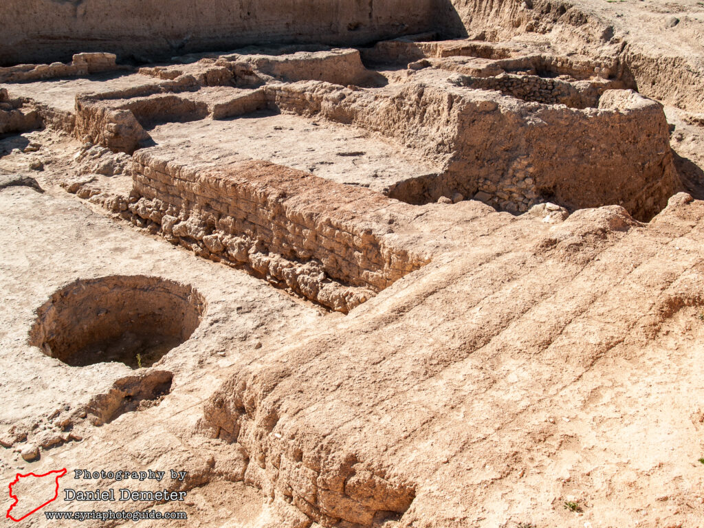
al-Mishrafeh (المشرفة), the ancient city of Qatna (قطنا), is one of the largest Bronze Age sites in Syria. Located between the city of Homs (حمص) and the town of Salamiyeh (سلمية), excavations here have resulted in important discoveries in recent decades. French archaeologist Robert du Mesnil du Buisson first researched the site in the 1920s, uncovering parts of the royal palace, three gates, and several tombs. Syrian teams began performing more extensive excavations starting in the late 1980s. The University of Udine, Italy and the University of Tübingen, Germany also contributed researchers to the site in the late 1990s and 2000s. The most significant finds came in 2002, with the discovery of chamber containing a large collection of cuneiform tablets.
The earliest settlement at Qatna (قطنا) was established on the central citadel mound in the middle to late 3rd millennium BCE. This early occupation appears to have been modest in scale, but the city rapidly expanded in the second quarter of the second millennium BCE. It was during this time that the large royal palace complex was constructed, along with the city’s massive defenses. Qatna (قطنا) held a strategic location on important regional trade routes, making it one of the most prosperous Amorite city-states. The city connected Mesopotamia with the Mediterranean coast via Mari (ماري) on the Euphrates, and was also on the route between Egypt and Yamhad, ancient Aleppo (ﺣﻠﺐ). Several artifacts from the Egyptian, Babylonian and Mitanni civilizations discovered at the site attest to the importance of this city in regional trade.
Qatna (قطنا) found itself in a precarious position in the Late Bronze Age, located on the frontier between the rivaling empires of Egypt and Mesopotamia. By the middle of the 14th century BCE, the Hittites had overtaken the Mitanni empire as the dominant force in the region, and the city was sacked by Hittite forces in 1340 BCE. Qatna (قطنا) subsequently survived through a series of tactical alliances with neighboring powers, but never fully recovered. Regional power then shifted to the cities of Emesa, modern Homs (حمص), and Hamath, modern Hama (حماة). Despite its declining importance, Qatna (قطنا) remained a regional administrative center under the Aramaean kingdom of Hamath. The settlement endured into the Iron Age on small scale industry, primarily textile production and agricultural processing, but was abandoned by the end of the period.
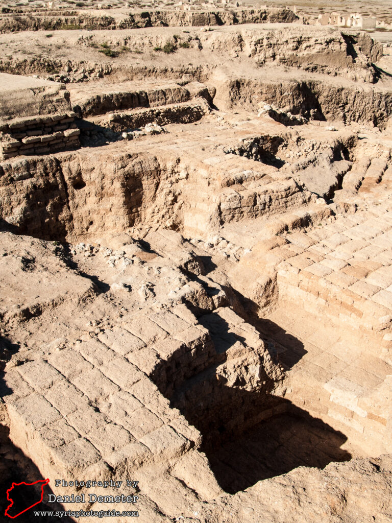
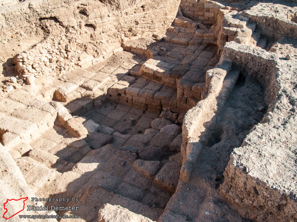
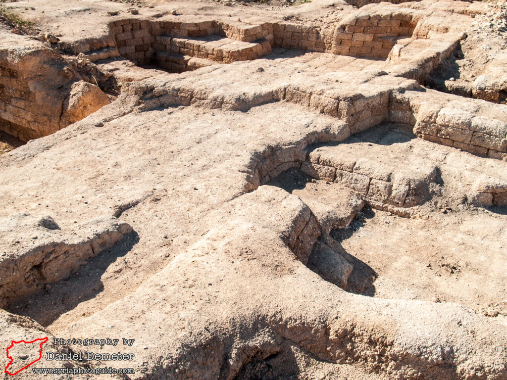
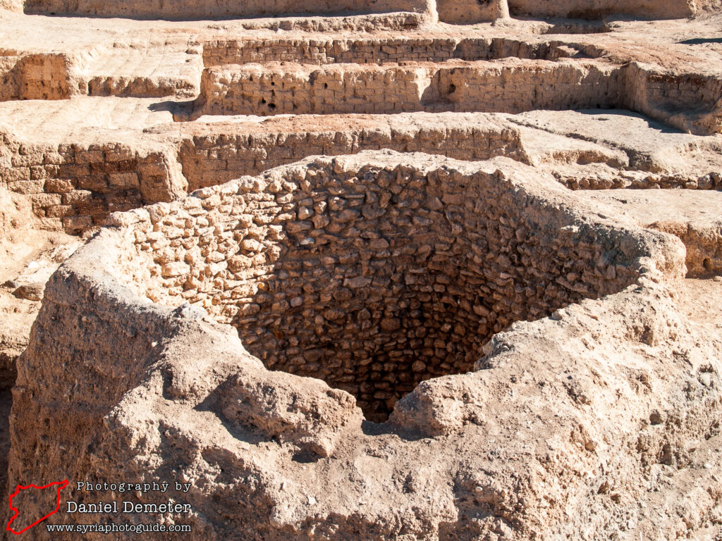
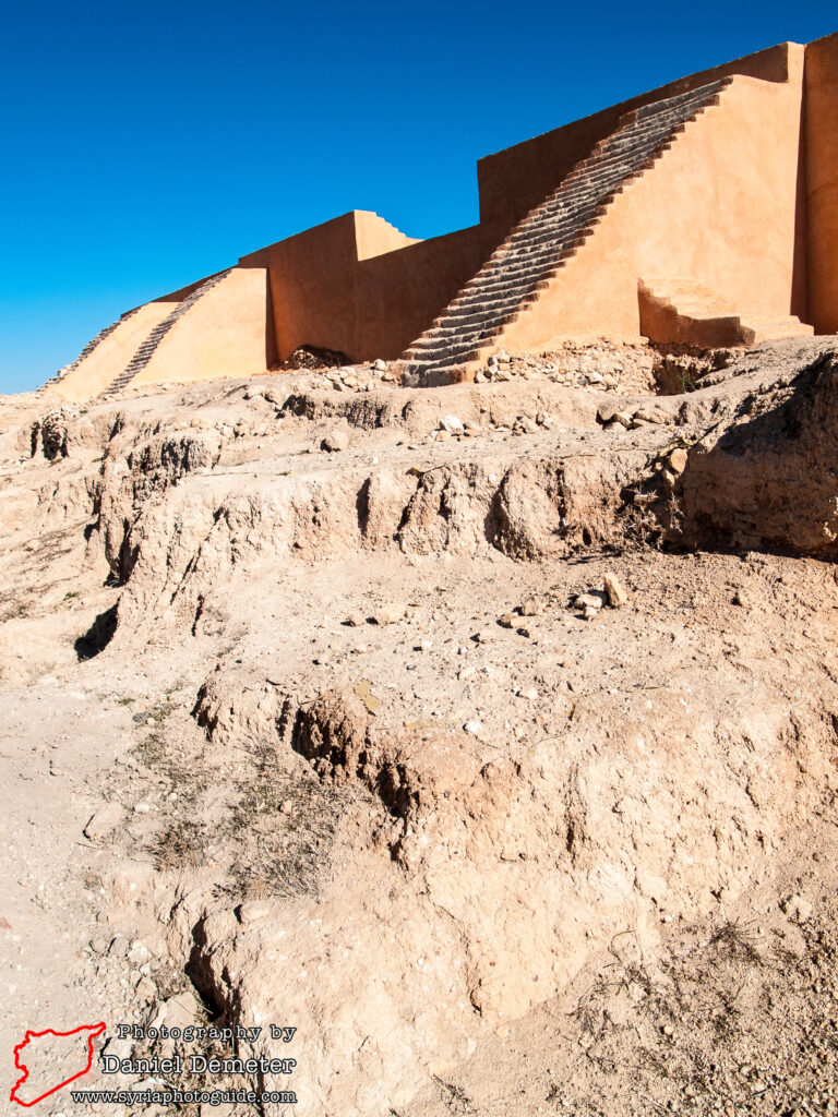
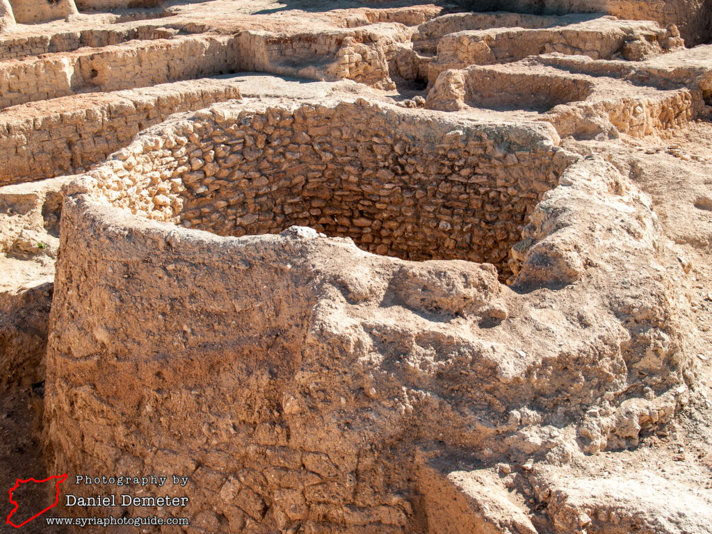
The surviving remains are highlighted by the massive royal palace, in use between 1650 and 1340 BCE. This is one of the largest Bronze Age palaces in Syria, featuring over eighty rooms in a layout that is reminiscent of the palace complex of Mari (ماري). It is located on the northwestern slope of the citadel mound. The central throne room and ceremonial hall was a remarkable forty meters by twenty meters. It was a funerary chamber connected to this throne room that was discovered in 2002. In addition to cuneiform tablets from the palace archives, the chamber also contained artifacts of the royal family suggesting the practice of ancestor worship. The cuneiform tablets date from the reign of King Idanda (around 1400 BCE) and include intelligence reports on the political situation in northern Syria (including concerns over the threat posed by the Hittites), and domestic and administrative texts. They were written in a mixture of the Akkadian and Hurrian languages.
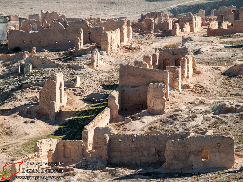
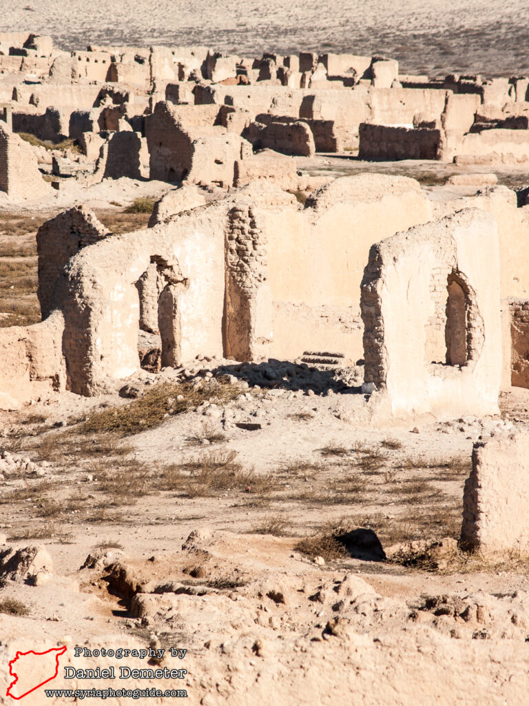
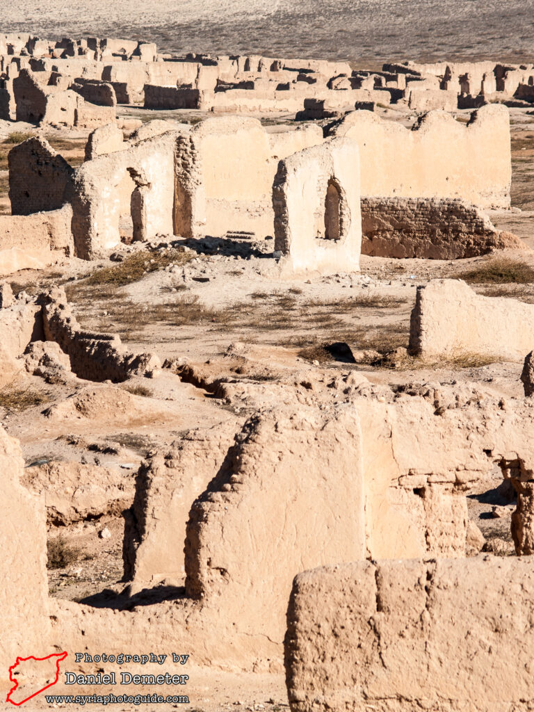
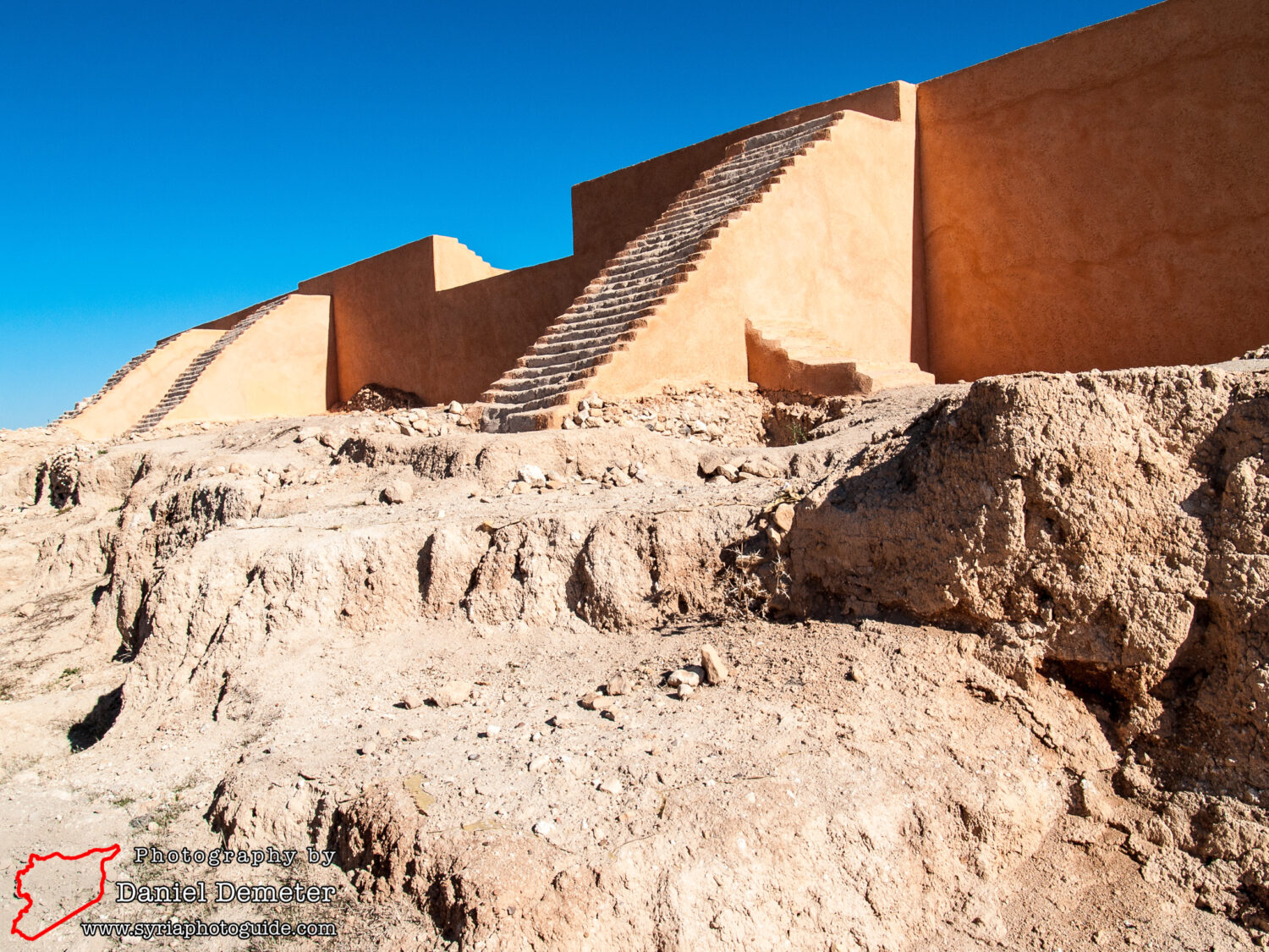
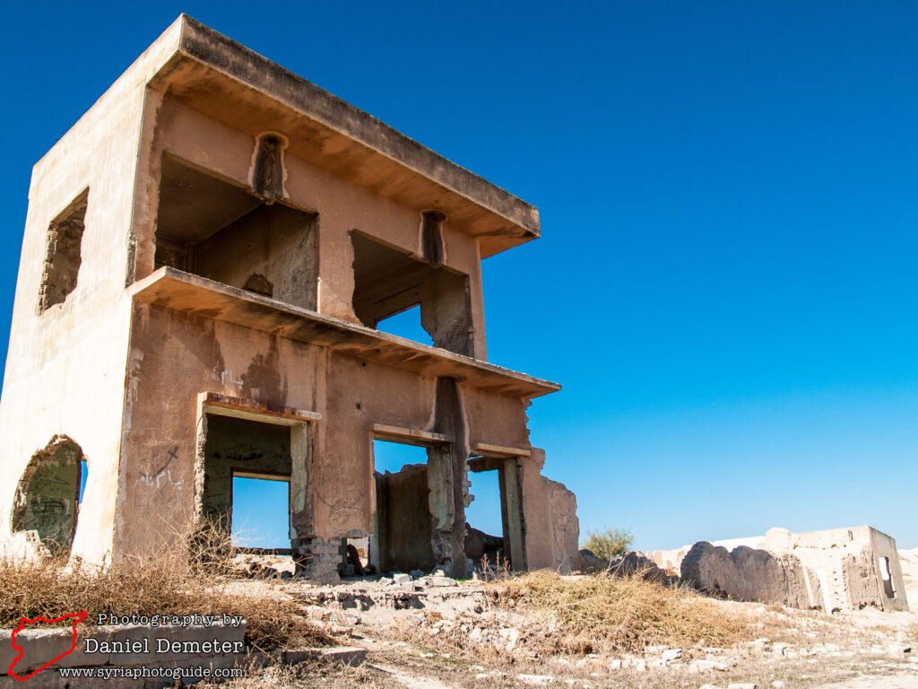
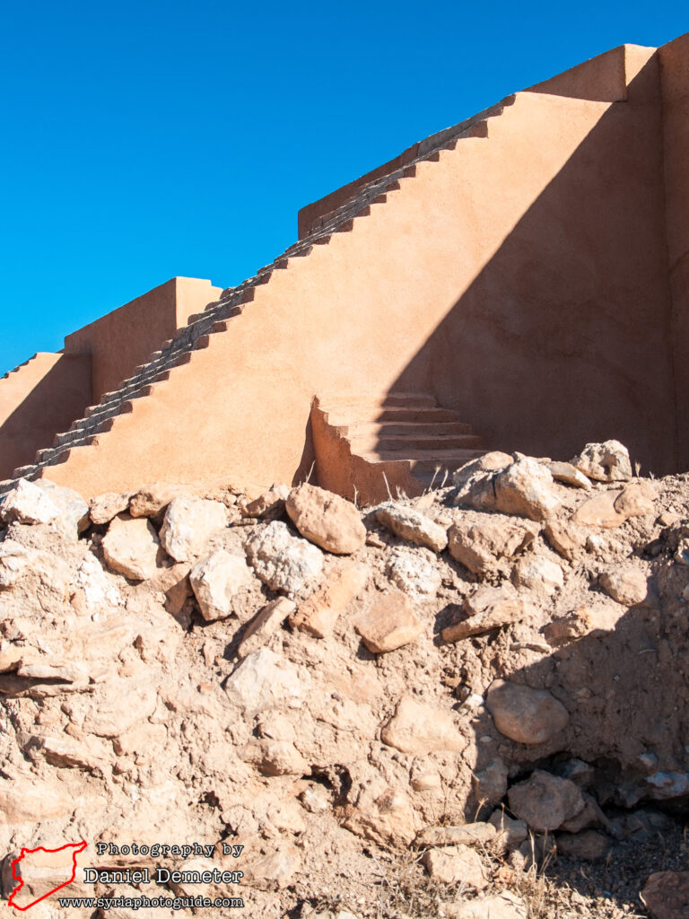
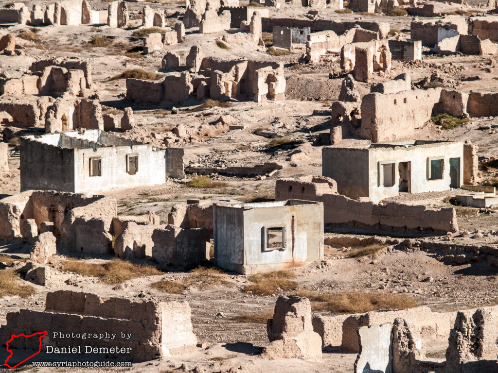
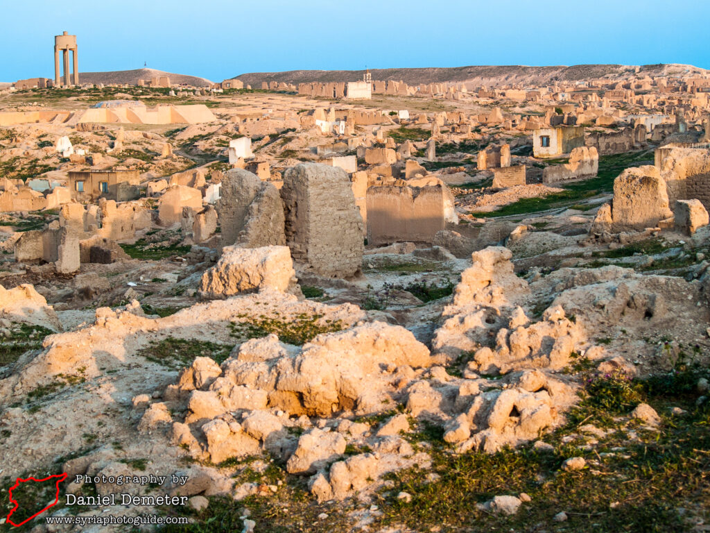
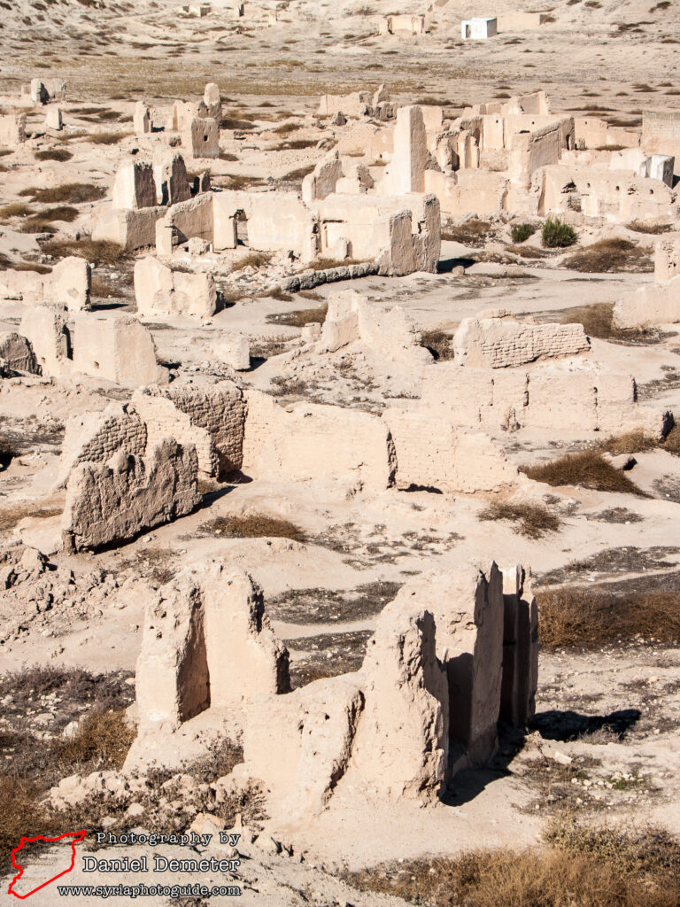
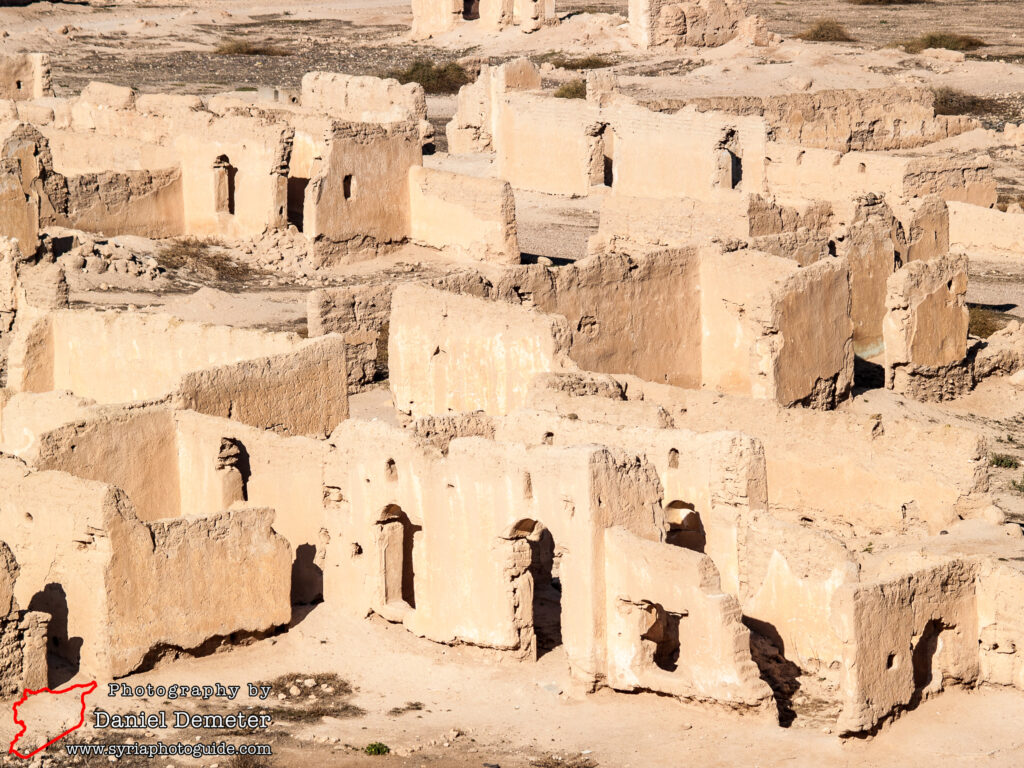
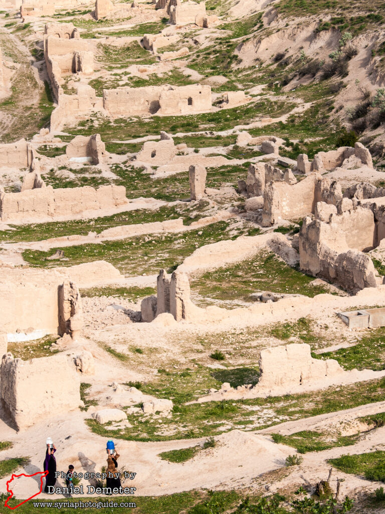
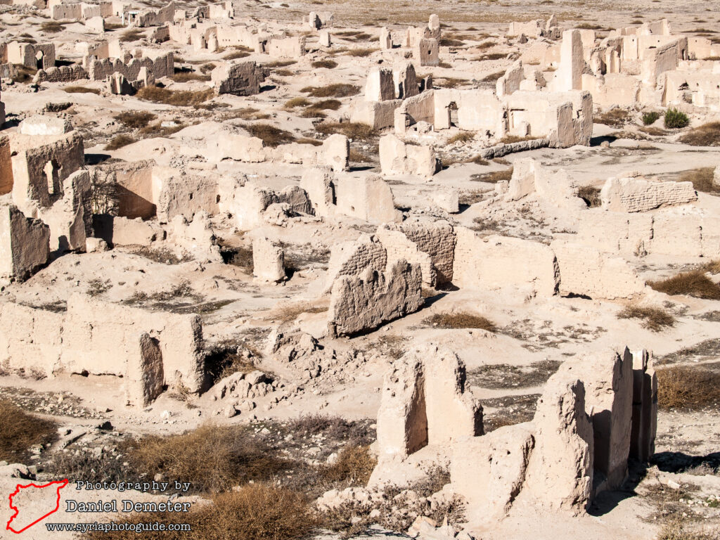
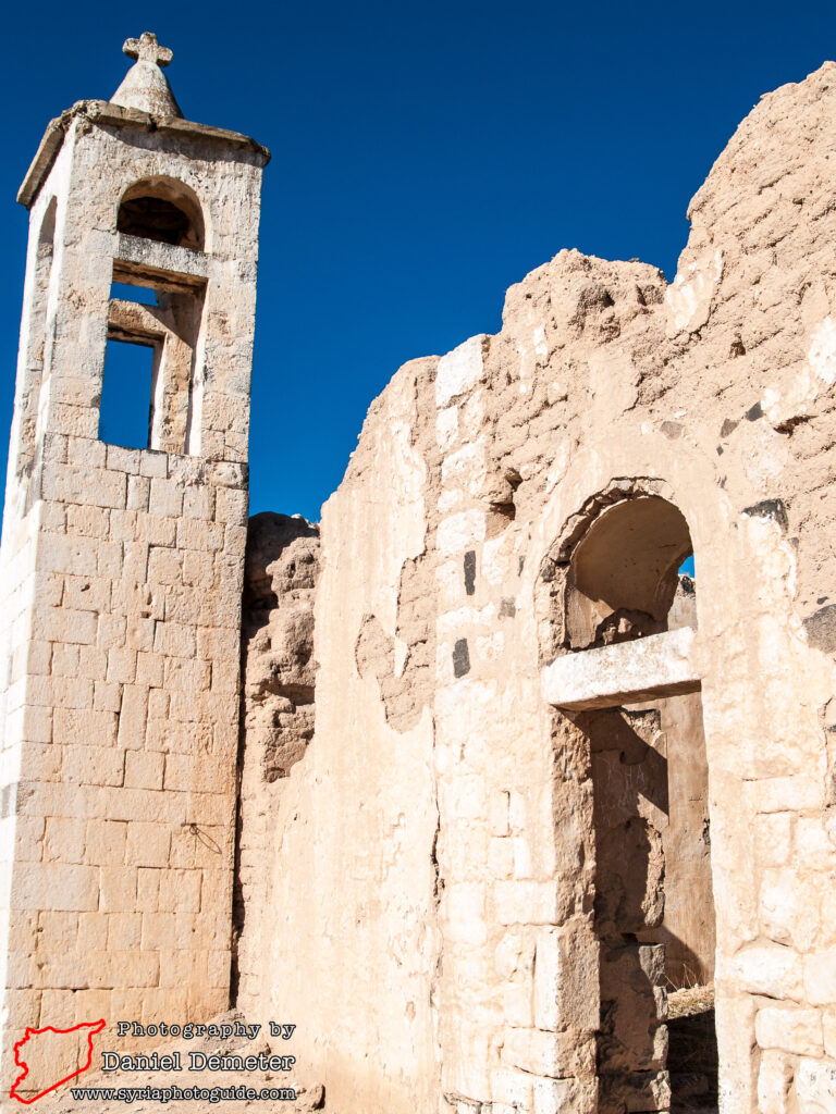
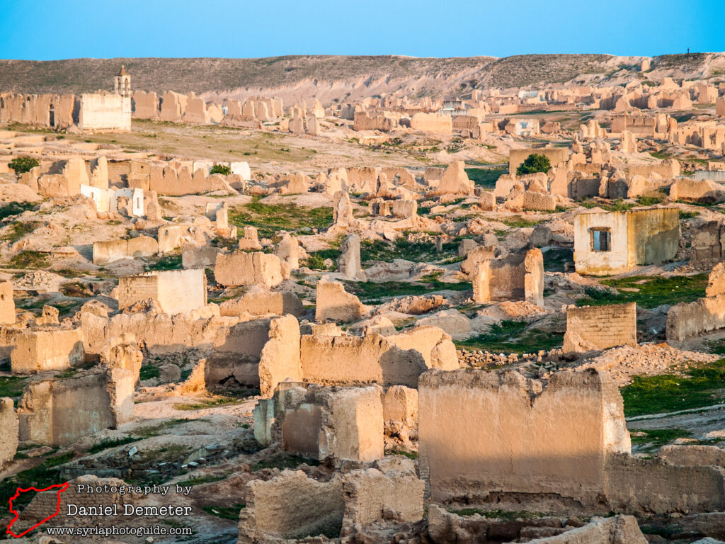
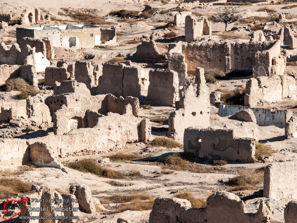
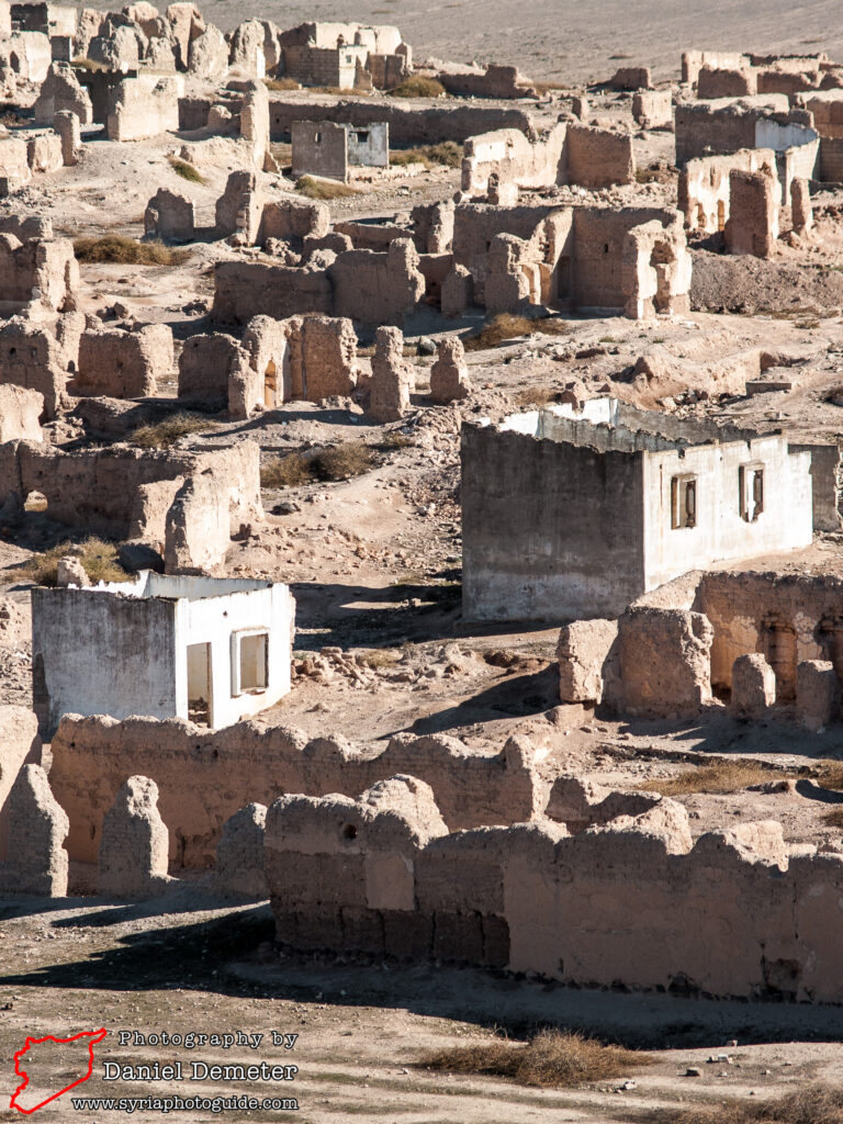
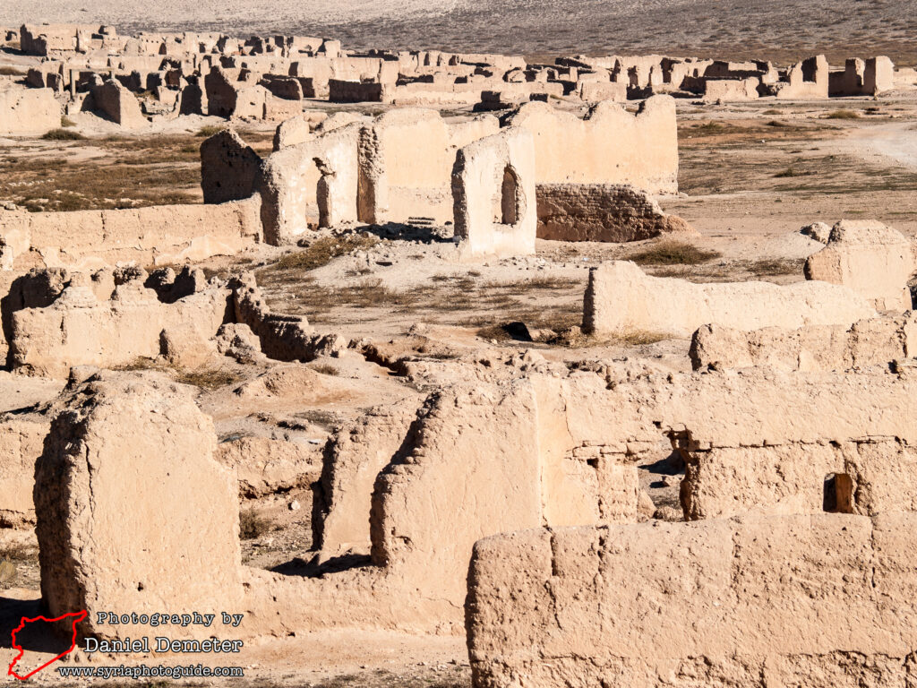
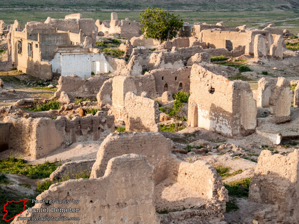
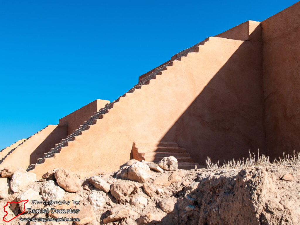
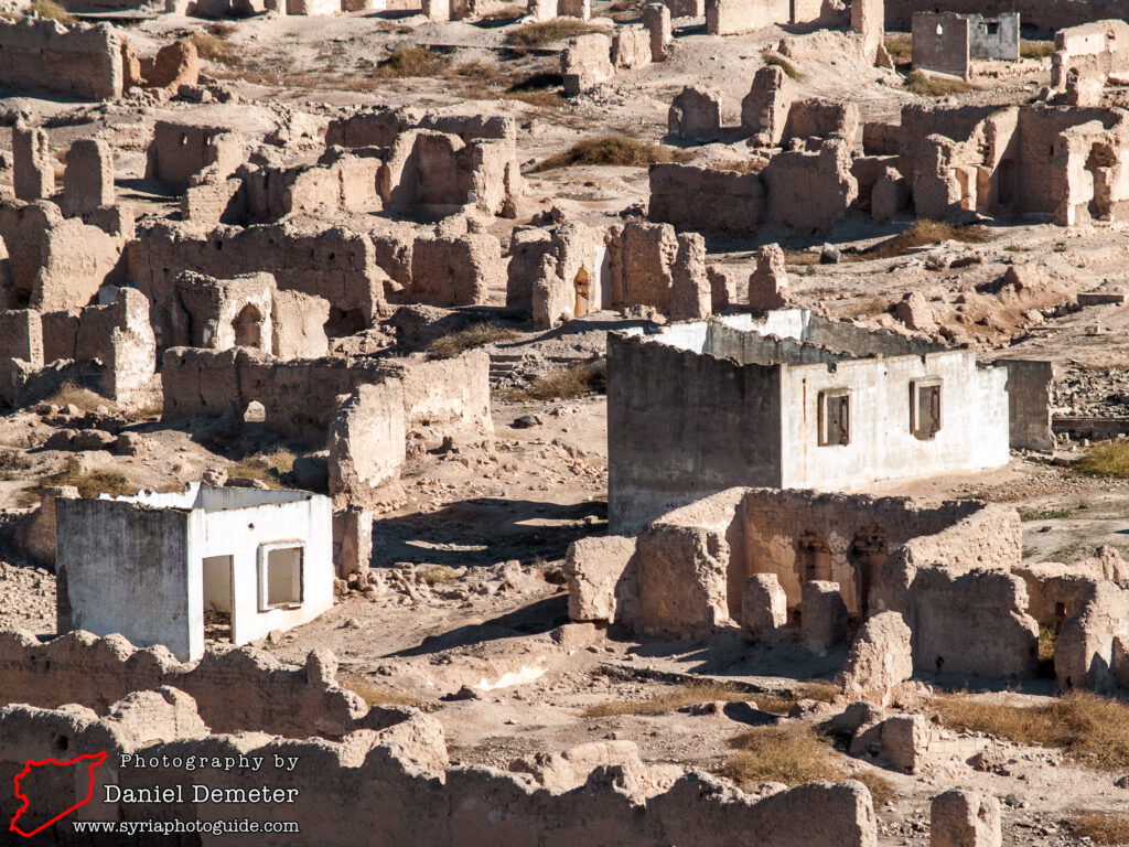
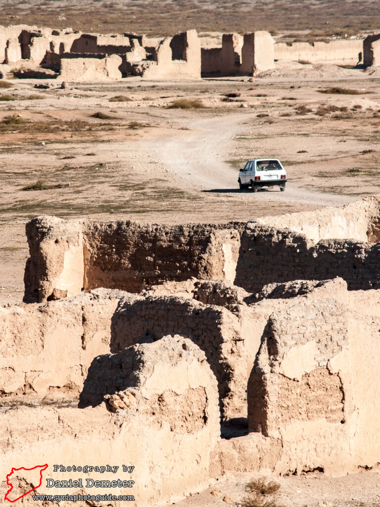
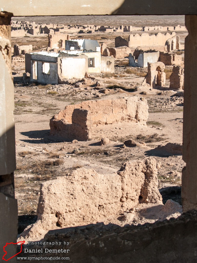
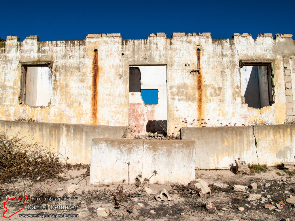
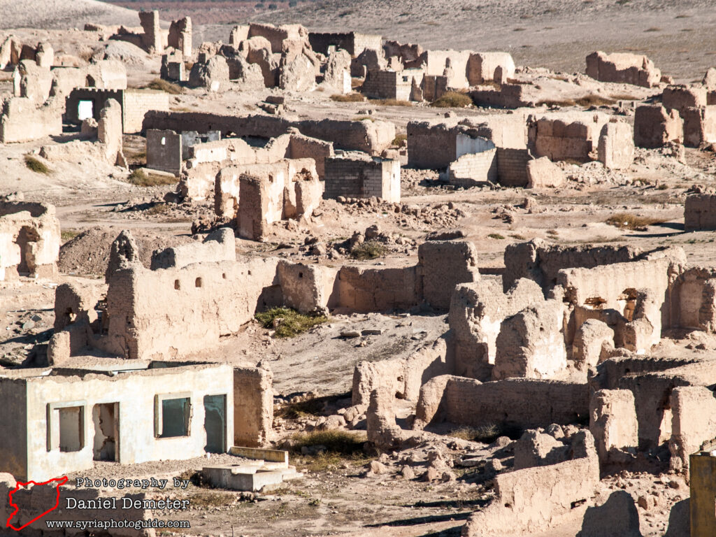
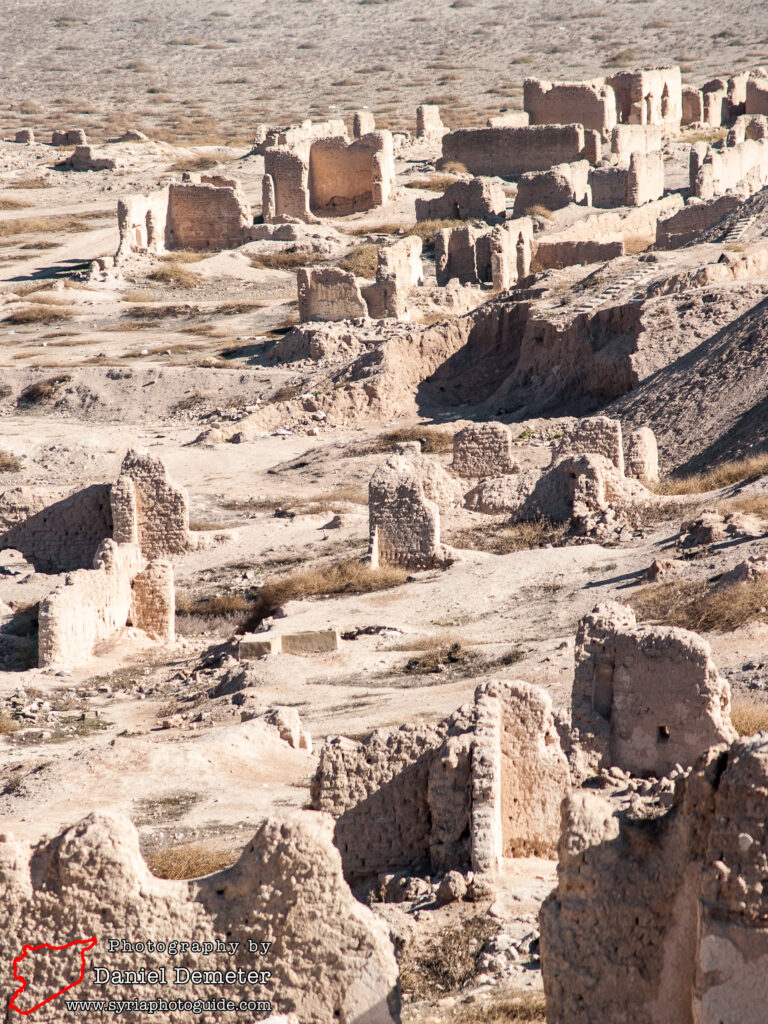
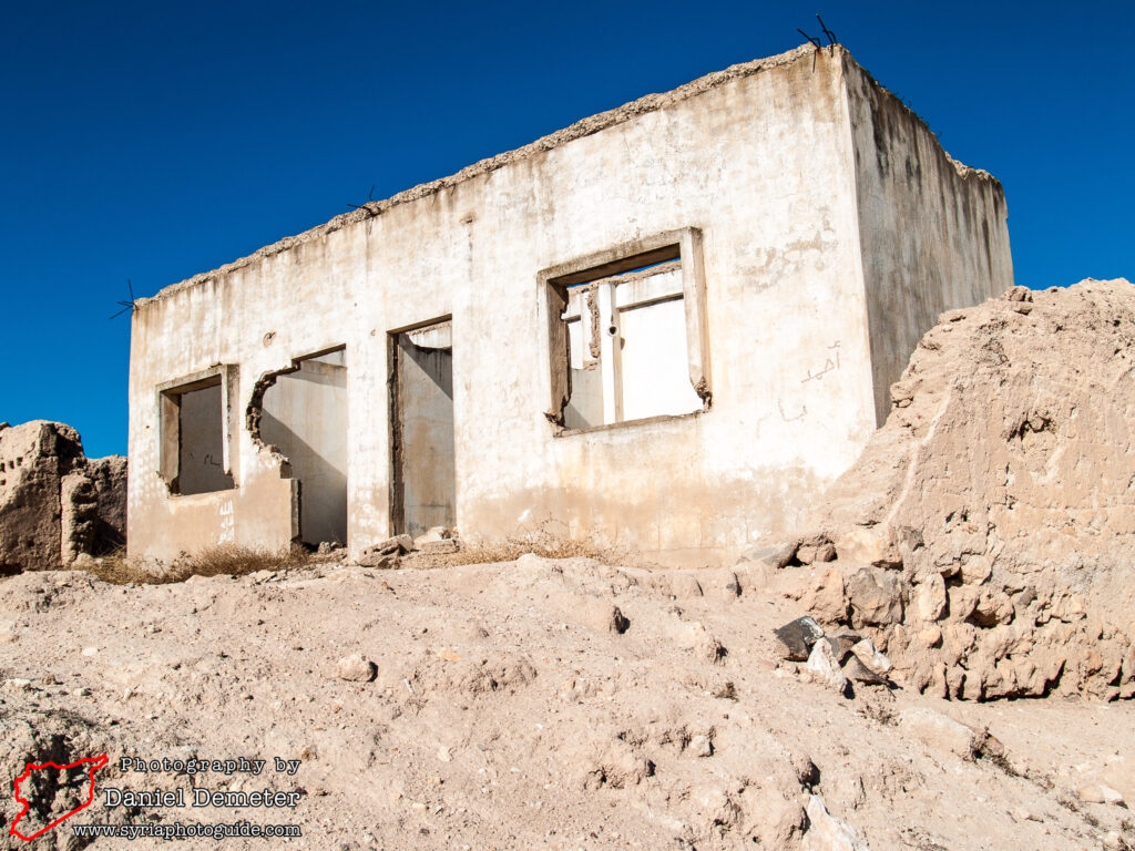
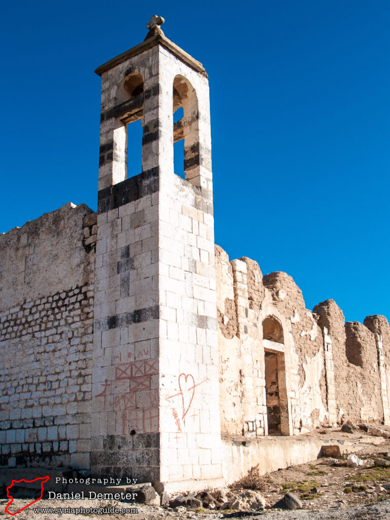
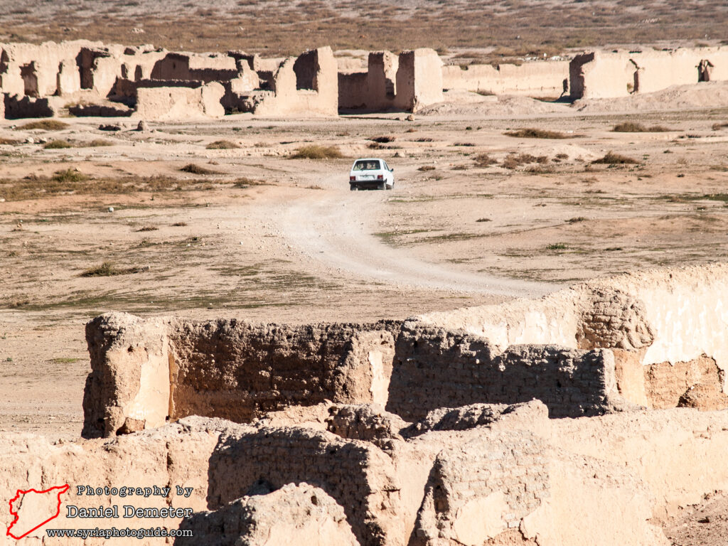
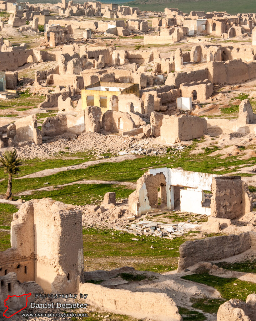
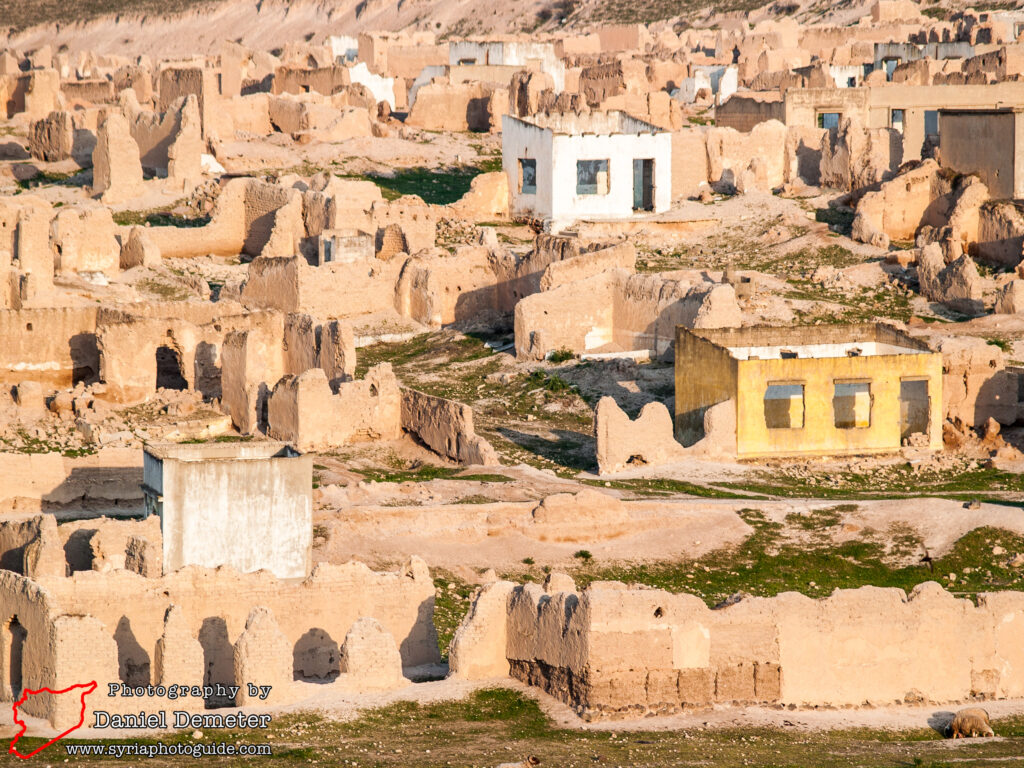
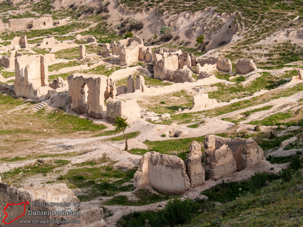
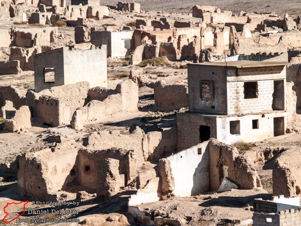
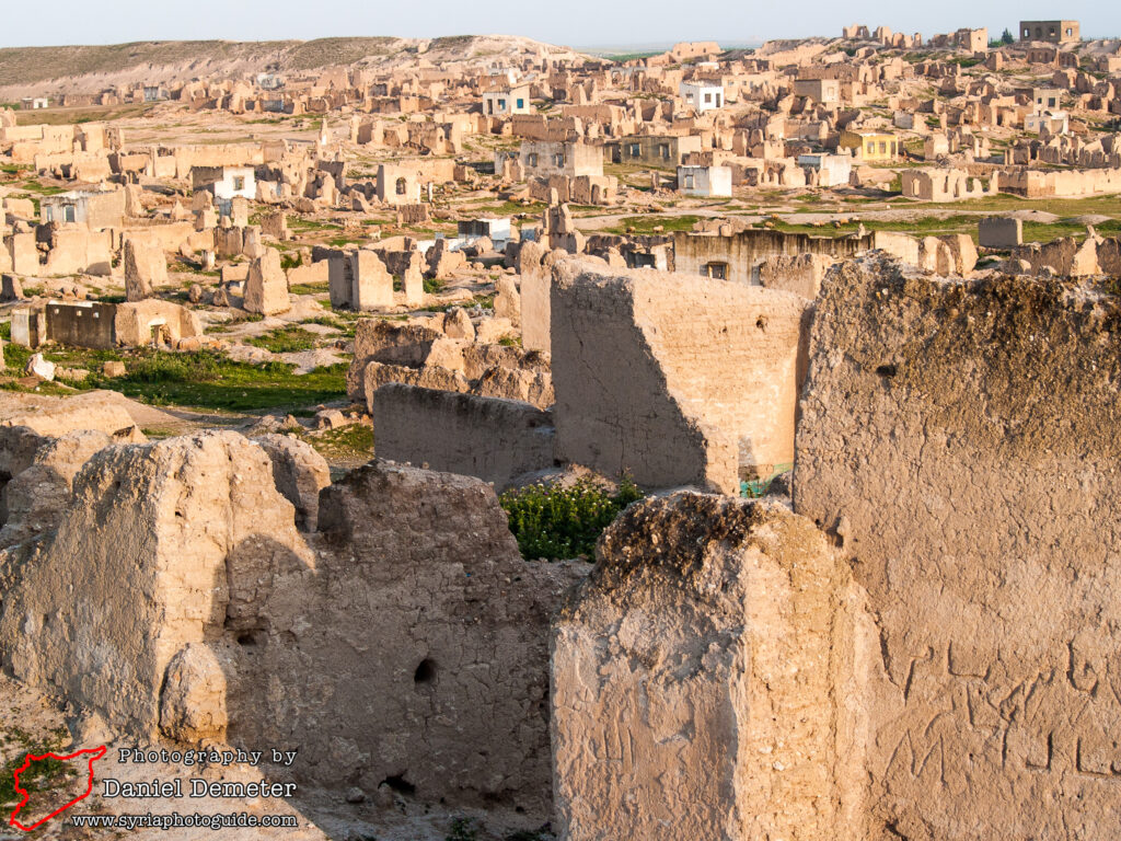
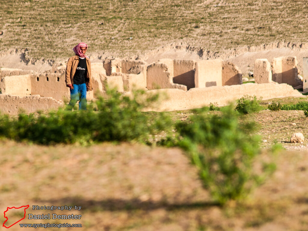
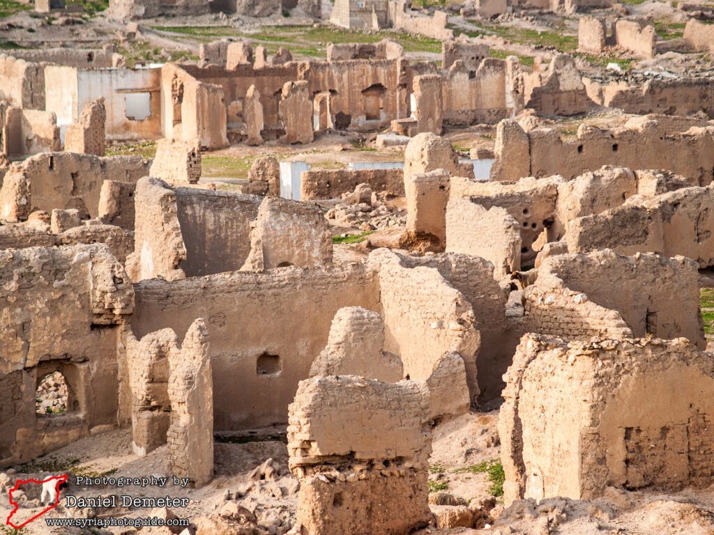
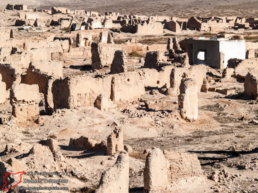
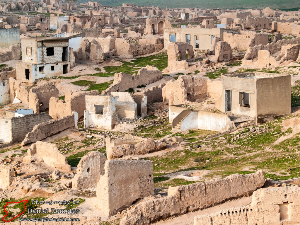
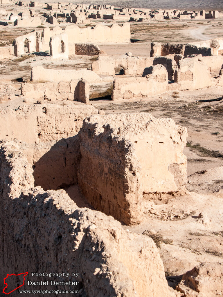
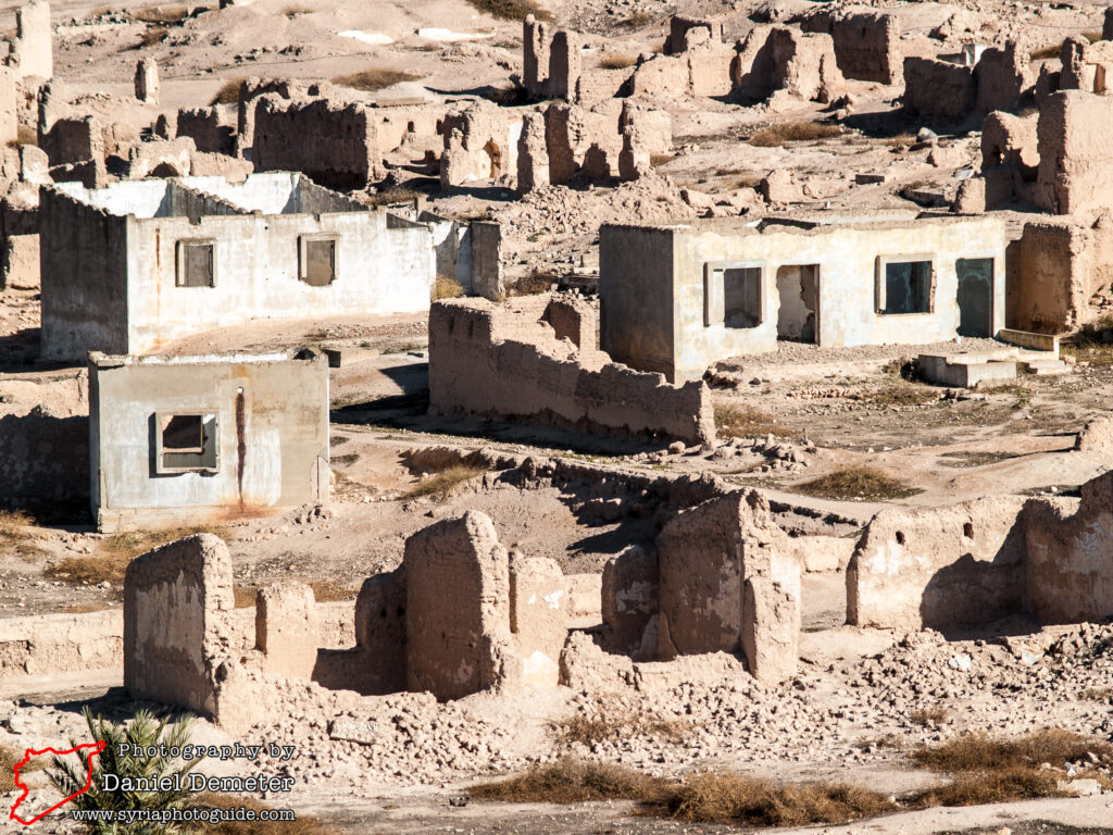
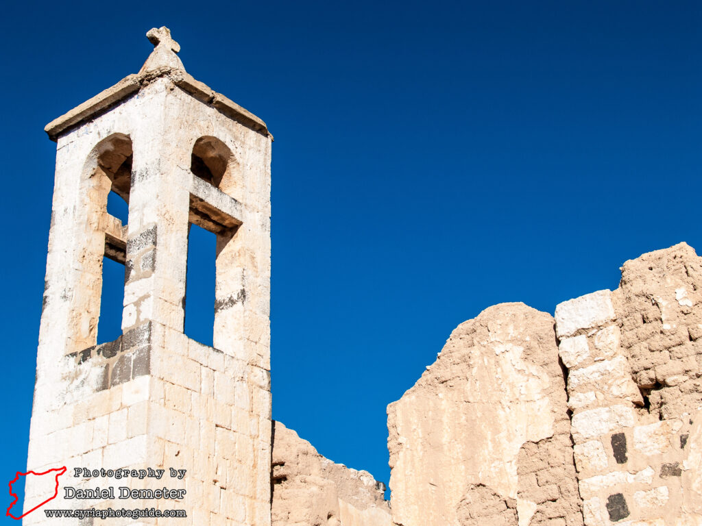
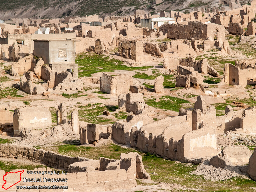
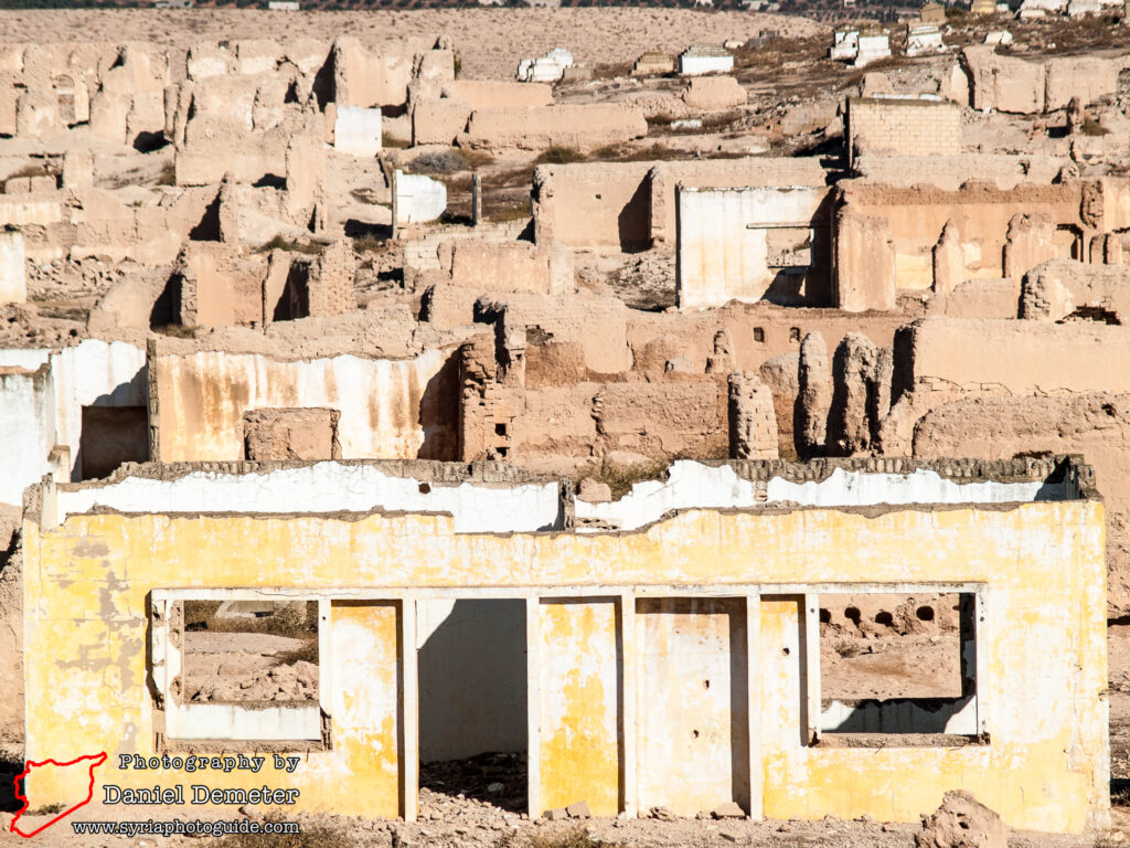
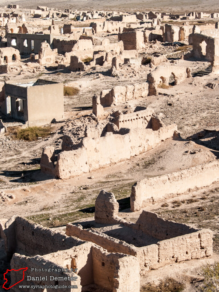
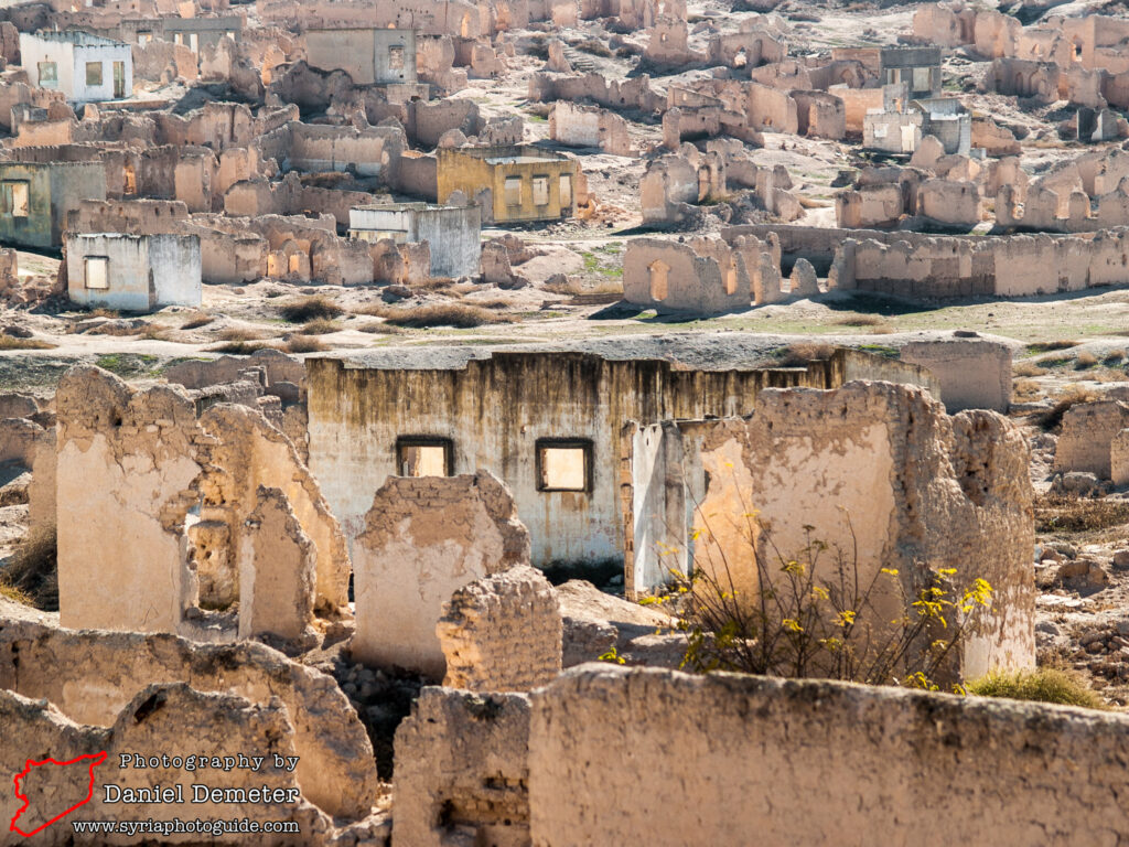
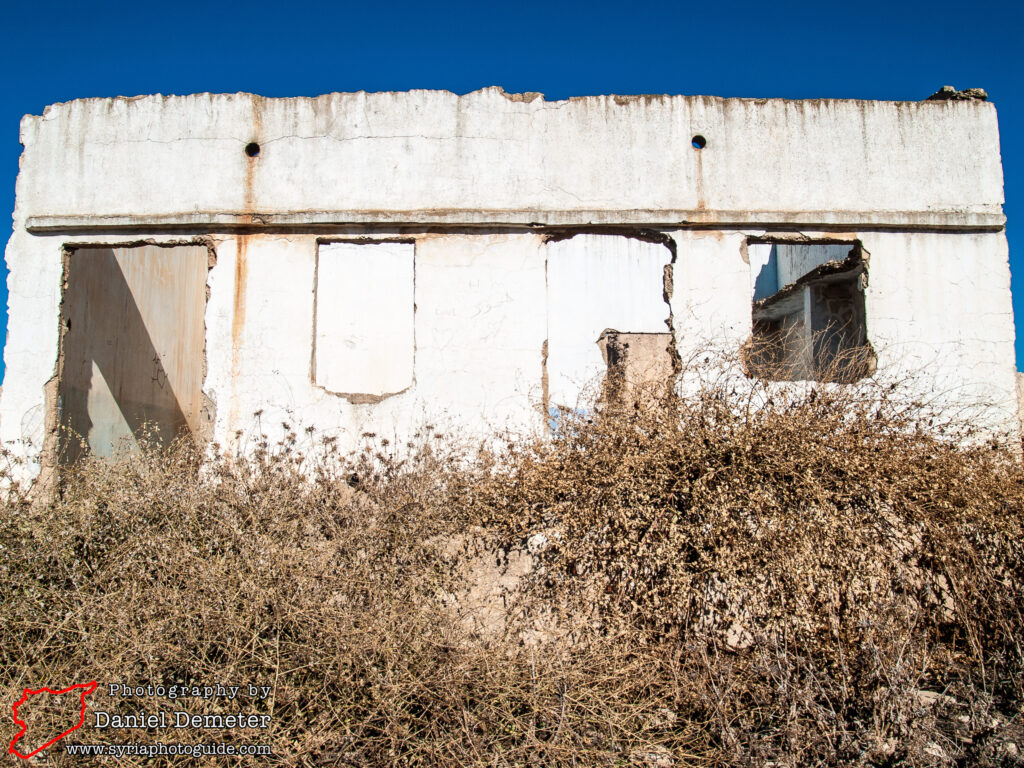
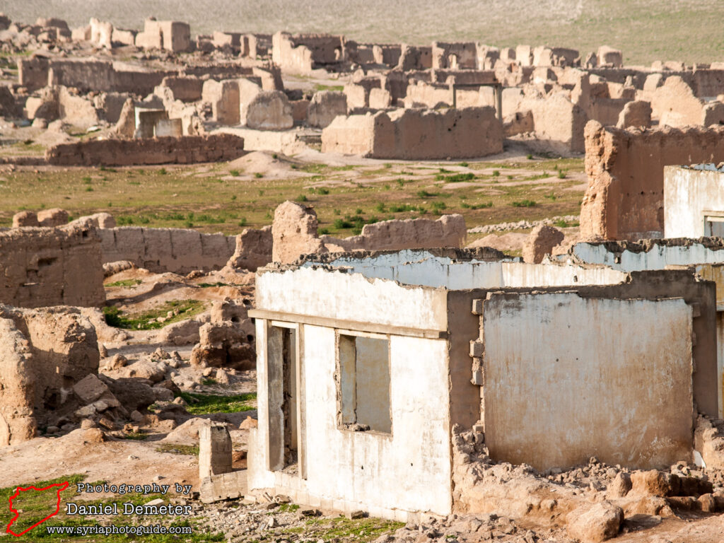
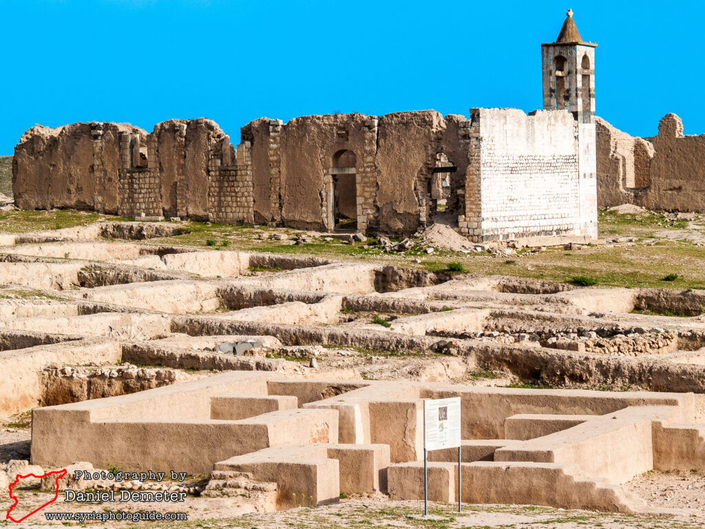
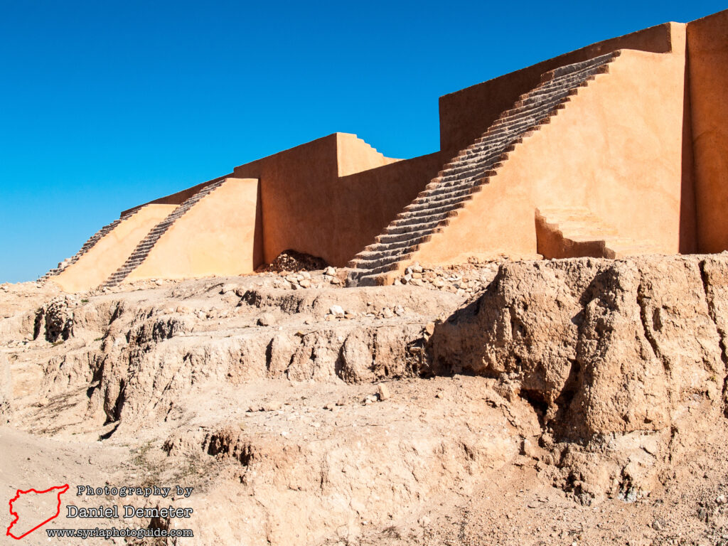
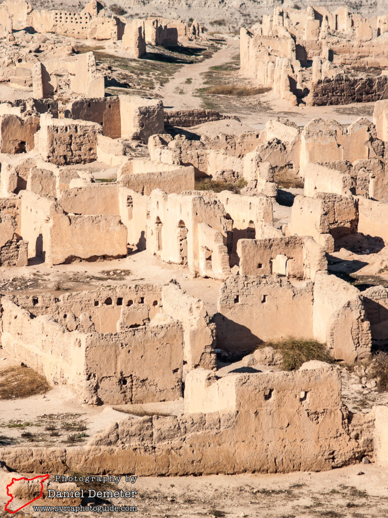
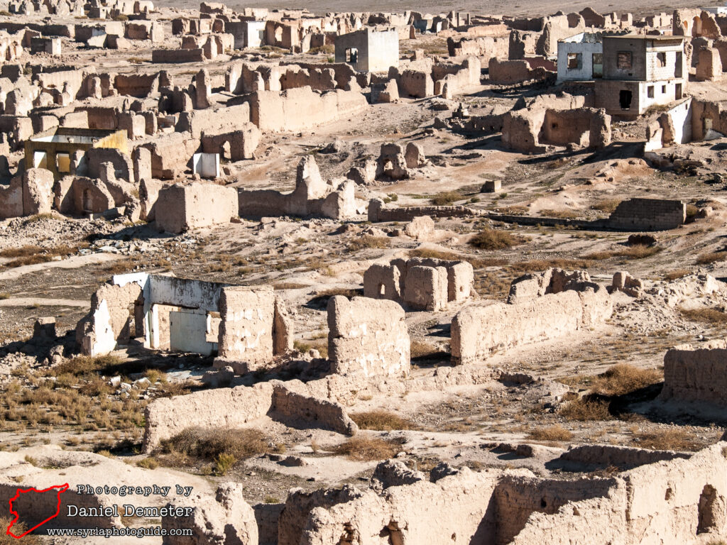
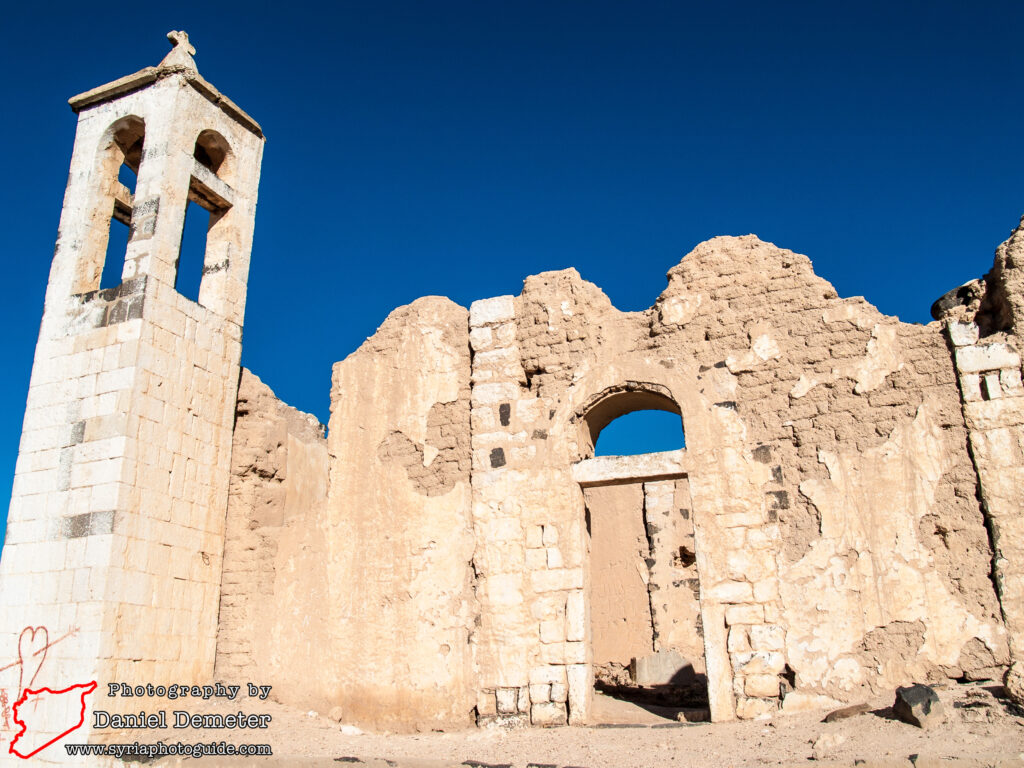
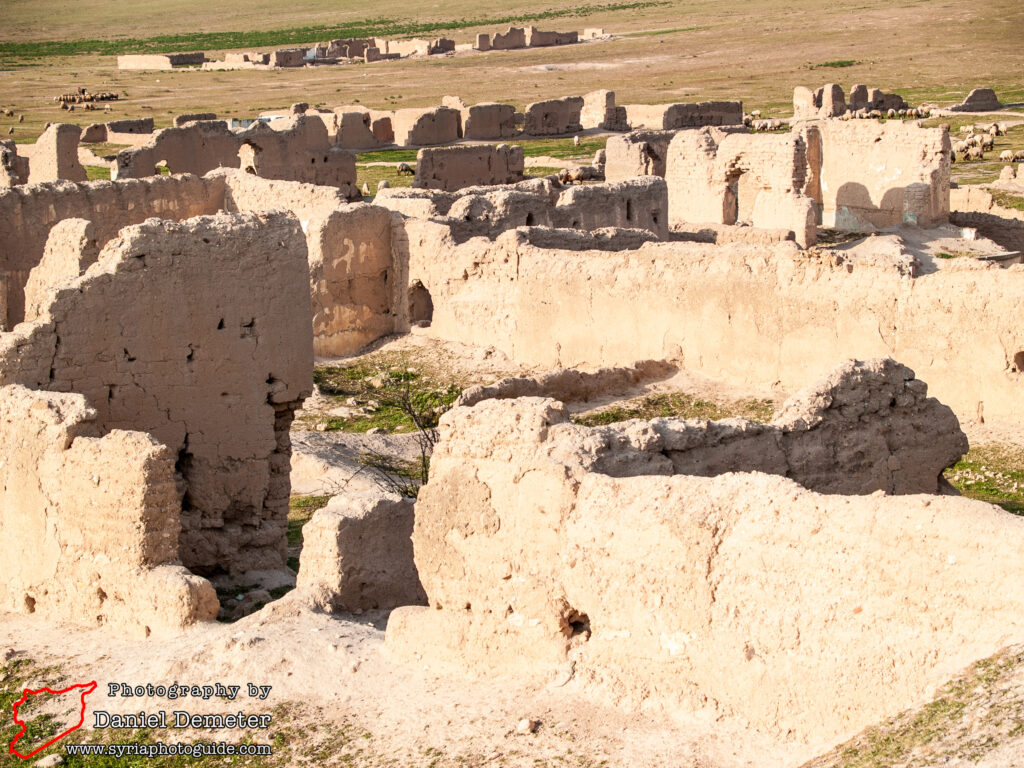
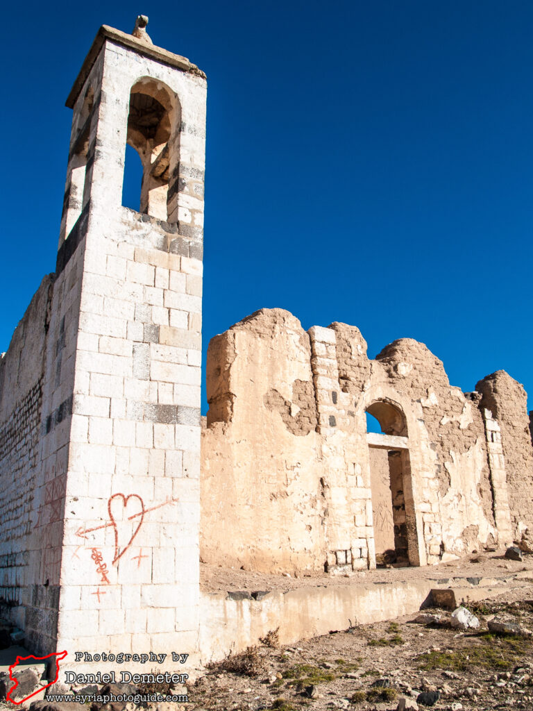
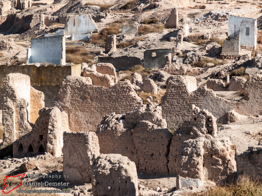
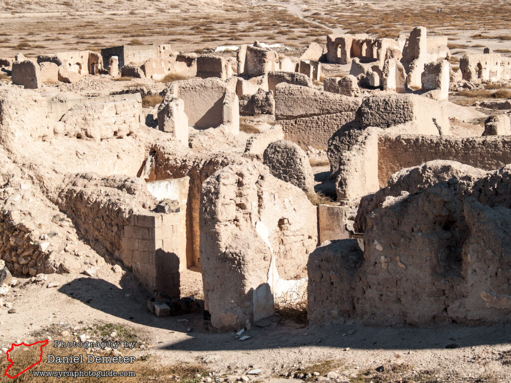
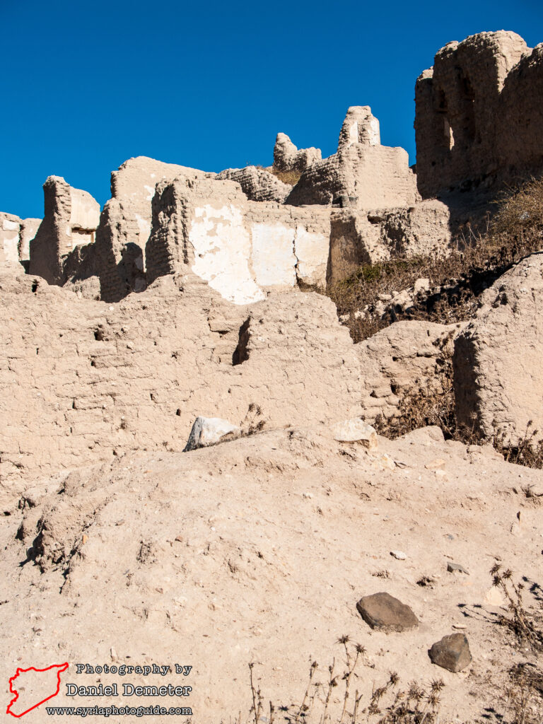
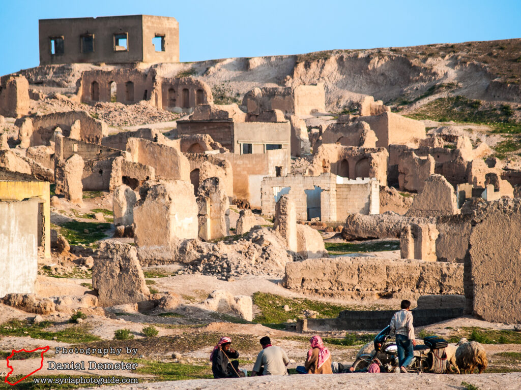
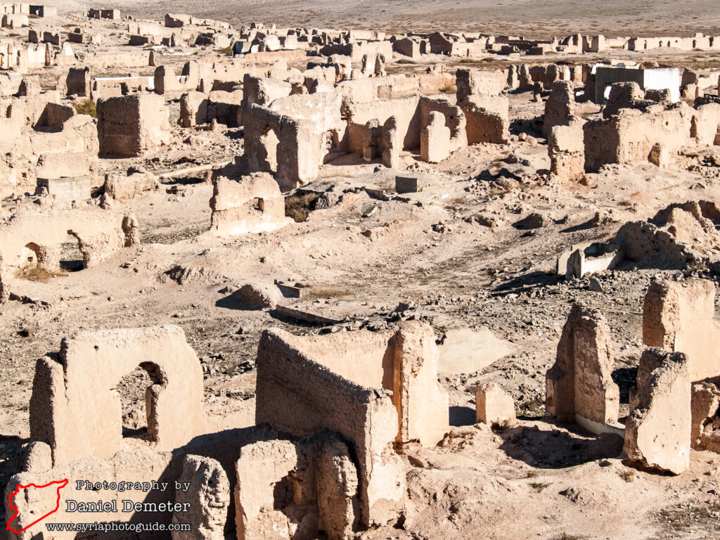
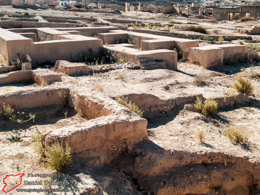
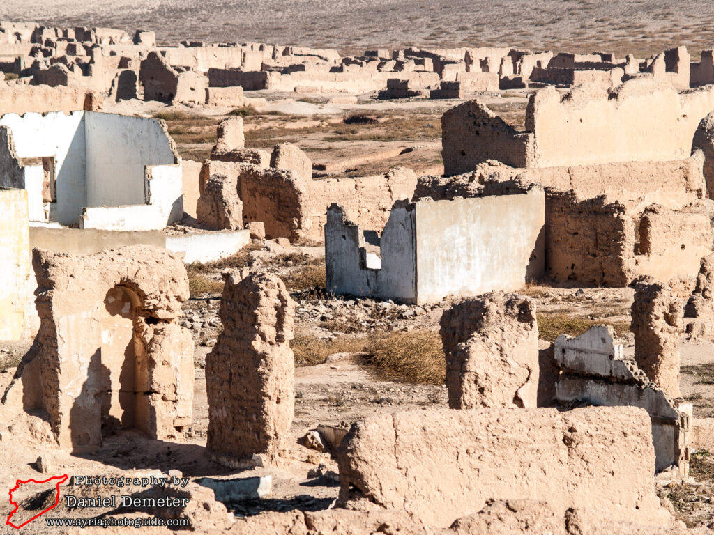
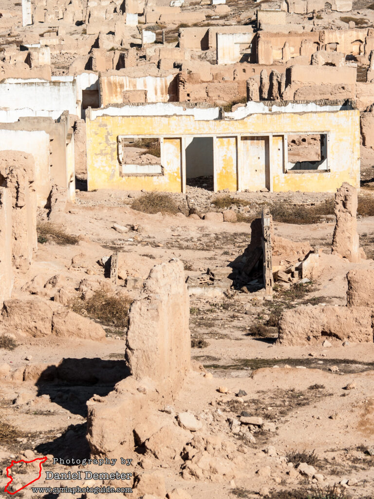
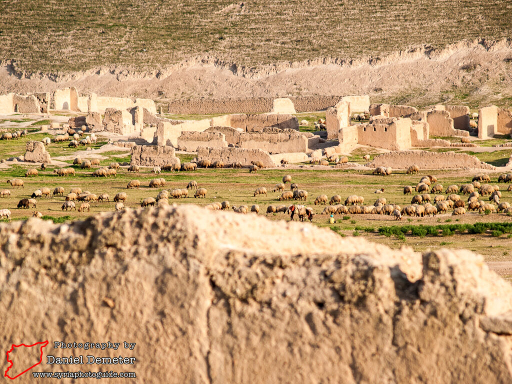
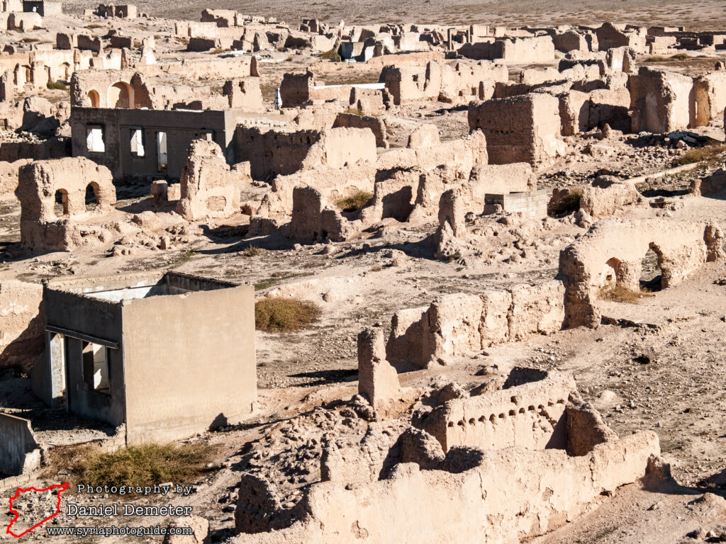
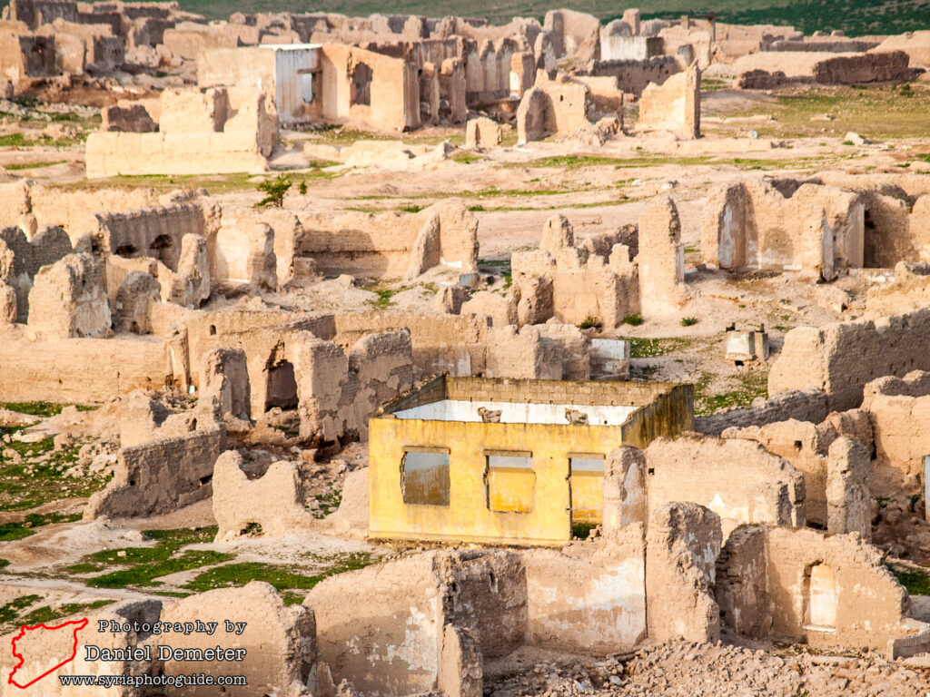
The massive earth ramparts that surrounded the city still reach between fifteen and twenty meters high, and form a near-square quadrilateral that is roughly eight hundred meters on each side. Each of the four walls had a gate near its middle point, the entrance approximately four meters wide. The wall was probably faced with mud-brick and surrounded by an artificial ditch. Some visitors may be interested in exploring the considerably more recently ruins at the site. The modern village of al-Mishrafeh (المشرفة) was originally constructed in the middle of the 19th century over the remains of the ancient city. It was not until 1982 that the predominantly Christian community was relocated to a newer development to the west of the site. Now emptied, the earlier settlement of mud-brick and concrete homes remains, abandoned to shepherds and their herds. Exploring this ghost town of a village is also worthwhile.


Preservation Status: While its position near the edge of the Syrian desert makes it vulnerable to attack, al-Mishrafeh (المشرفة) has remained under government control throughout the ongoing crisis. Thankfully, there have been no reports of vandalism or looting of the archaeological site, though small scale looting may have gone unnoticed.
Getting There: Regular microbuses travel from Homs (حمص) to Salamiyeh (سلمية), passing al-Mishrafeh (المشرفة) enroute. The massive earthen mounds that make up the ancient city walls are easily identifiable on the left-hand side of the road. Alternatively, there are less frequent microbuses that travel direct from Homs (حمص) to al-Mishrafeh (المشرفة), stopping in the center of the modern village.
Coordinates: 34°50’05.00″N / 36°51’59.00″E
Transliteration Variants: al-Mishrafe, al-Mishrifeh, al-Mishrife, al-Mishrafah, al-Mishrafa, al-Mishrifah, al-Mishrifa, al-Mishrefeh, al-Mishrefe, al-Mishrefah, al-Mishrefa
Rating: 5 / 10
References: http://www.qatna.org/