
Palmyra – Colonnaded Streets تدمر – شوارع معمدة
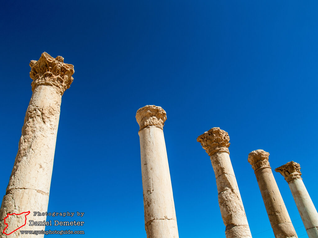
The ancient city of Palmyra (تدمر) had already been well established by the time the Romans seized control over the region, and the layout of the town was inconsistent with the Roman model of city planning. Various adaptations were made to incorporate imperial urban planning over subsequent centuries, and one of the main developments was the construction of colonnaded streets (شوارع معمدة) throughout the city. Several sections of these streets can still be traced, some remarkably well-preserved.
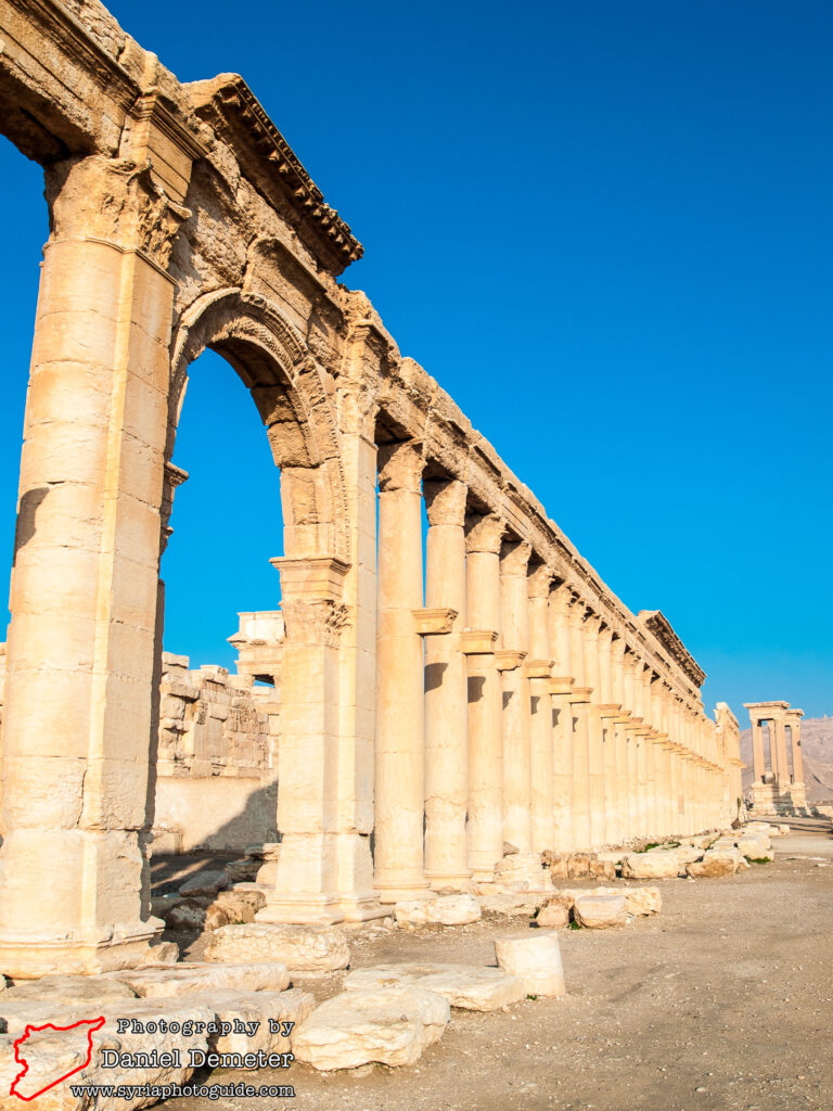
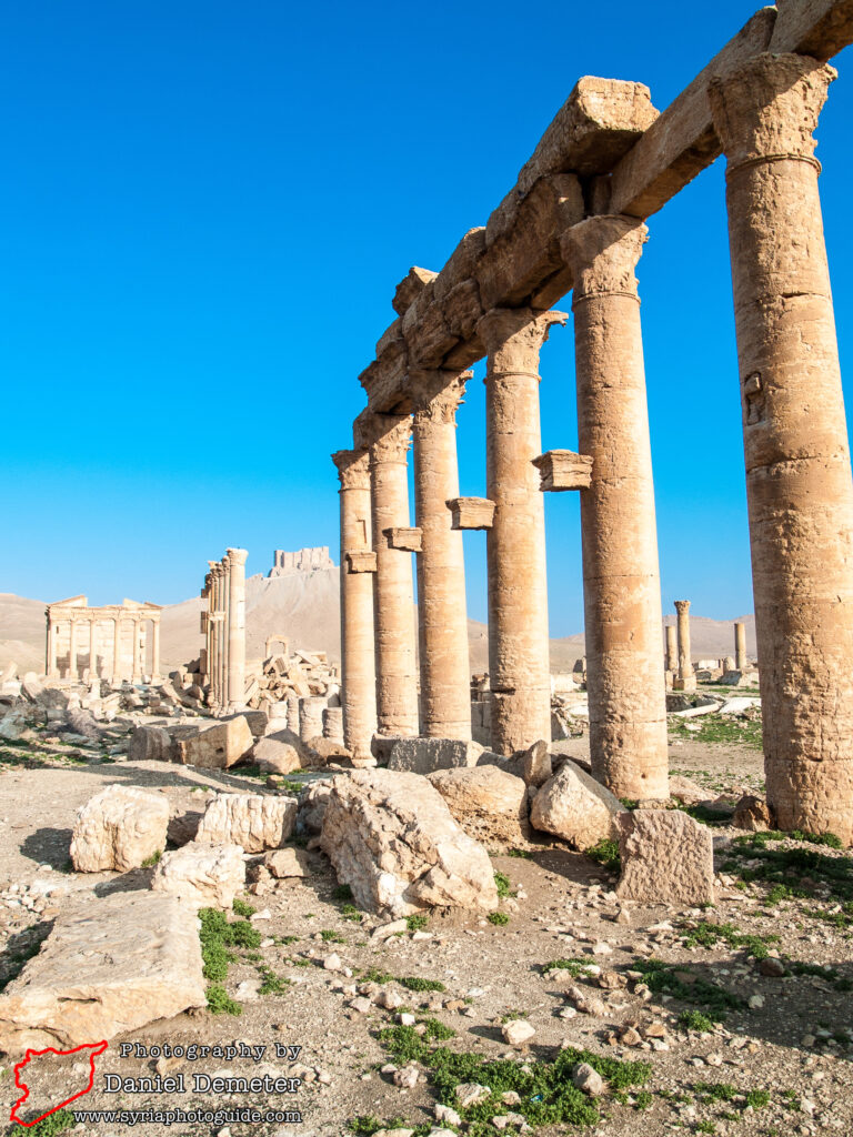
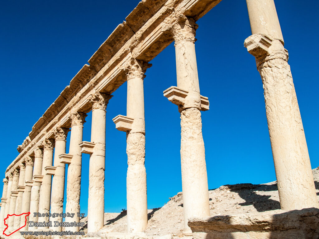
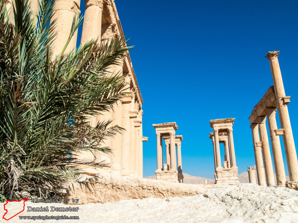
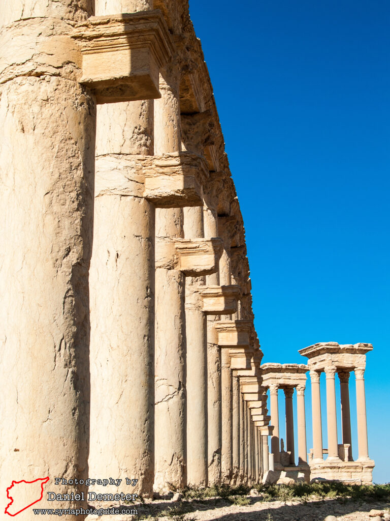
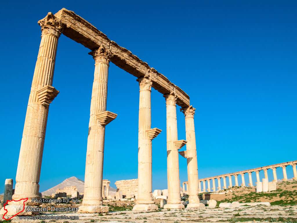
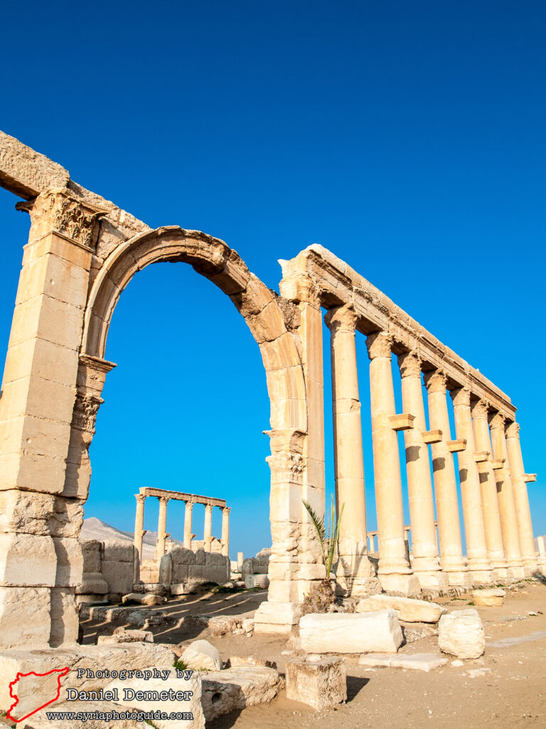
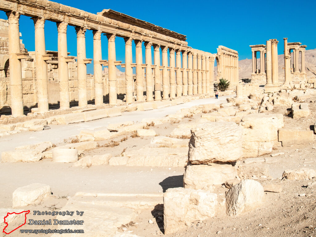
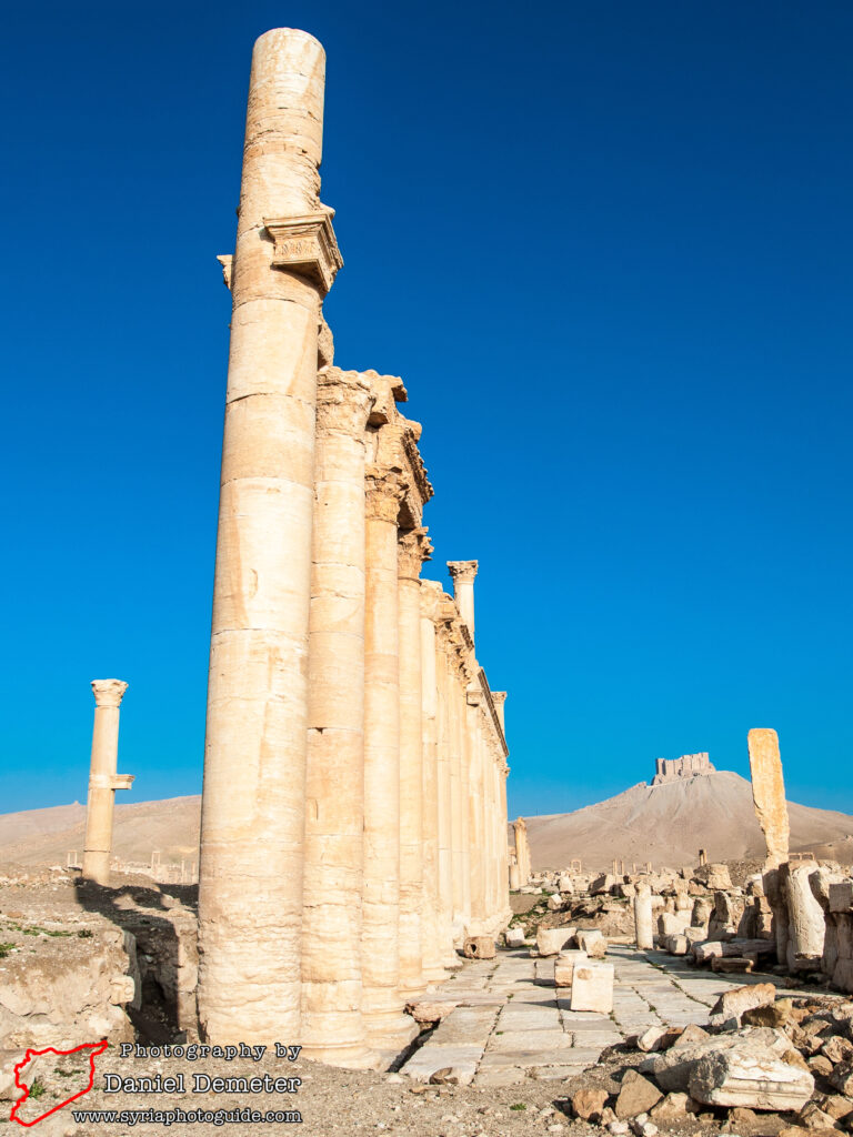
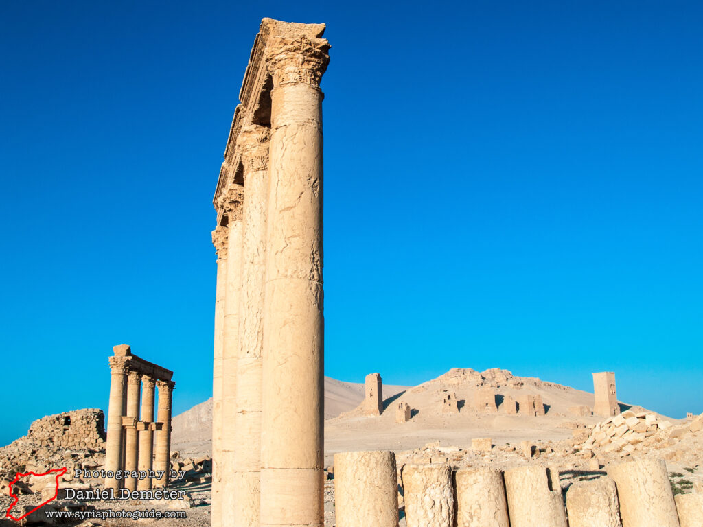
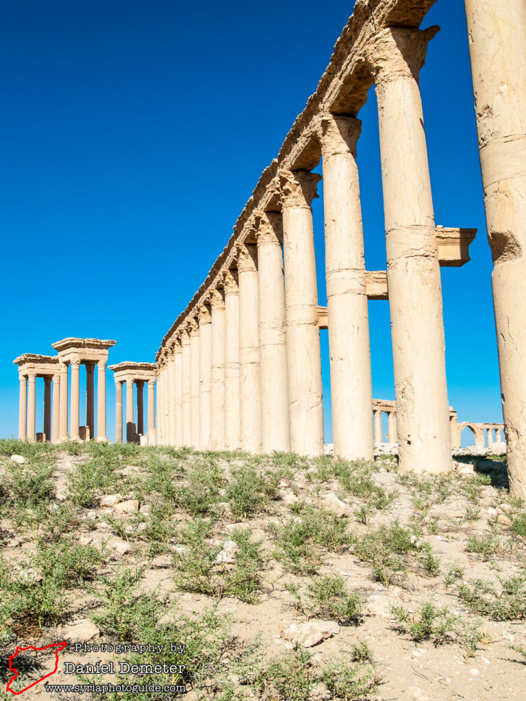
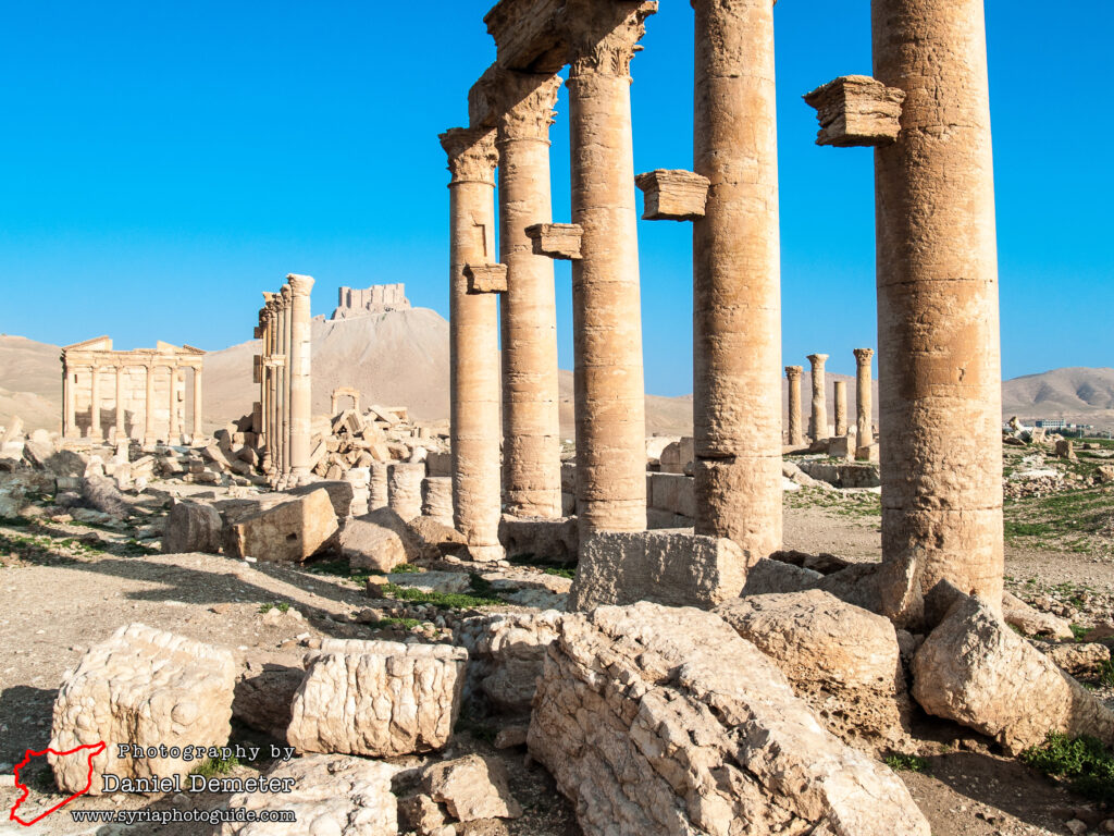
The main colonnaded street, sometimes referred to as the Great Colonnade (الشارع الطويل), extends for a distance of over one kilometer from the northwest to the southeast. It was constructed in several different phases. The northwestern section, which begins at the funerary temple (المعبد الجنائزي) and extends to the tetrapylon (التترابيل), was constructed in the first half of the second century. Its orientation may have originally been intended to continue straight across the city to the Temple of Bel (معبد بل), but if so that plan was never fully realized. The theater (مسرح) and Temple of Nabu (معبد نبو) obstructed this path, and any plan to redesign or remove these structures was ultimately abandoned.
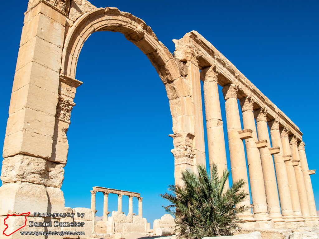
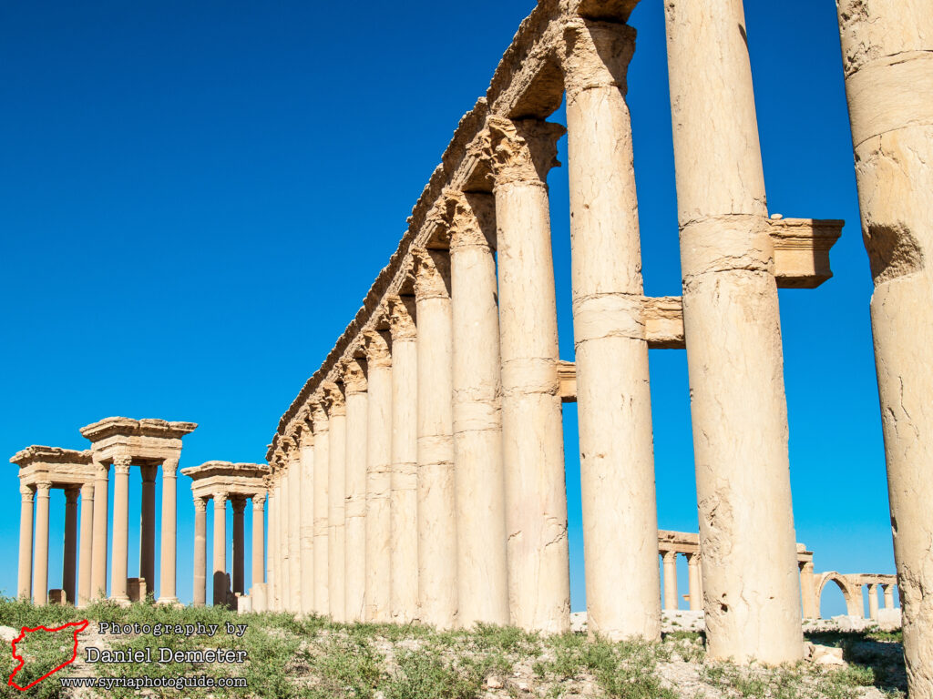
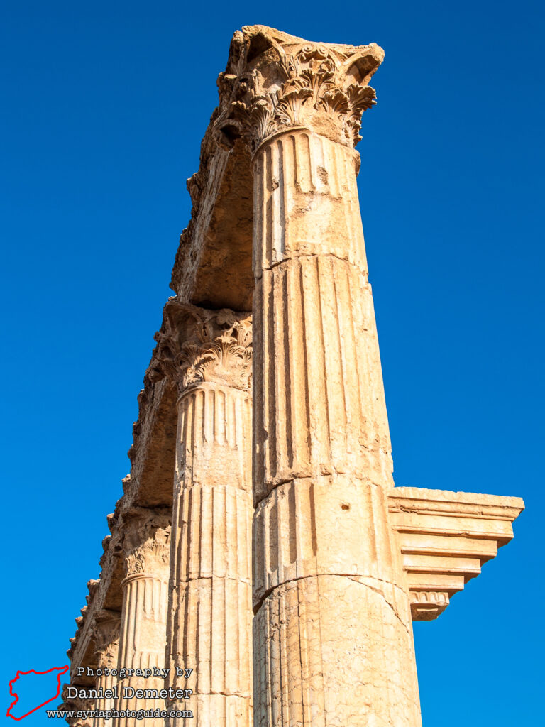
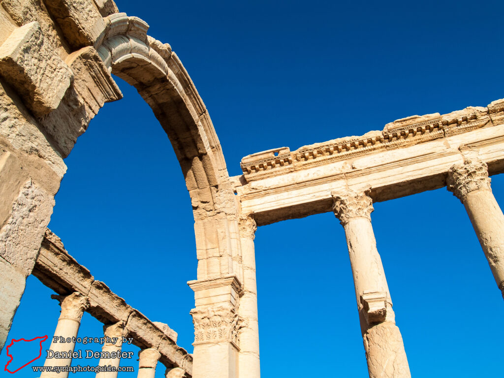
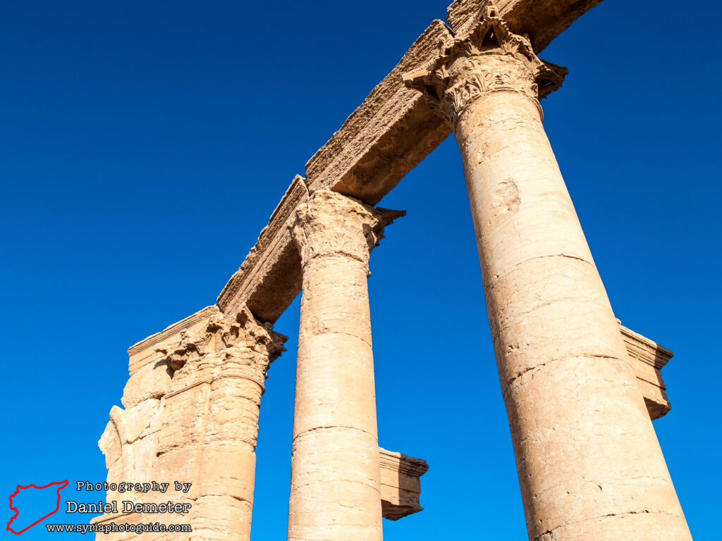
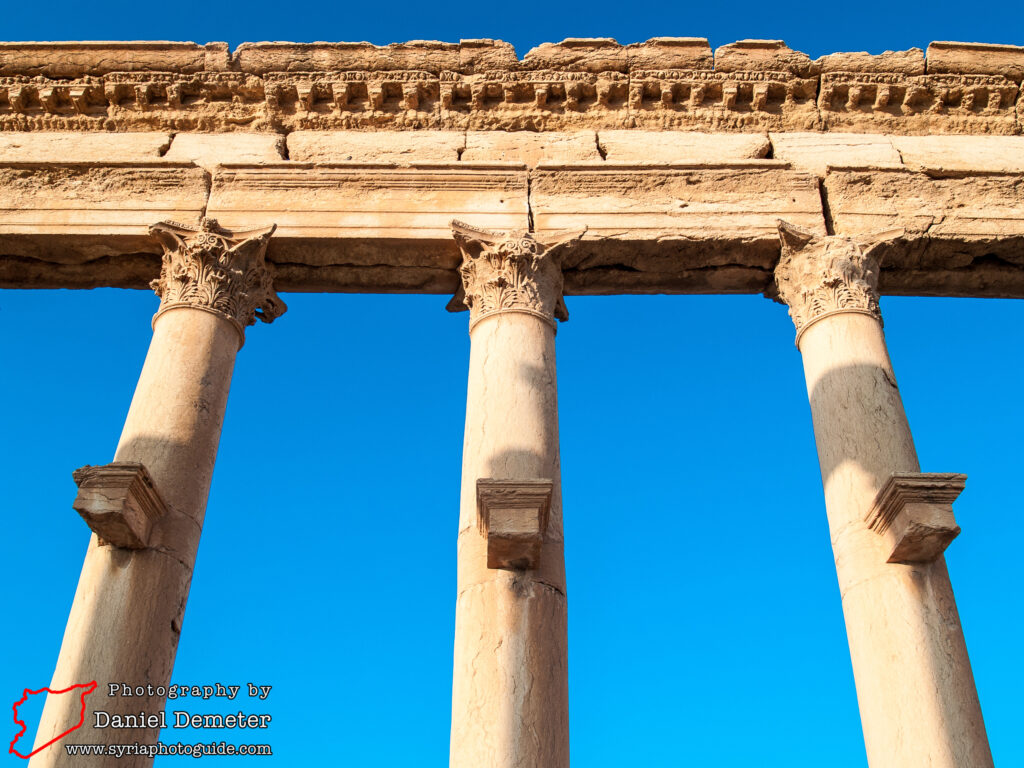
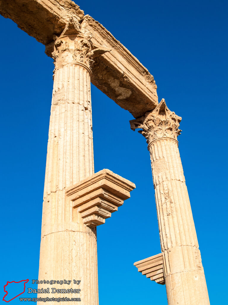
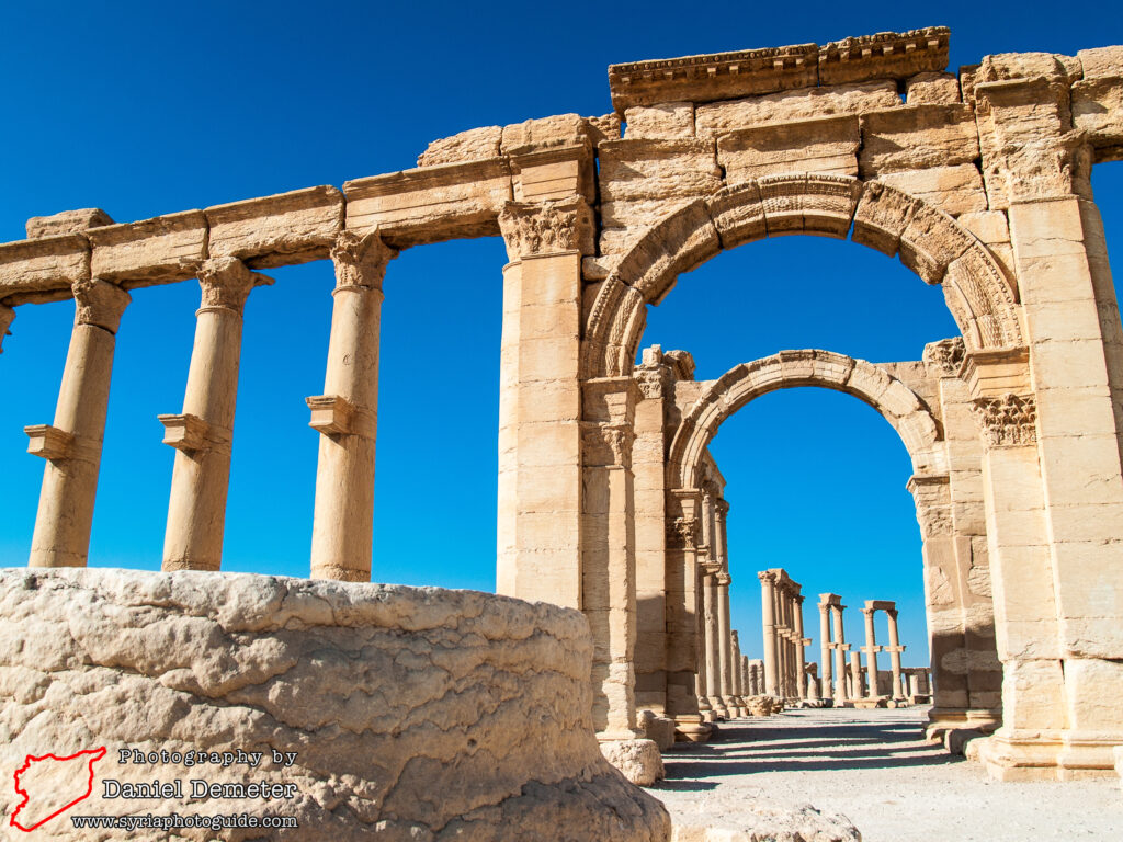
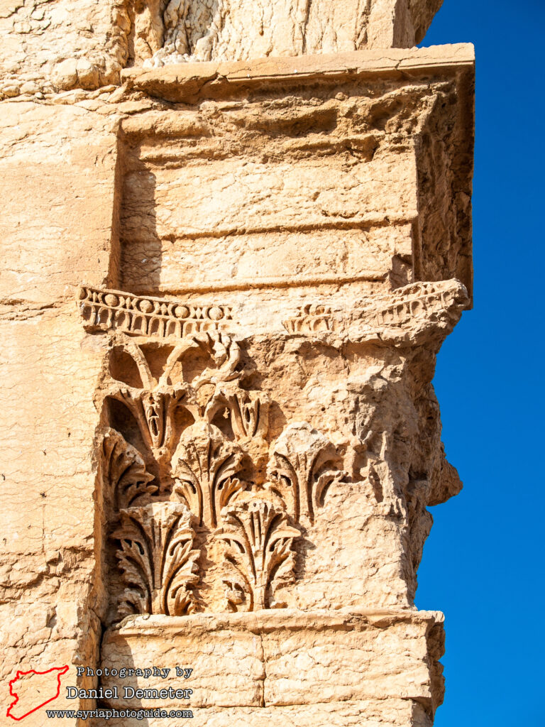
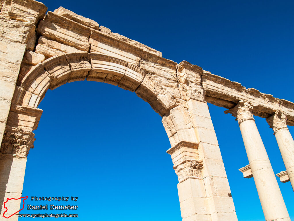
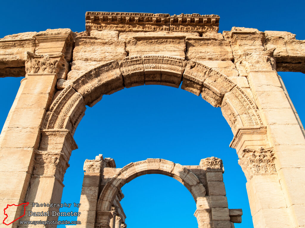
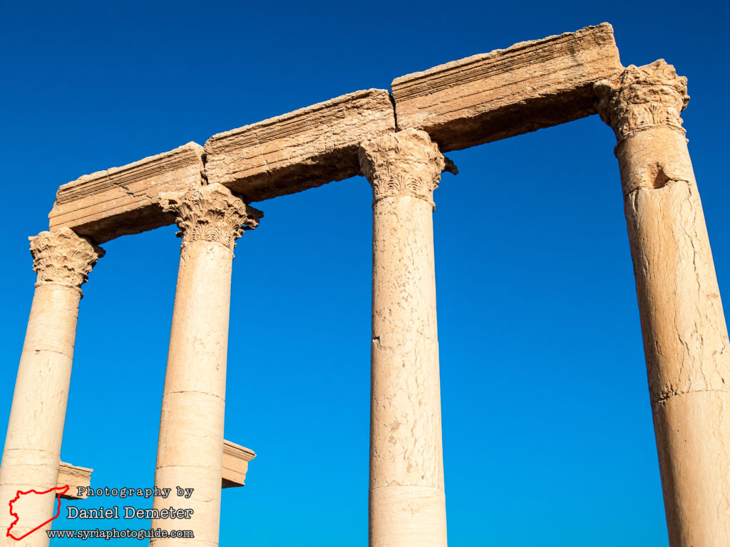
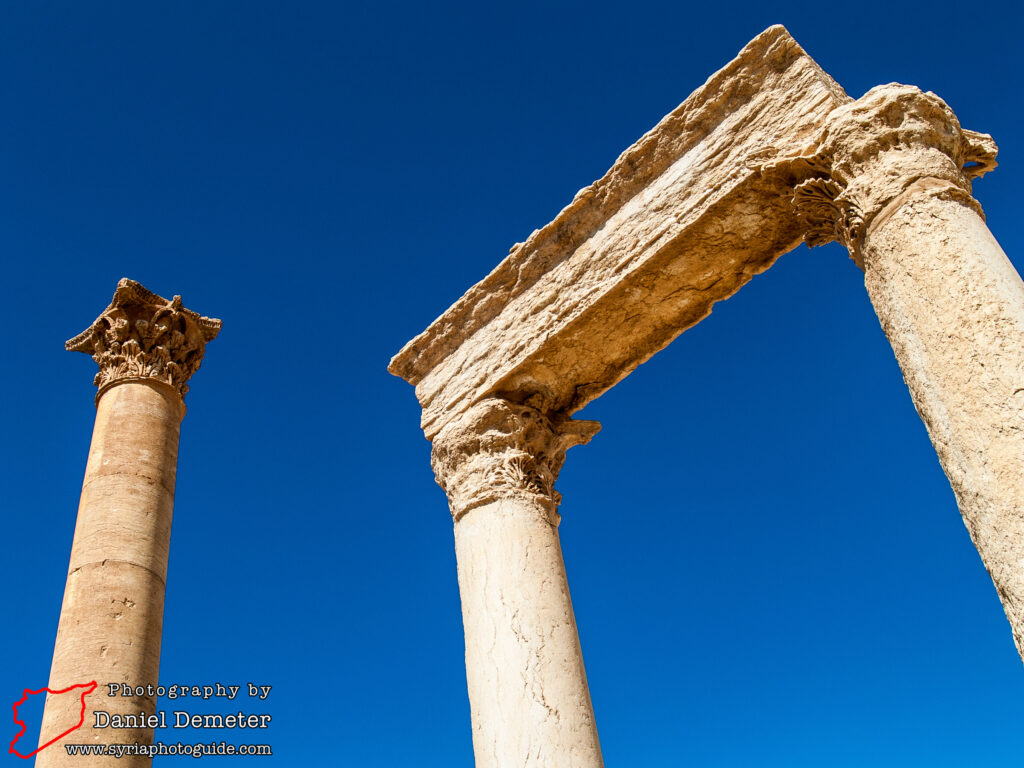
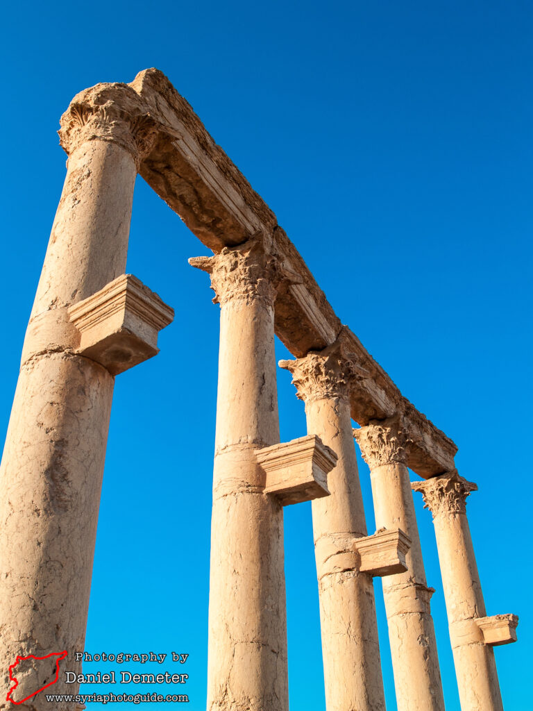
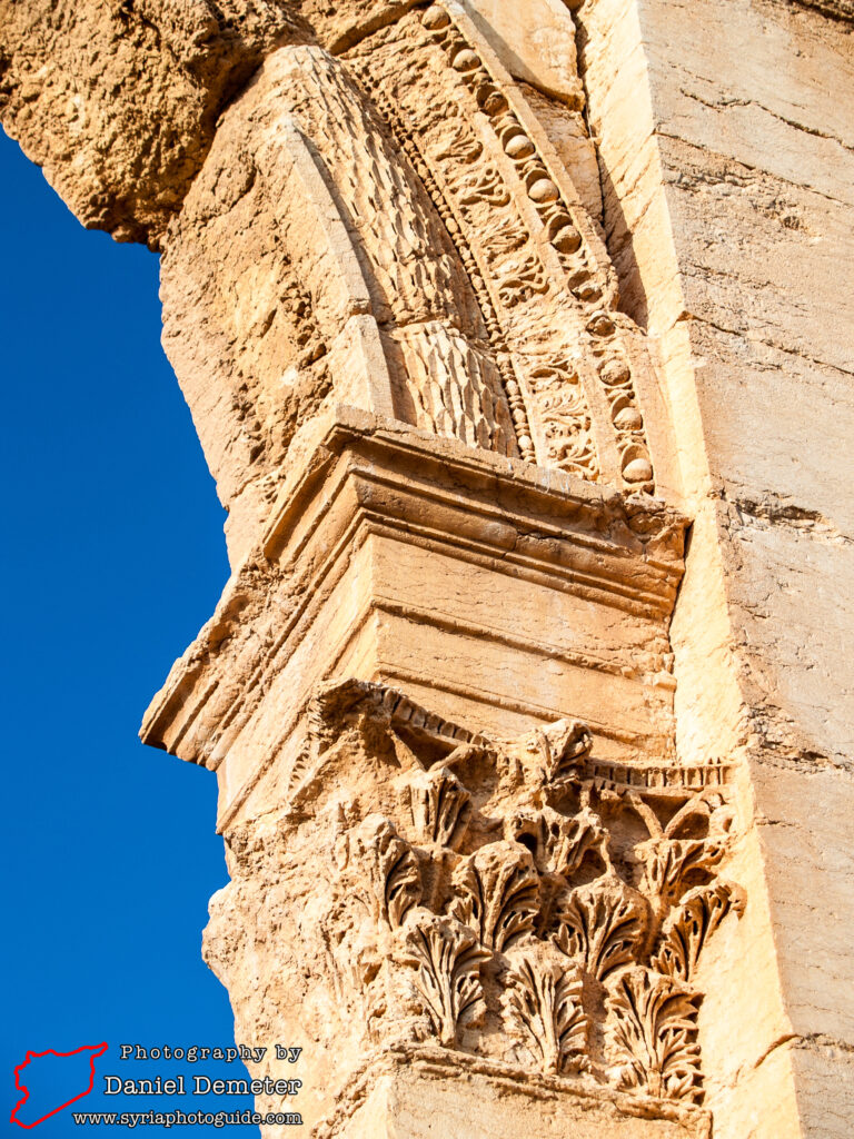
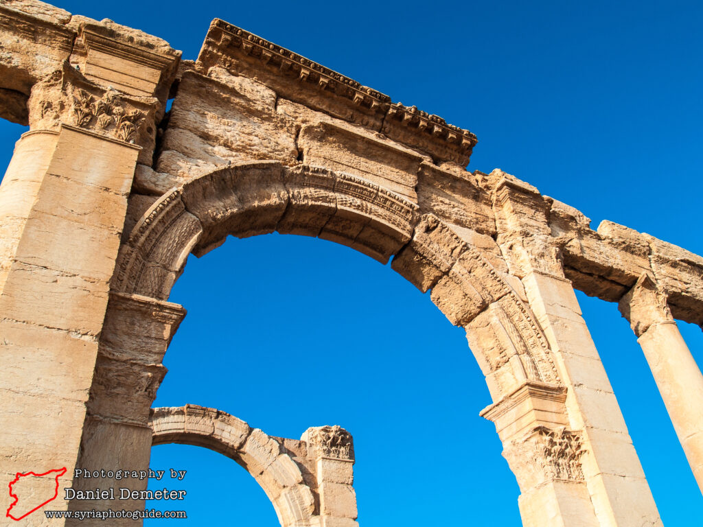
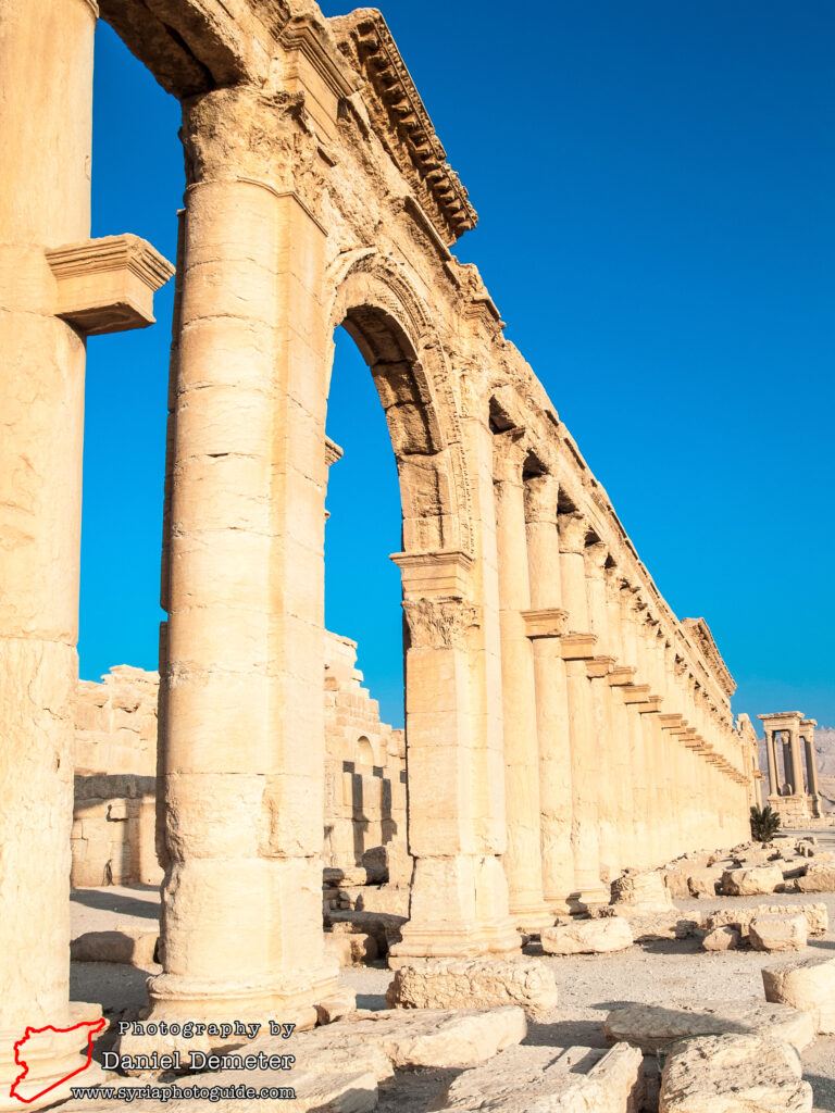
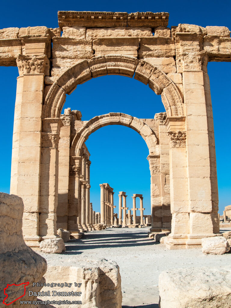
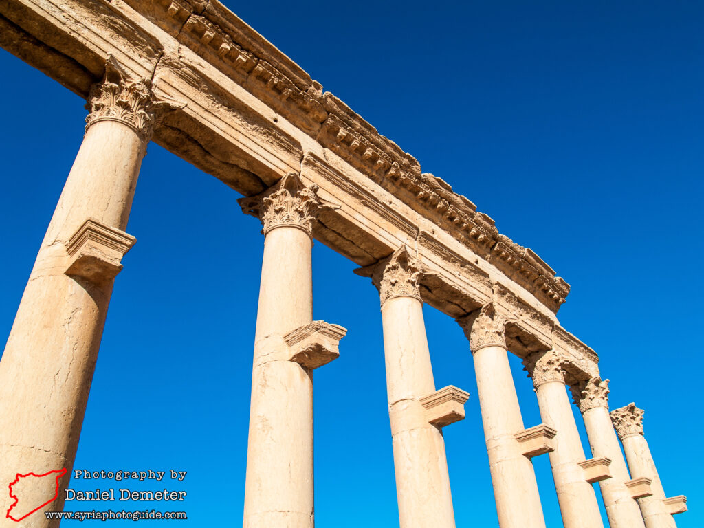
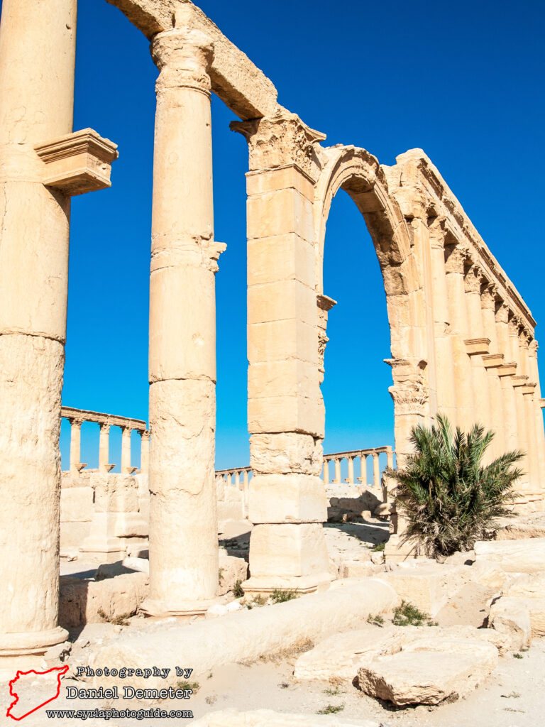
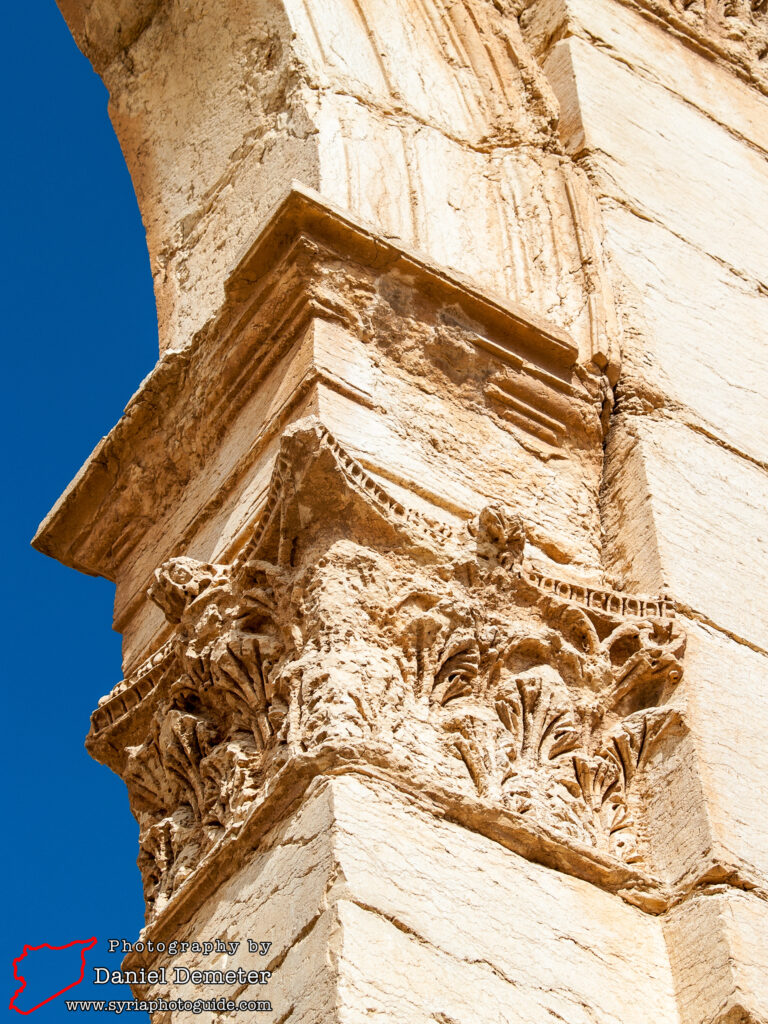
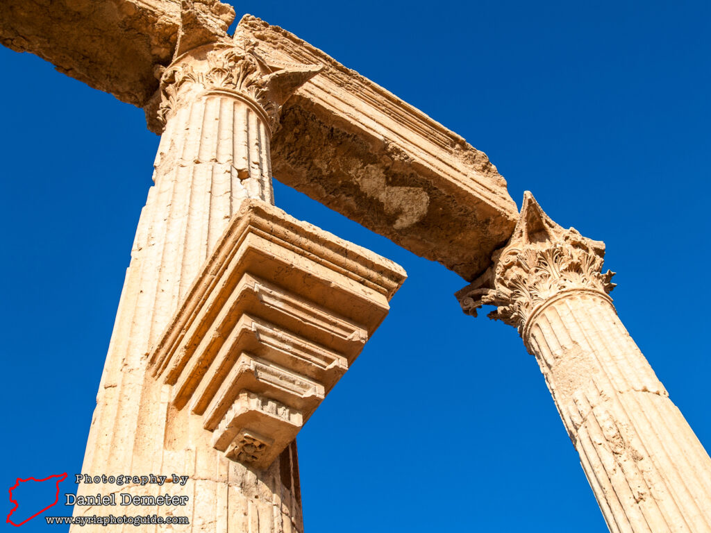
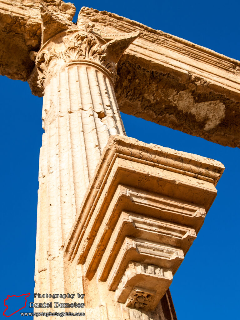
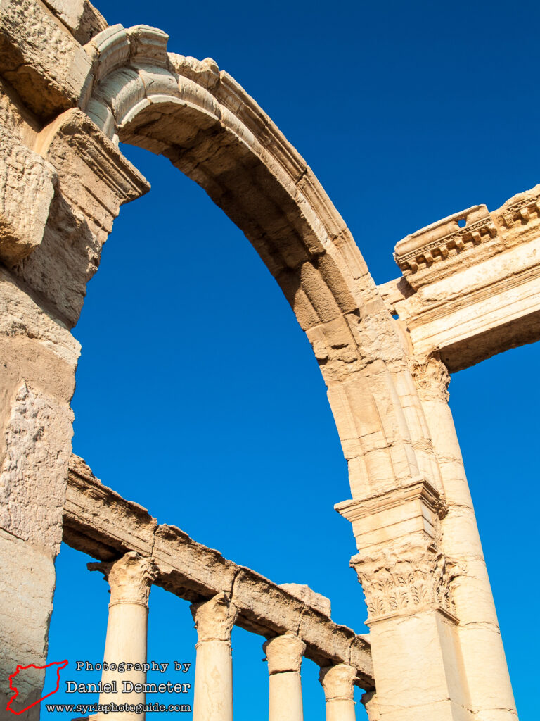
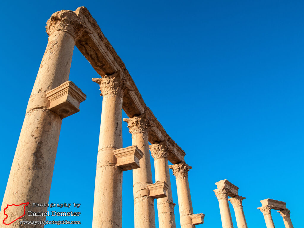
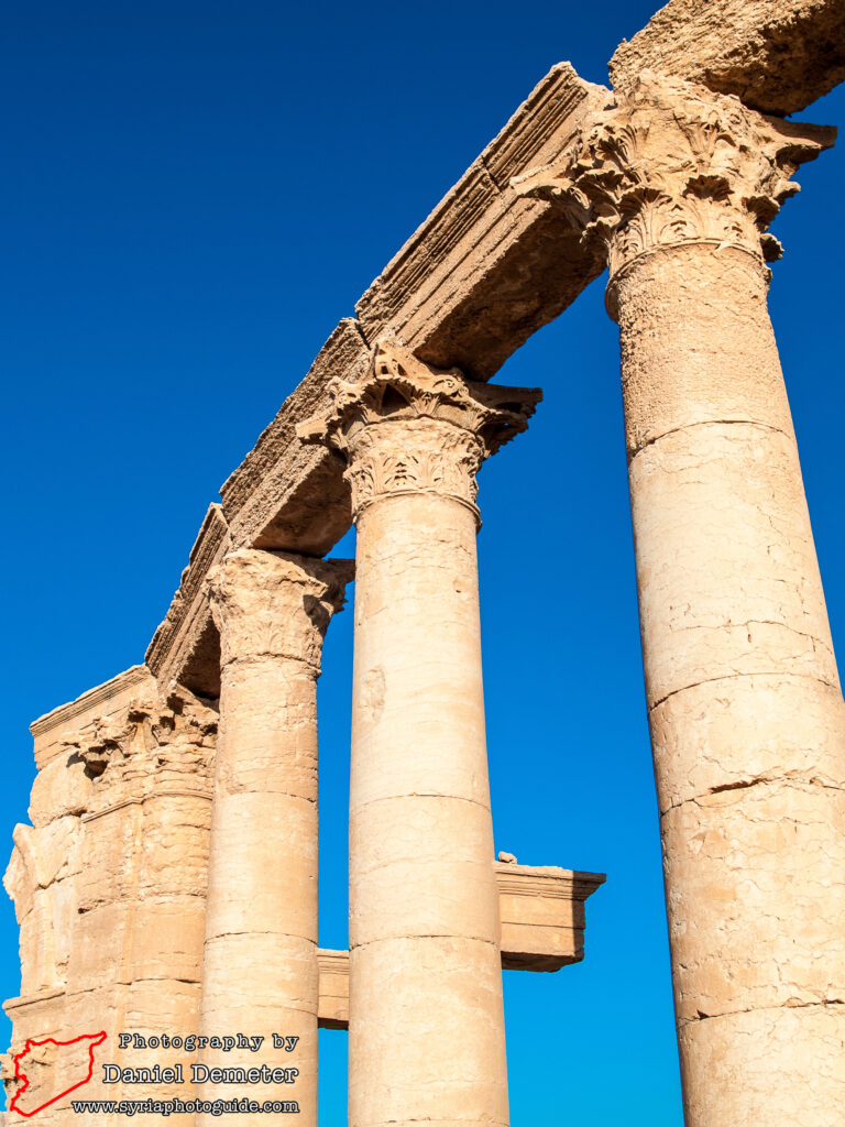
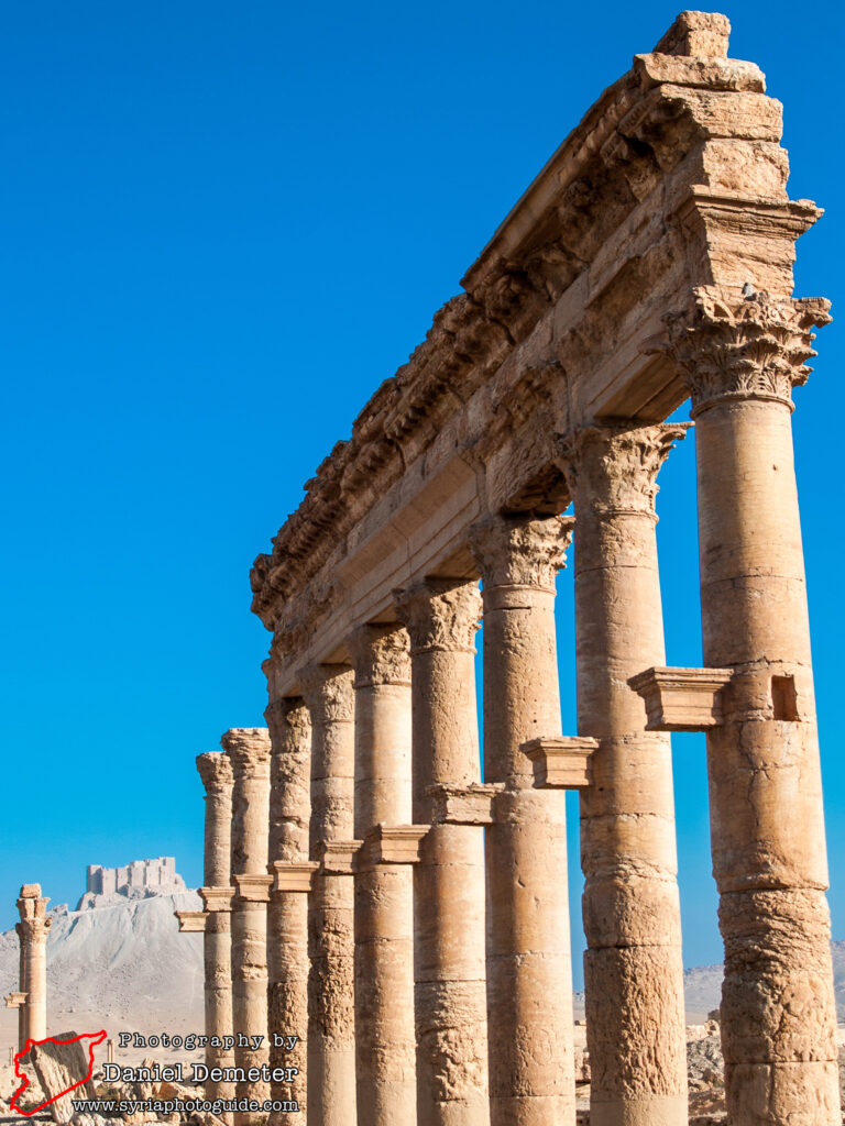
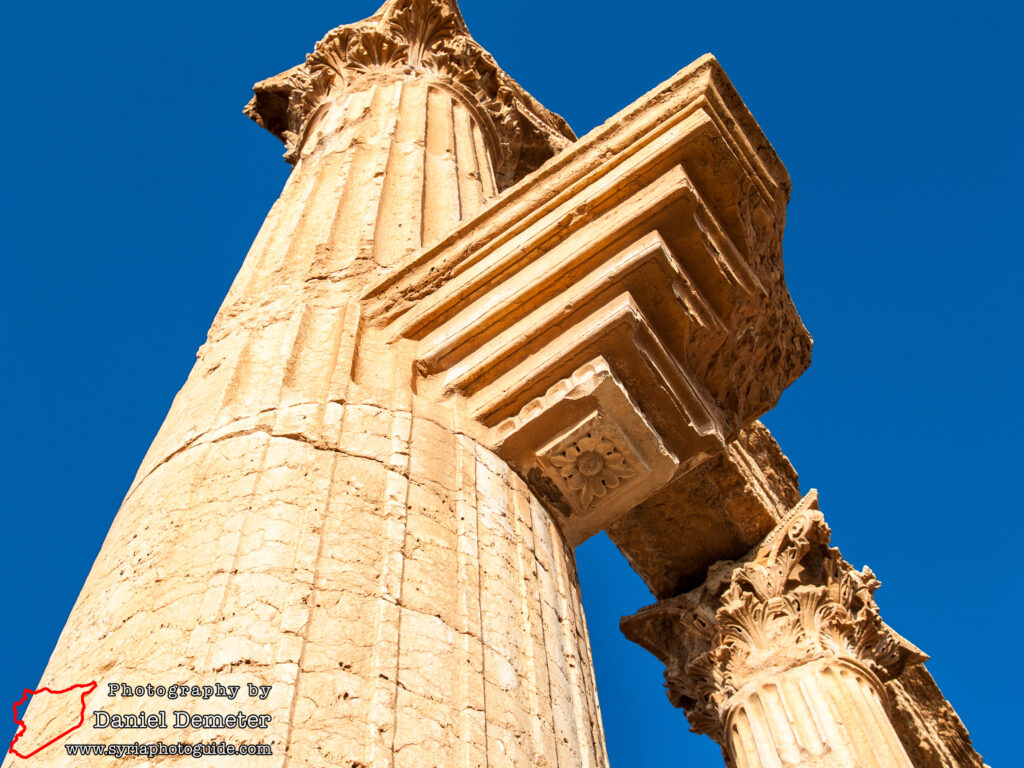
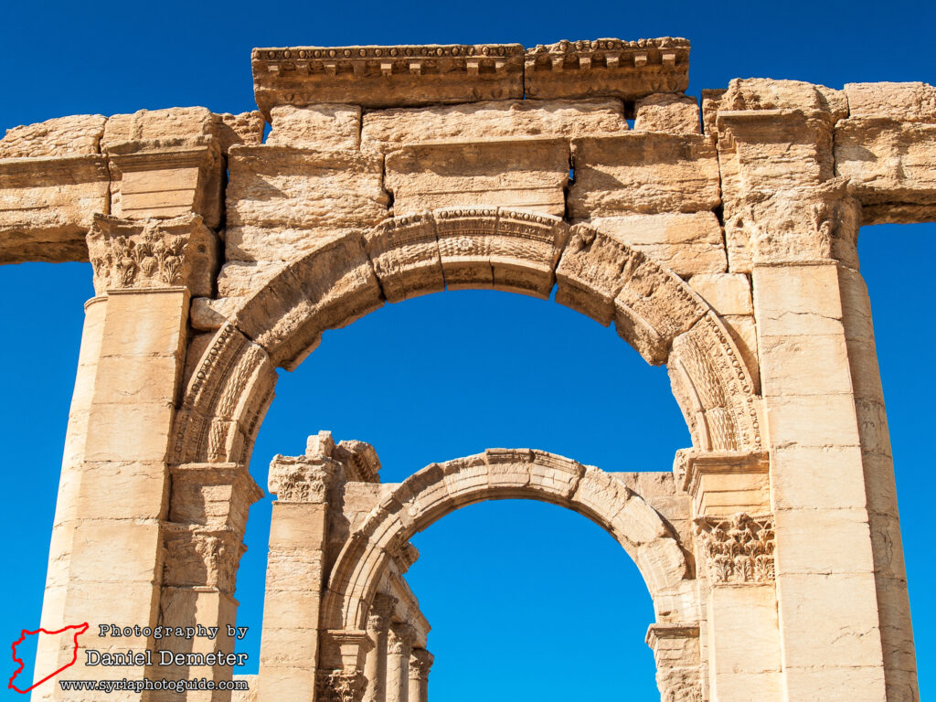
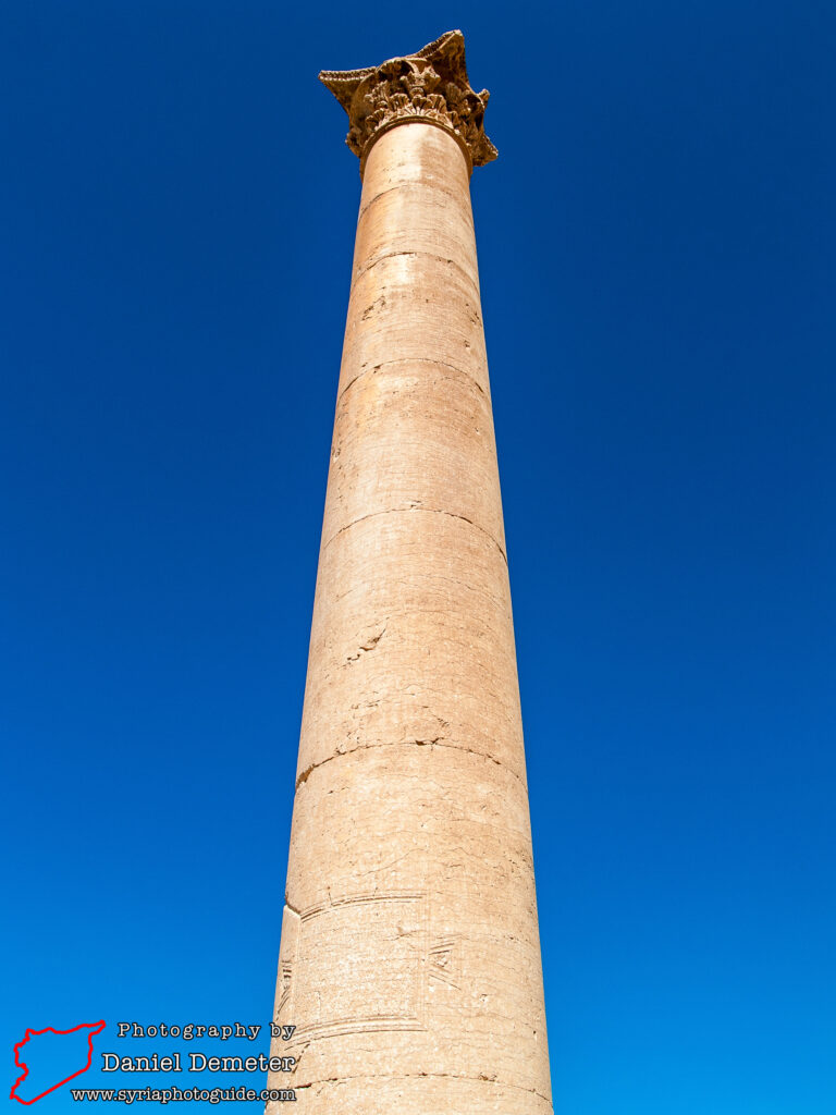
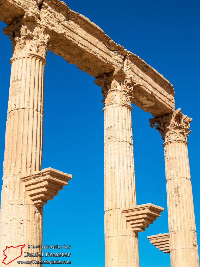
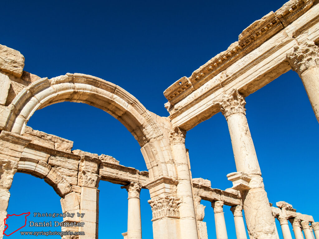
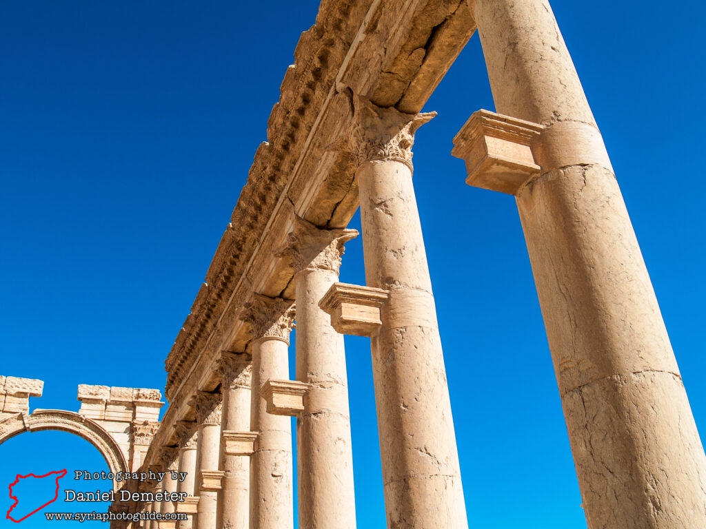
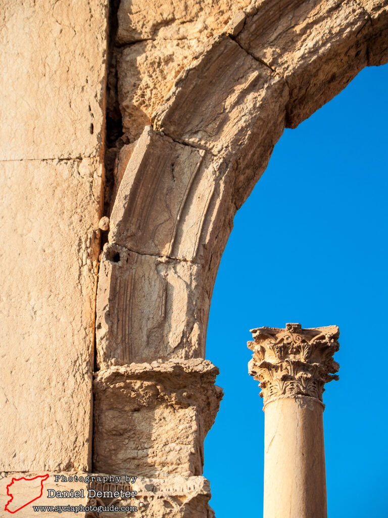
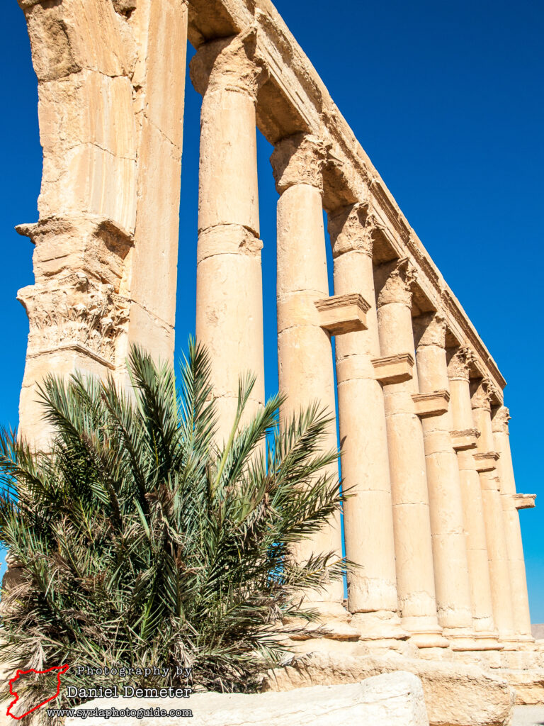
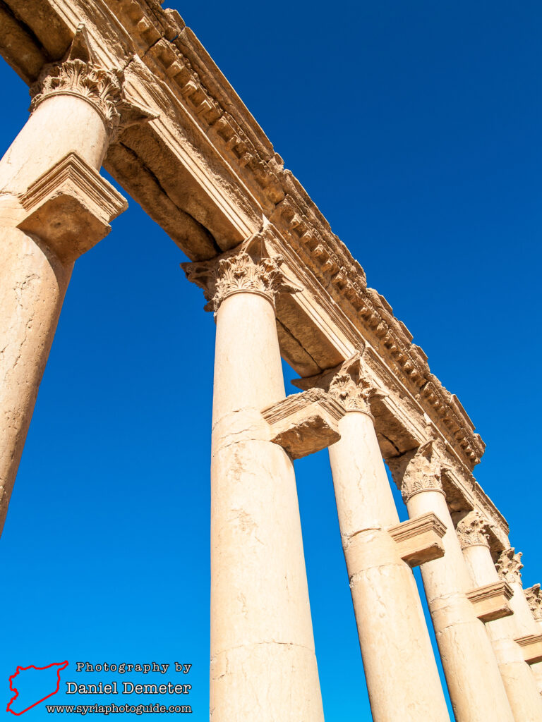
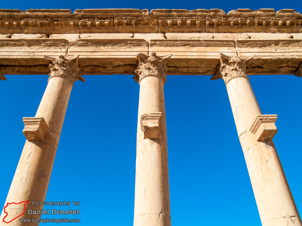
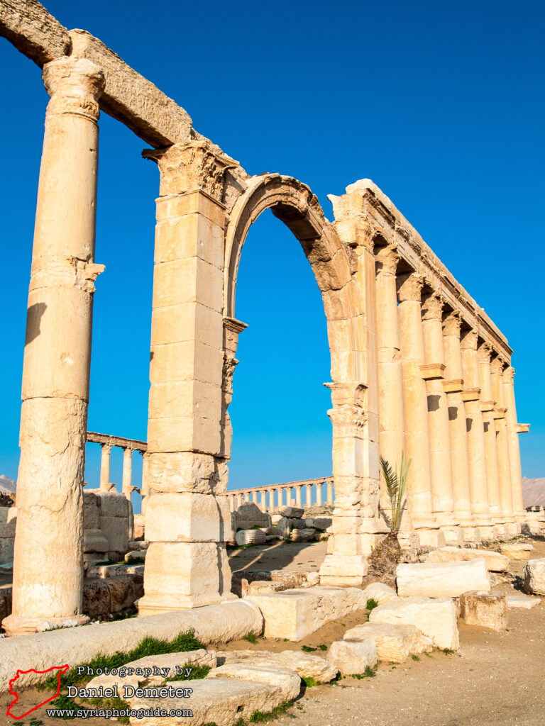
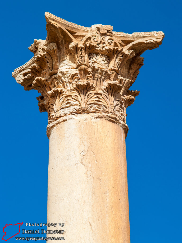
The tetrapylon (التترابيل) marks a ten degree shift in direction for the main colonnaded street, and also an important intersection in the city. Continuing southeast, this section of the main colonnaded street is the best preserved, and was constructed in the early to mid third century. The central carriageway was eleven meters wide and was flanked by porticos six to ten meters broad. In several areas the foundations of small shops can be found behind the porticos. Throughout this area of the city, brackets which originally held statues of prominent citizens protrude from the columns. Beyond the theater (مسرح) and baths (الحمامات) is the monumental arch (قوس النصر), which marks another shift in the orientation of the Great Colonnade (الشارع الطويل), this time by thirty degrees. The remaining length of the main street, from here to the gateway of the Temple of Bel (معبد بل), was constructed in the late second or early third century. It appears that this final section was never fully completed.
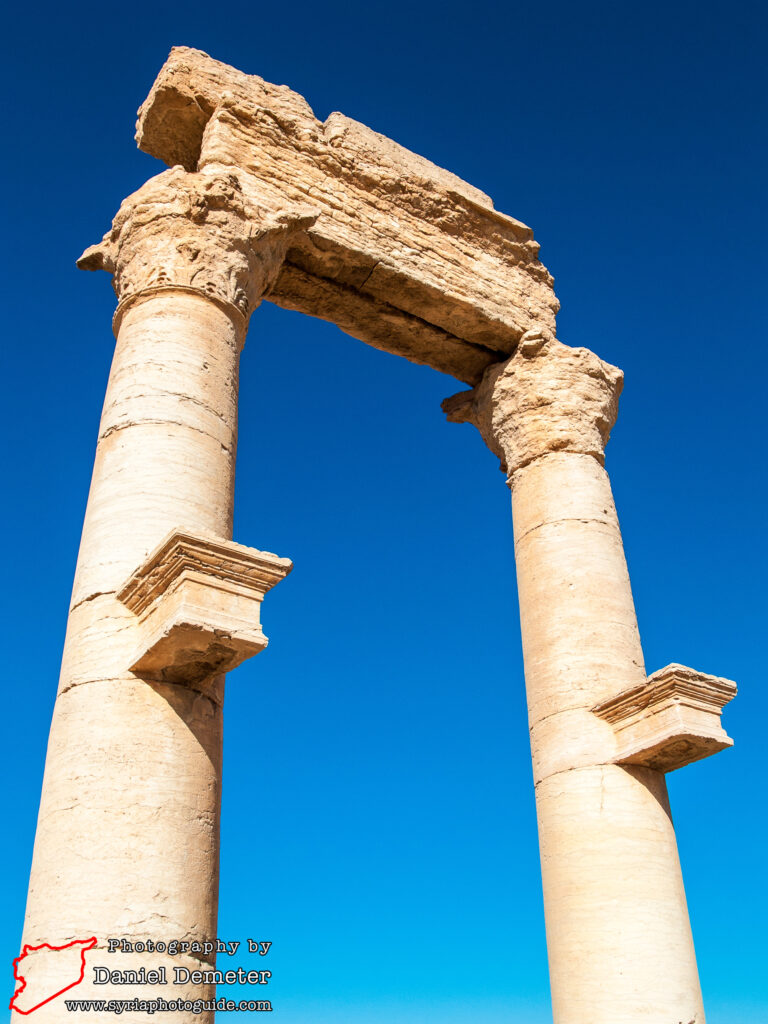
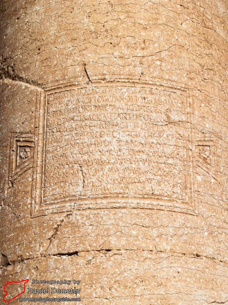
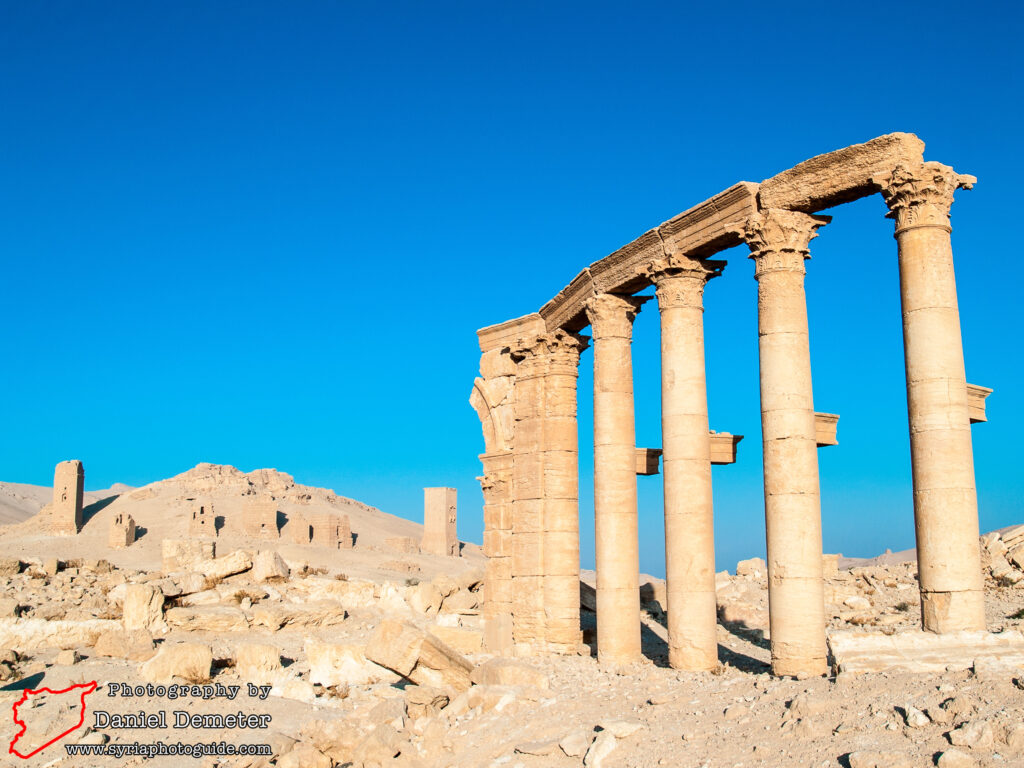
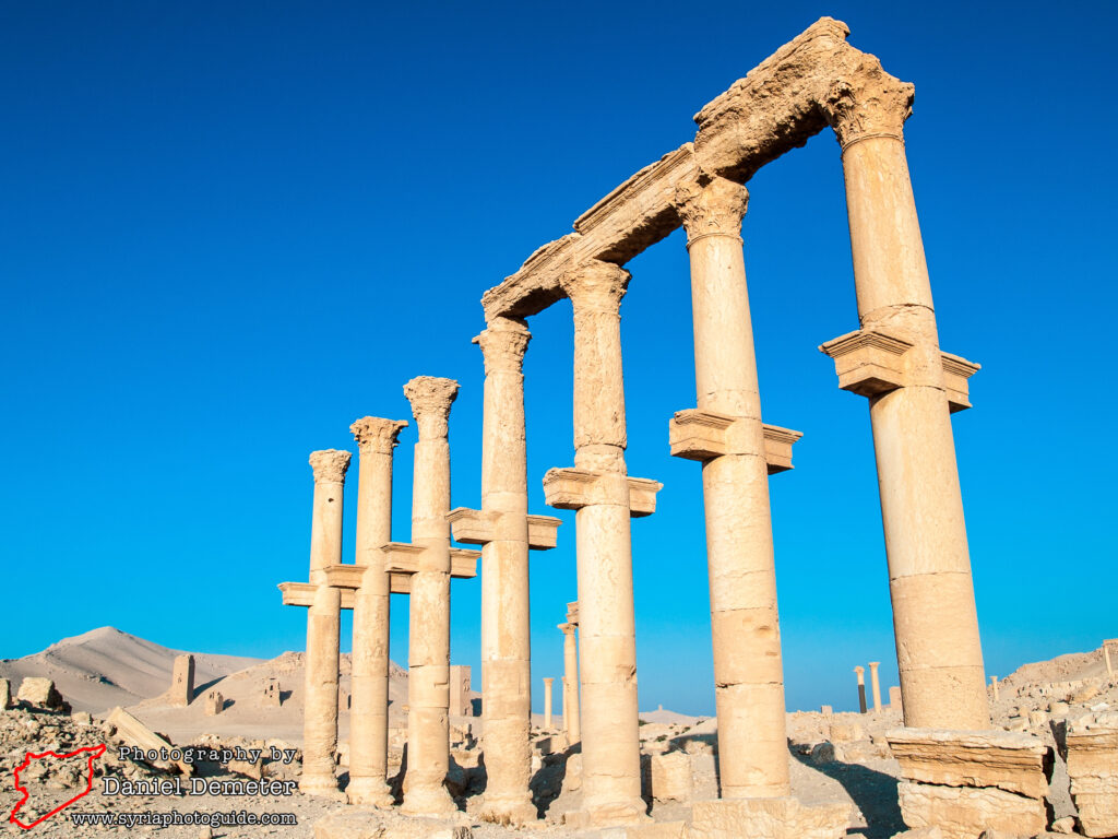
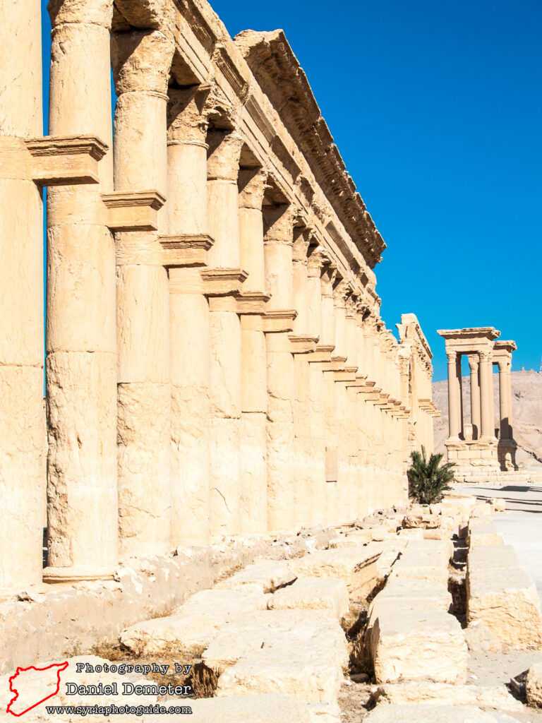
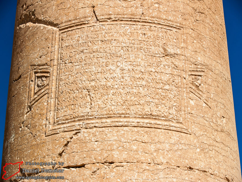
Sections of other colonnaded streets (شوارع معمدة), many of which traverse the main colonnade, can be found throughout the acropolis. Preceding the funerary temple (المعبد الجنائزي) is an important street that travels southwest through the Camp of Diocletian (معسكر ديوقلسيان) to the southwestern city gate. Another travels southwest from the tetrapylon (التترابيل) to the agora (الآغورا). Of these, only small sections of the colonnade remains standing. Other streets would have traveled in a northeast direction from the main colonnade, towards the Temple of Baal-Shamin (معبد بعلشمين) and residential quarters, but very little of these survive. Another colonnade forms a half circle around the theater (مسرح) and extends southwest from there. An additional street traveled northeast of the monumental arch (قوس النصر) towards the city’s northeastern gate. Sparse remains of this colonnade, including one monumental column with inscription, can be found about five hundred meters to the northeast.


Preservation Status: The archaeological remains of Palmyra (تدمر), including the colonnaded streets (شوارع معمدة), are under enormous risk. Since May 2015, the town and environs have been under control of the Islamic State (الدولة الإسلامية) militant group, committed iconoclasts who have purposely targeted archaeological heritage in both Syria and Iraq for destruction. There have been numerous reports of explosives being planted throughout the site, which may include sections of the colonnaded streets (شوارع معمدة).
Getting There: Palmyra (تدمر) is located at a major crossroads in the Syrian desert between three major cities. It is located east of Homs (حمص), northeast of Damascus (دمشق) and southwest of Deir al-Zur (دير الزور). Most buses traveling between Homs (حمص) or Damascus (دمشق) and Deir al-Zur (دير الزور) will stop in Palmyra (تدمر). The colonnaded streets (شوارع معمدة) are located throughout the acropolis, primarily to the northwest of the monumental arch (قوس النصر).
Coordinates: 34°33’03.00″N / 38°16’10.00″E
Transliteration Variants: Tadmur, Tadmour
Rating: 6 / 10