
Qasr al-Heir al-Sharqi قصر الحير الشرقي
Qasr al-Heir al-Sharqi (قصر الحير الشرقي) is remote desert palace complex dating to the late Umayyad period. Construction began in 728 under Hisham (هشام), the tenth Umayyad caliph. While it was once believed that the site had Roman or Byzantine origins, it appears more likely that stonework was transported from other locations by the Umayyads, or that they employed Christian craftsmen. The site may have been in use earlier as an agricultural settlement, irrigated by waterways from a dam located thirty kilometers to the northwest.
It appears the original purpose of the complex was to assert Umayyad authority over the area, a region where tribal warfare had been widespread. Later, the site would also serve a commercial role on the desert caravan route between Mesopotamia and Damascus (دمشق). Not long after the death of Hisham (هشام) in 743, Umayyad rule was supplanted by the Abbasid dynasty based in Baghdad (Iraq). Syria was largely neglected during Abbasid rule, but Qasr al-Heir al-Sharqi (قصر الحير الشرقي) remained in use until the tenth century. The site was settled again in the 12th century under the Ayyubids, but it was abandoned during the Mongol invasions of the following century.
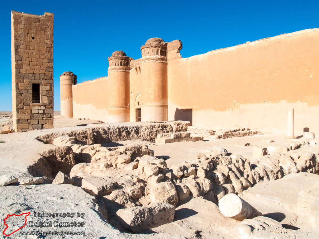
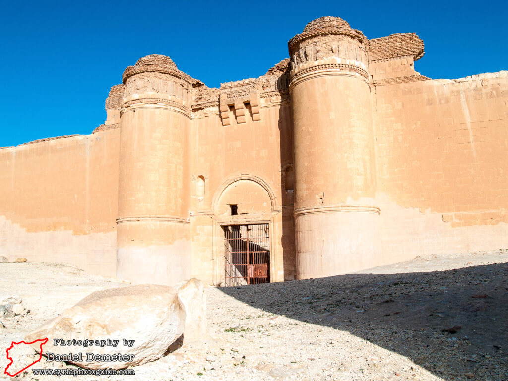
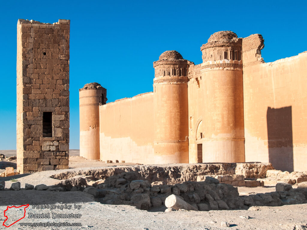
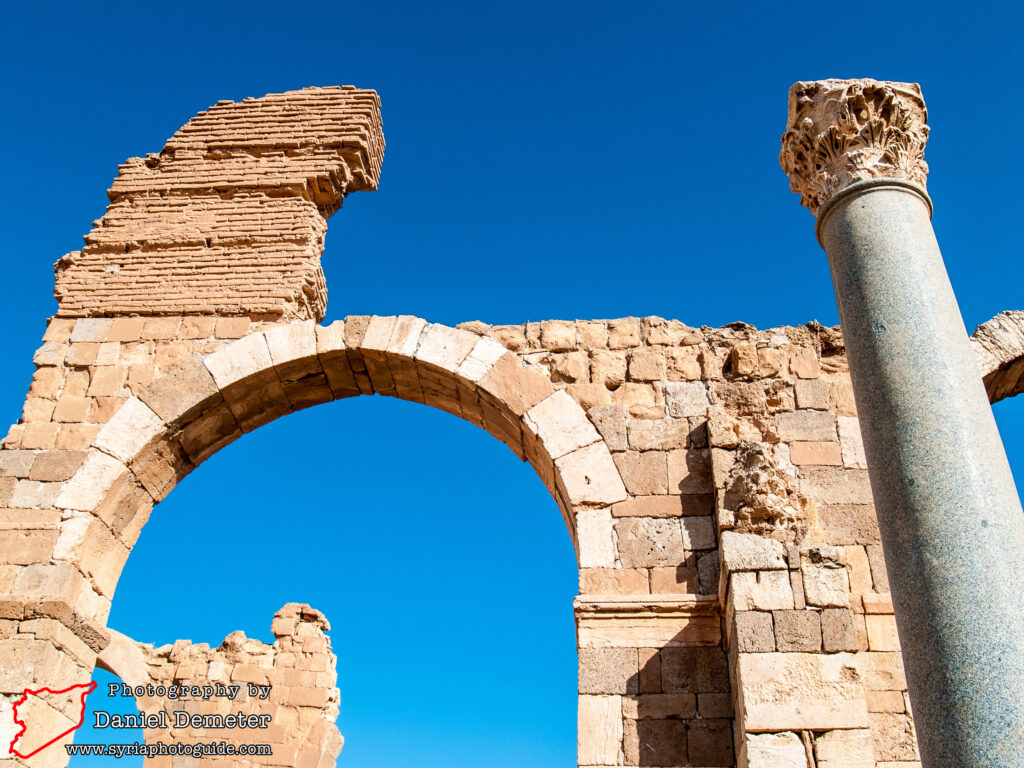
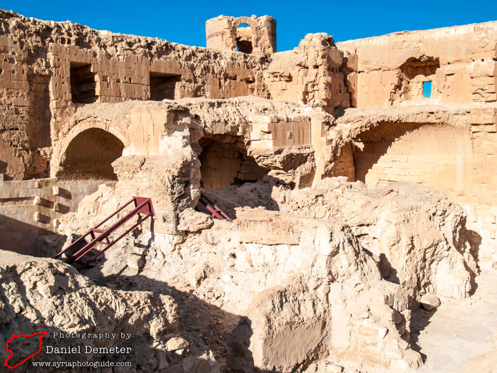
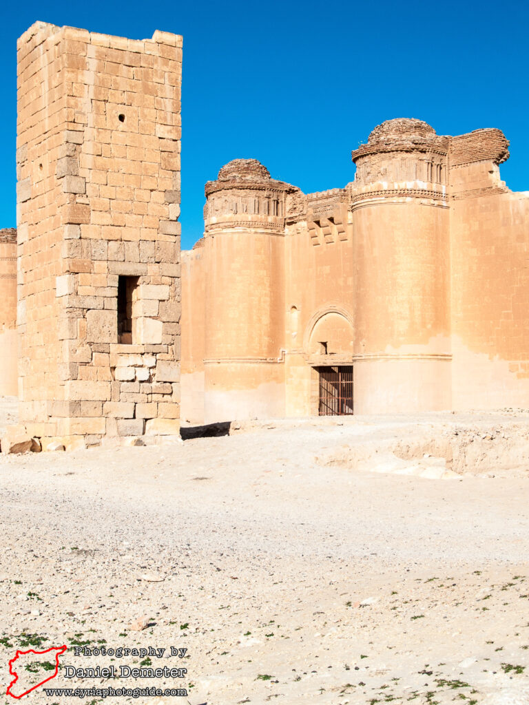
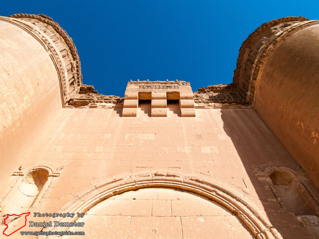
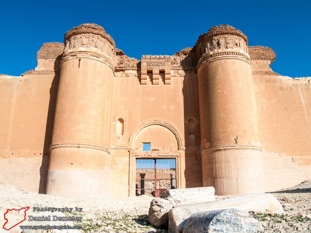
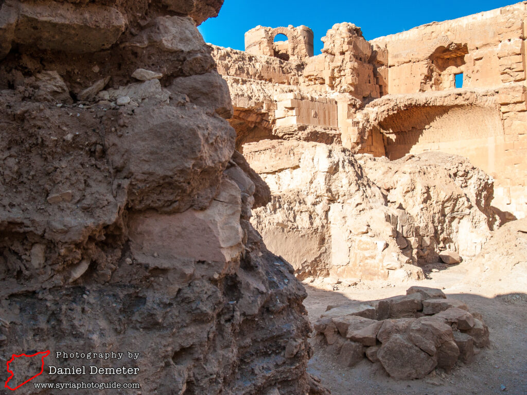
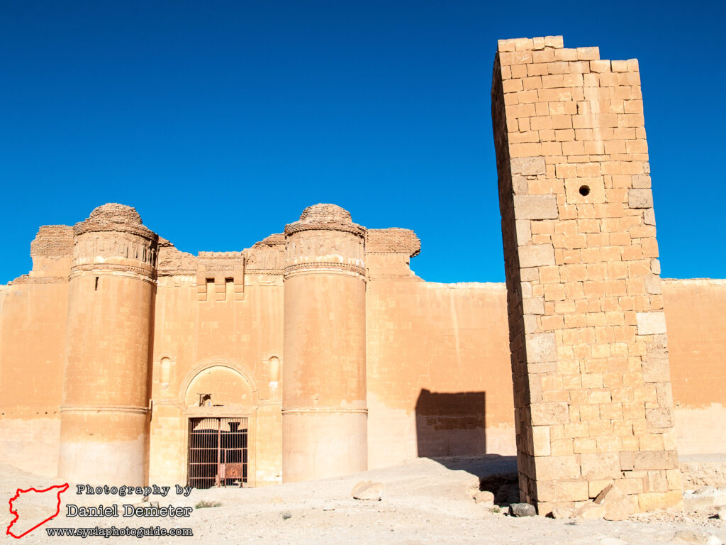
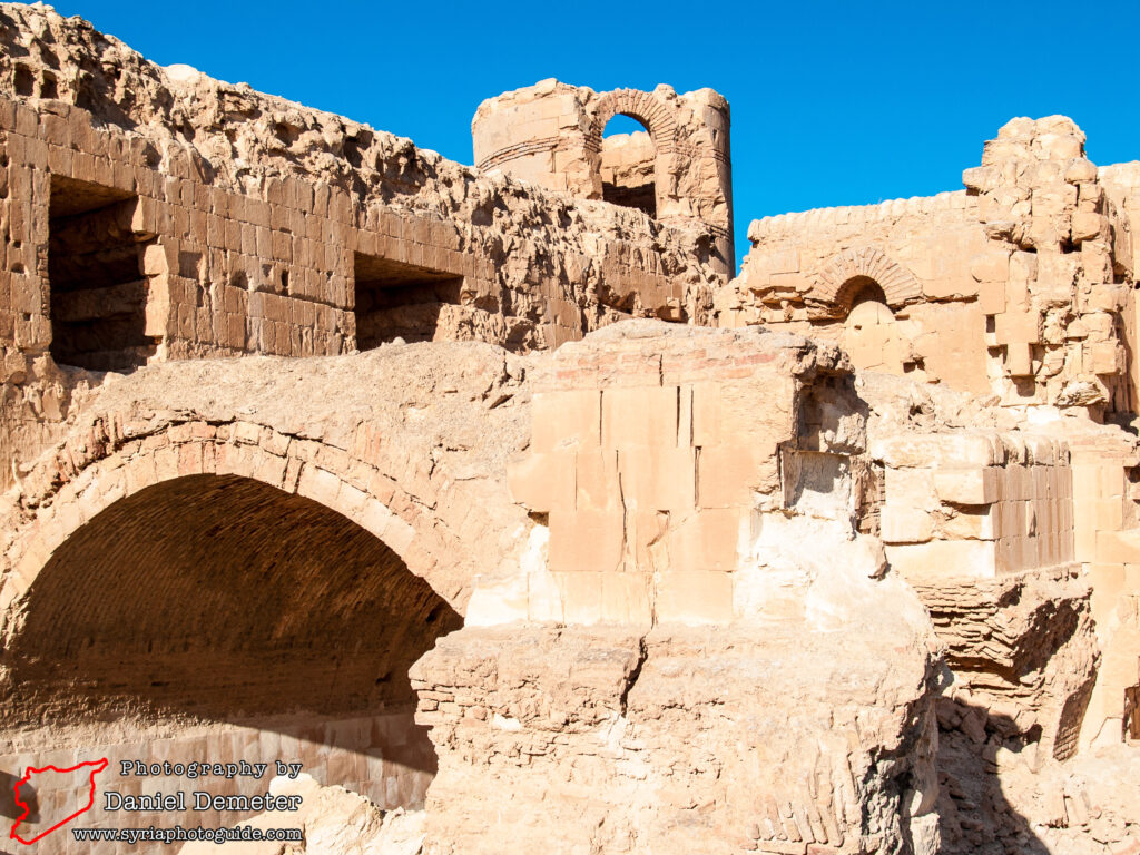
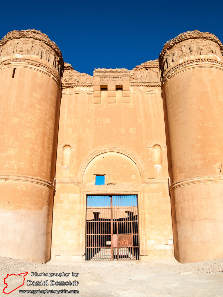
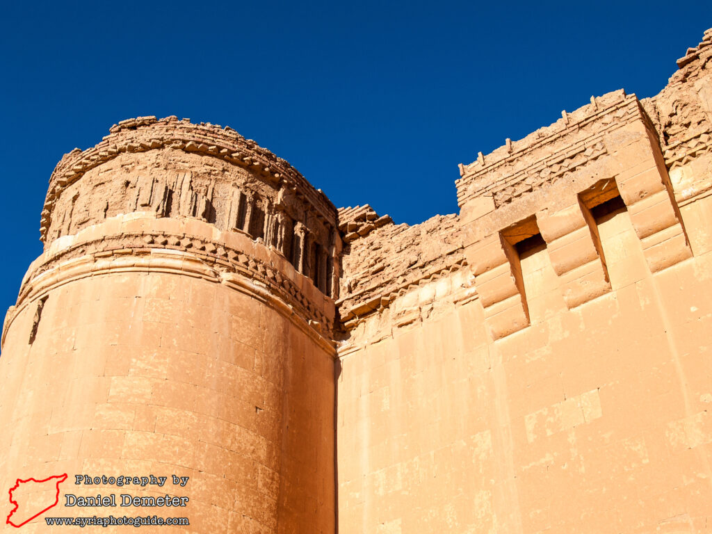
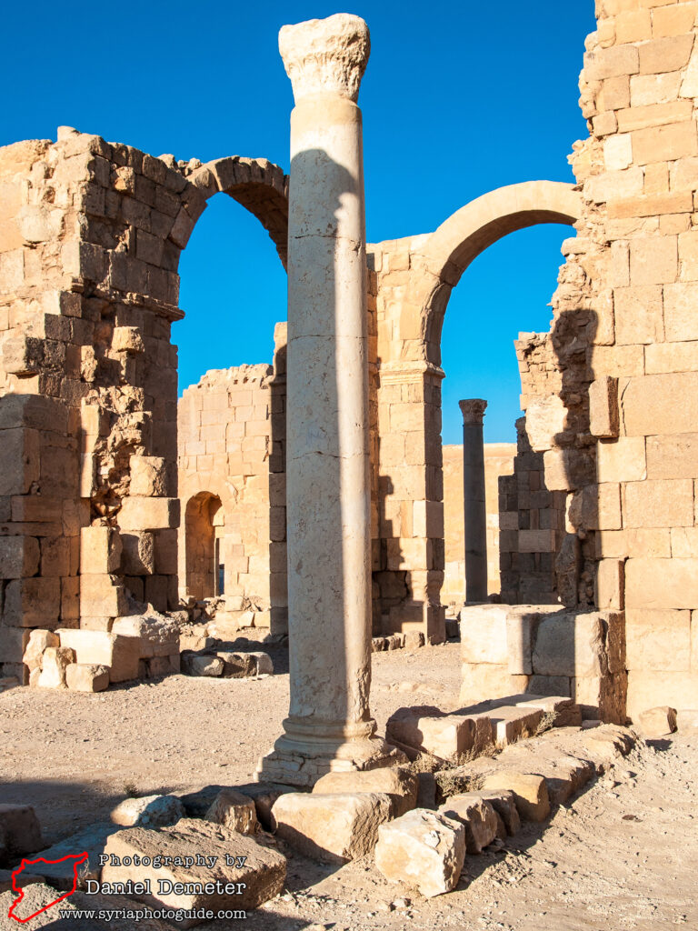
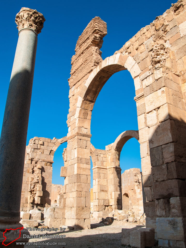
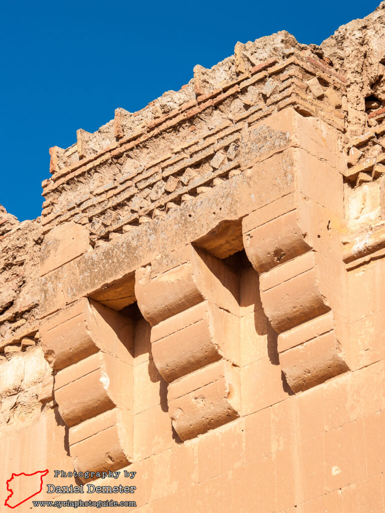
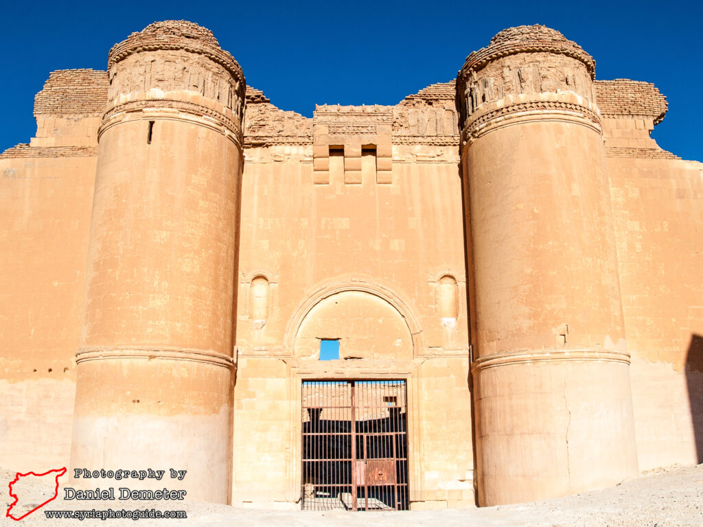
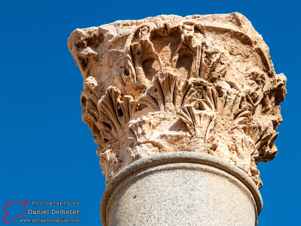
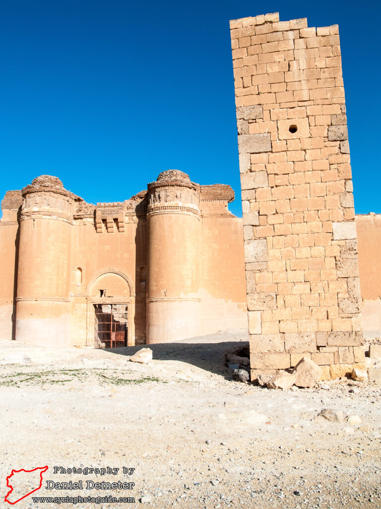
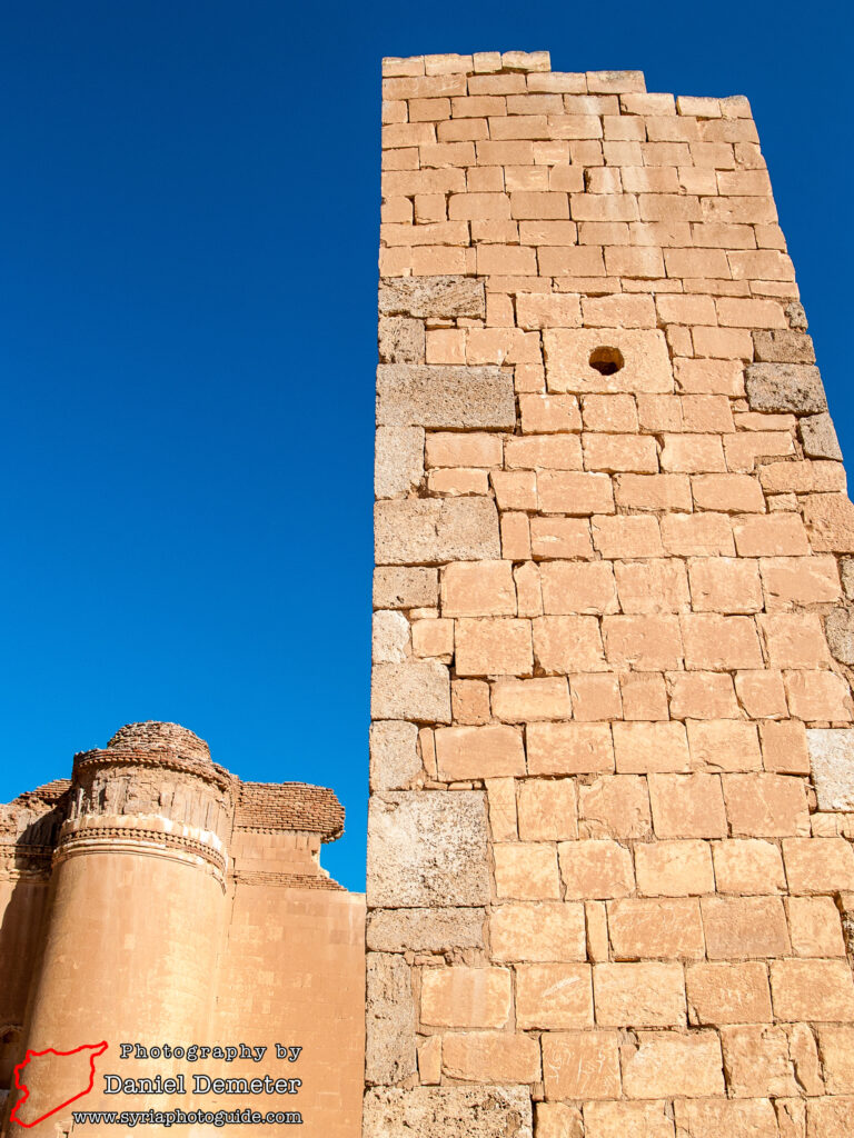
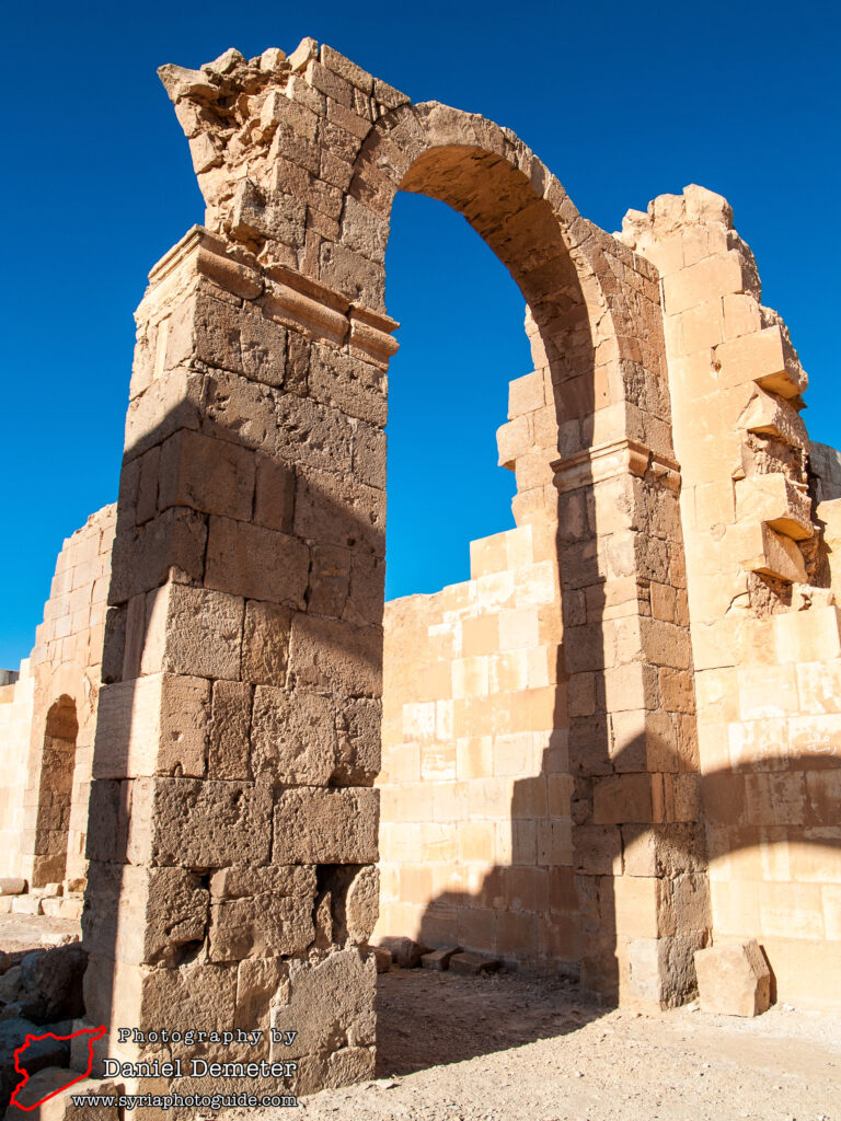
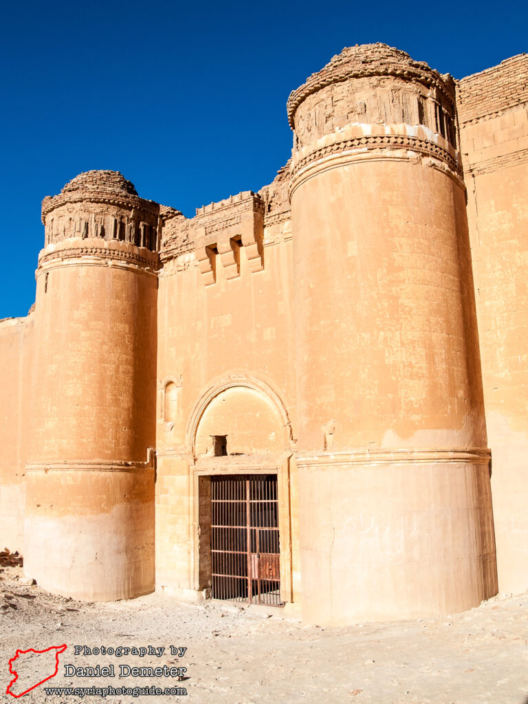
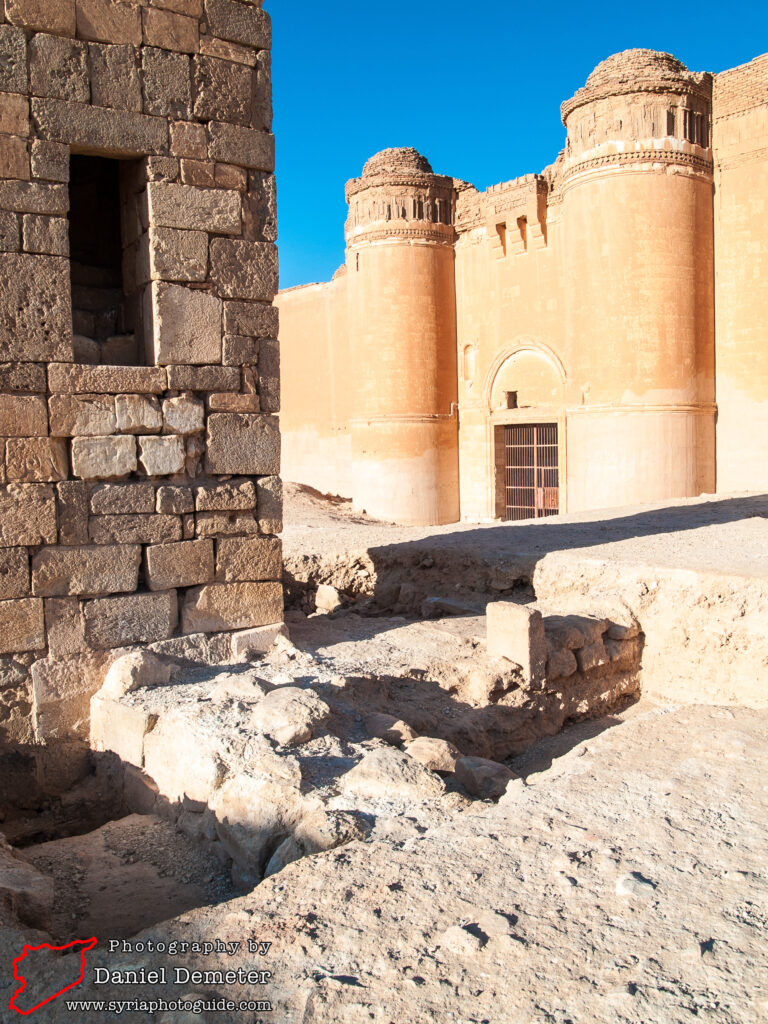
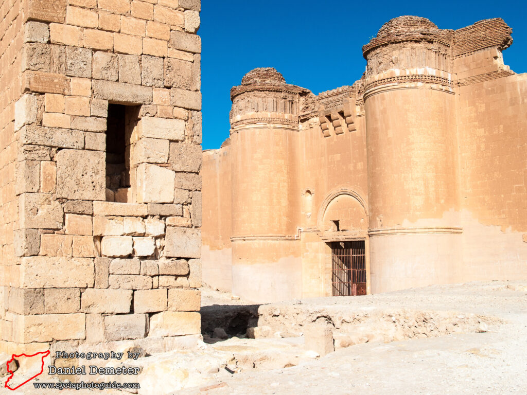
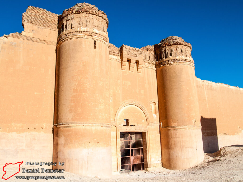
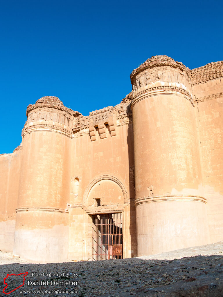
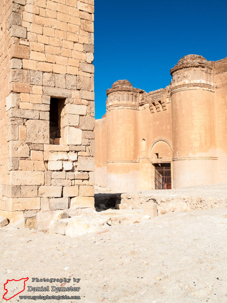
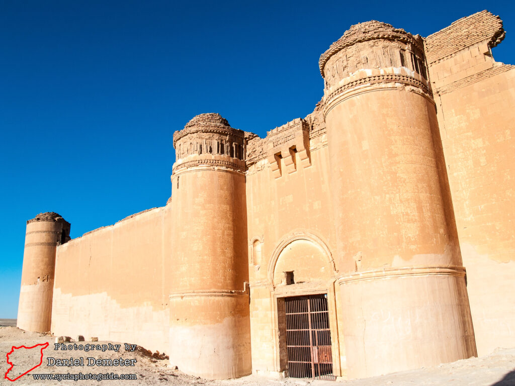
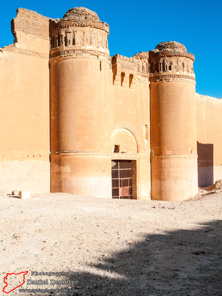
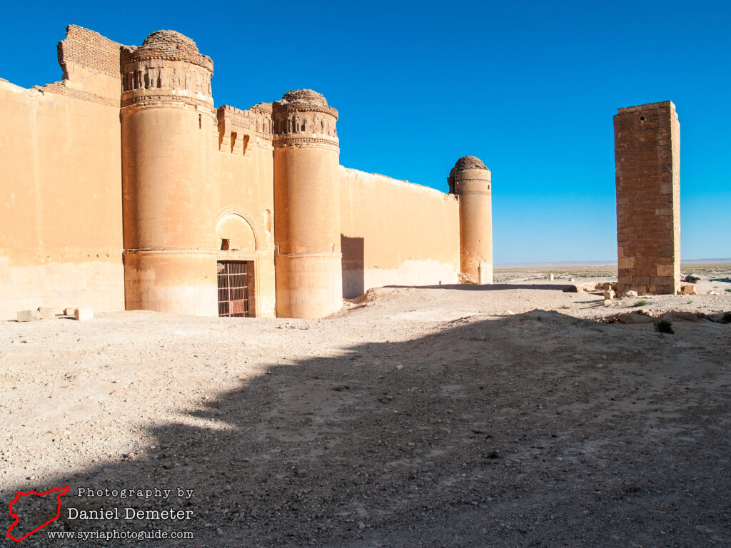
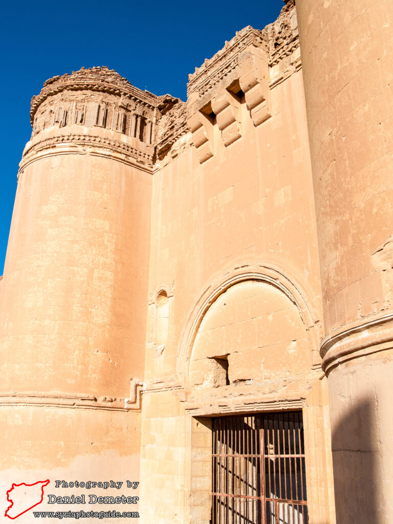
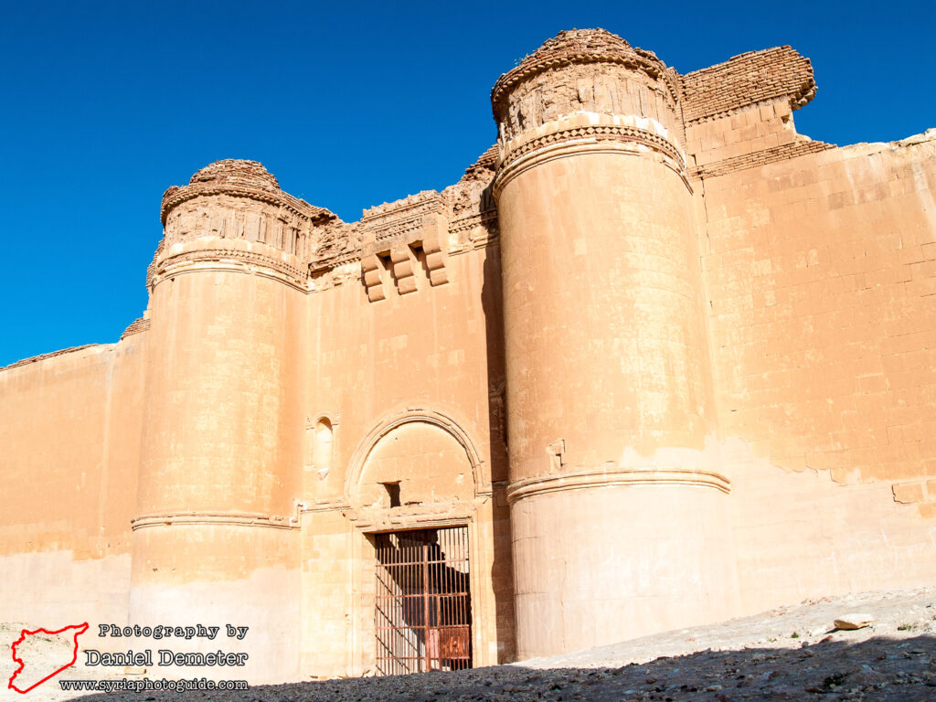
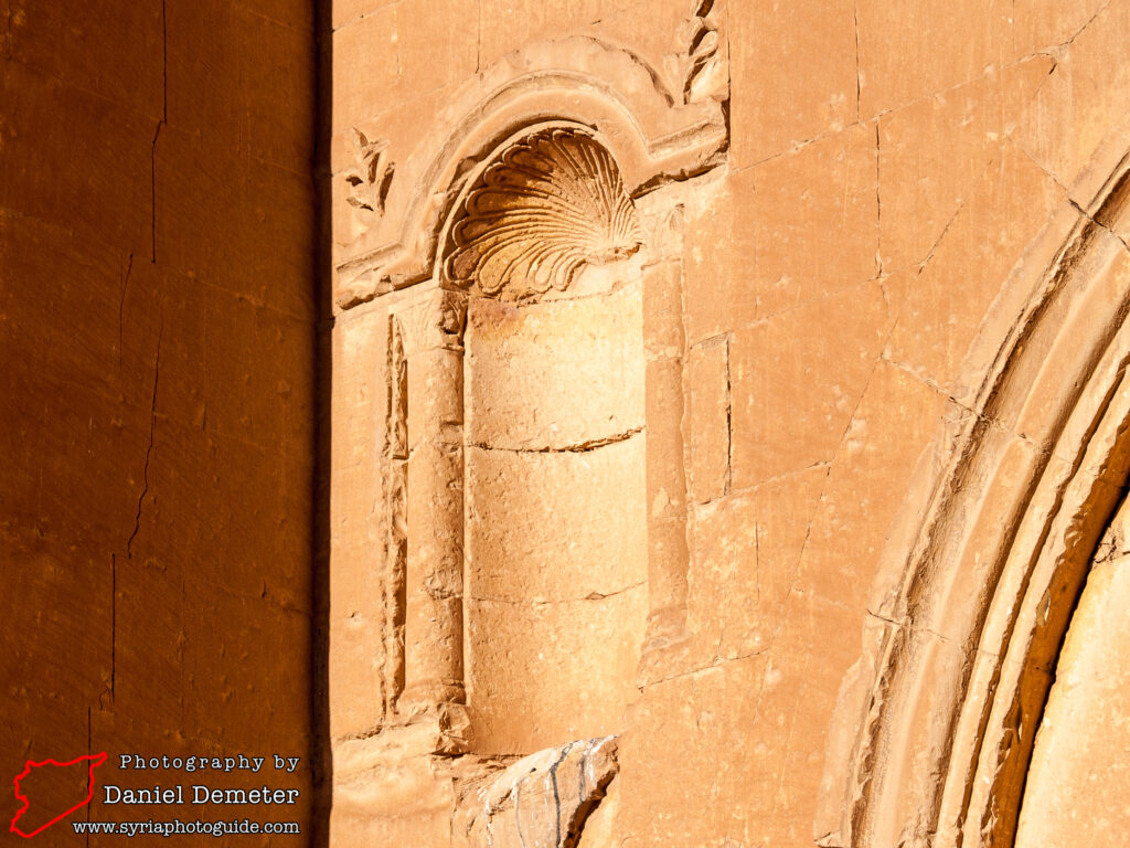
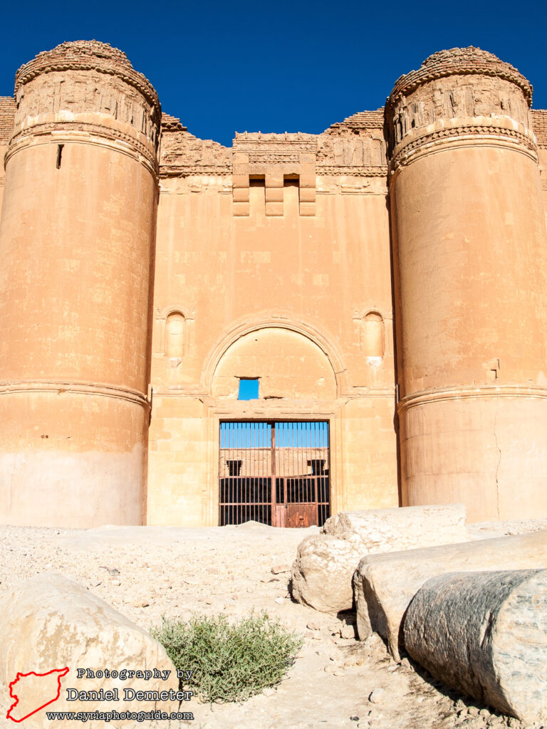
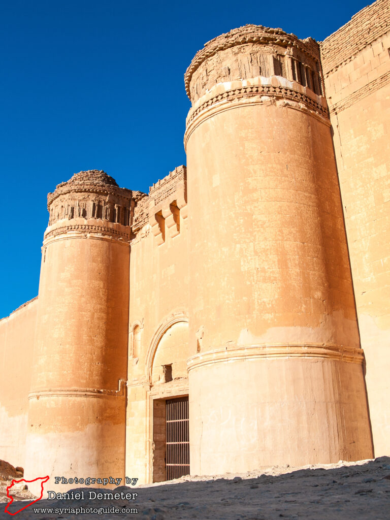
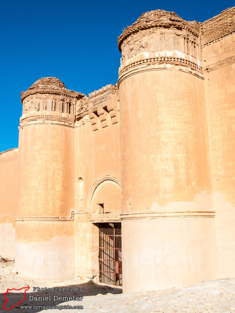
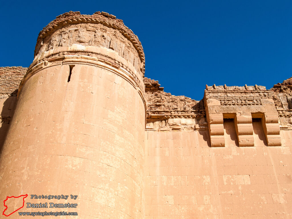
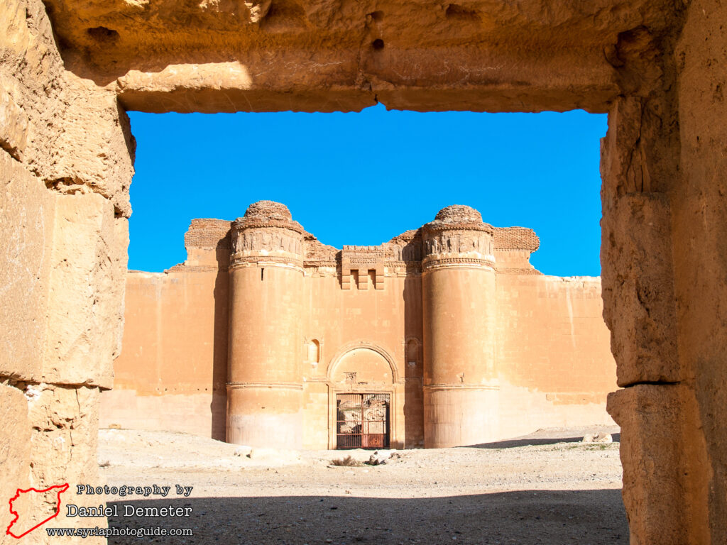
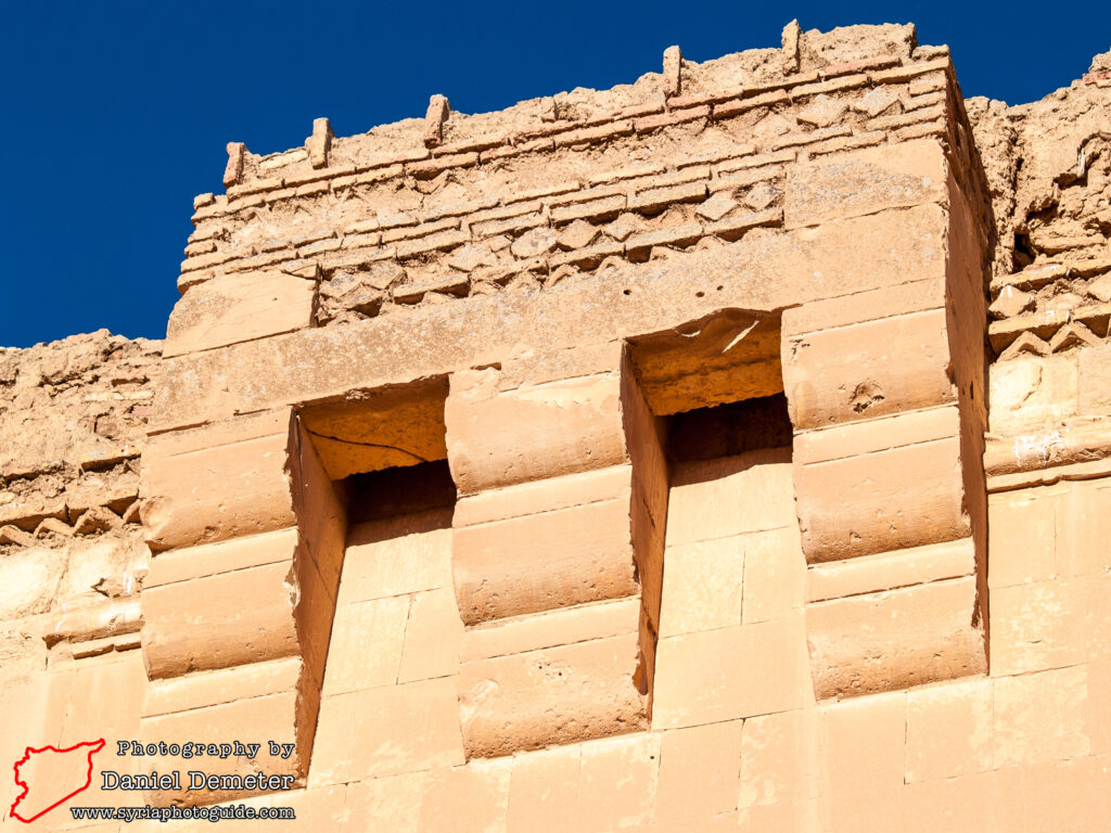
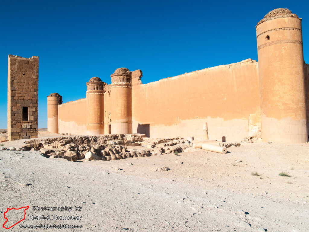
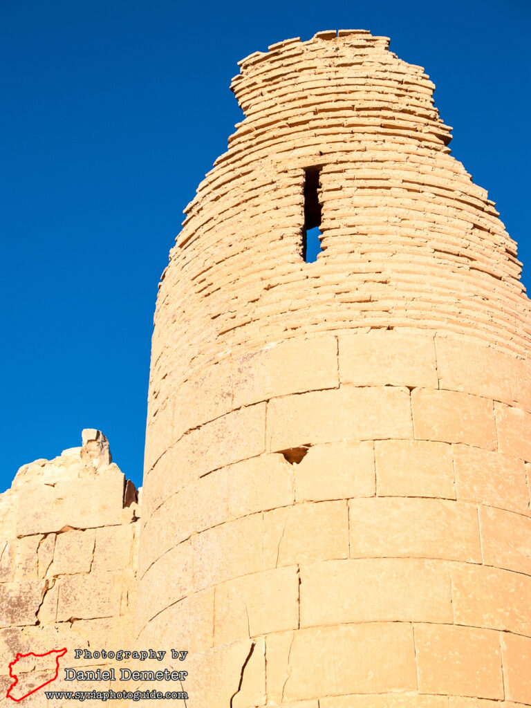
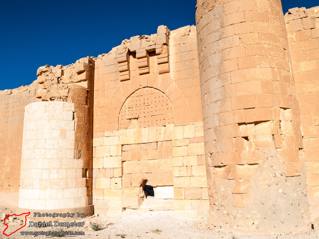
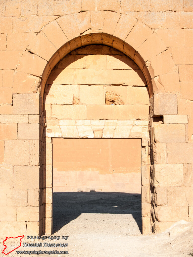
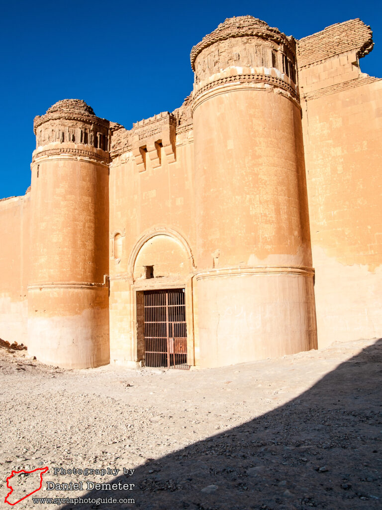
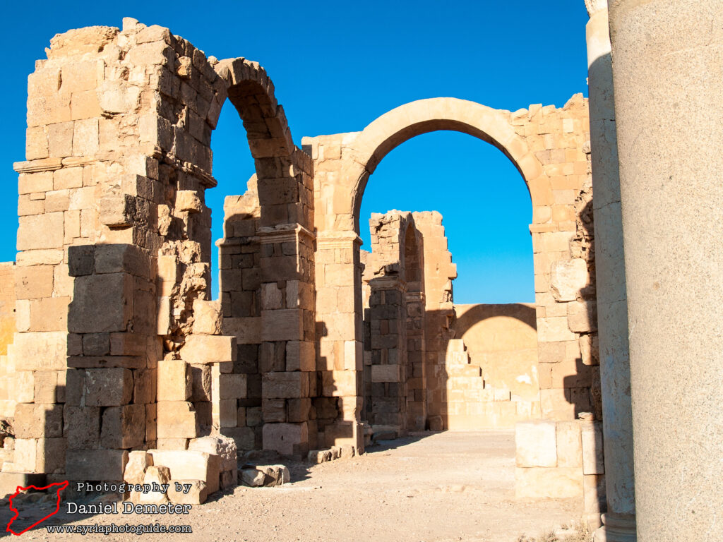
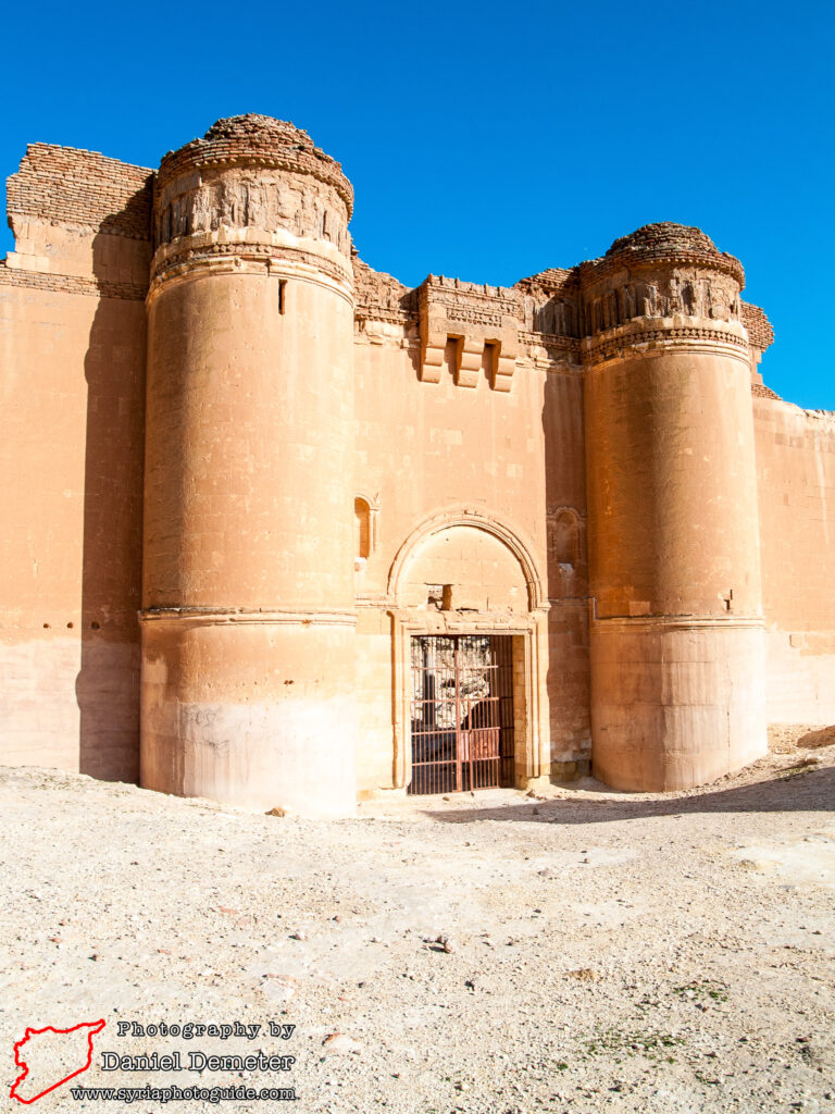
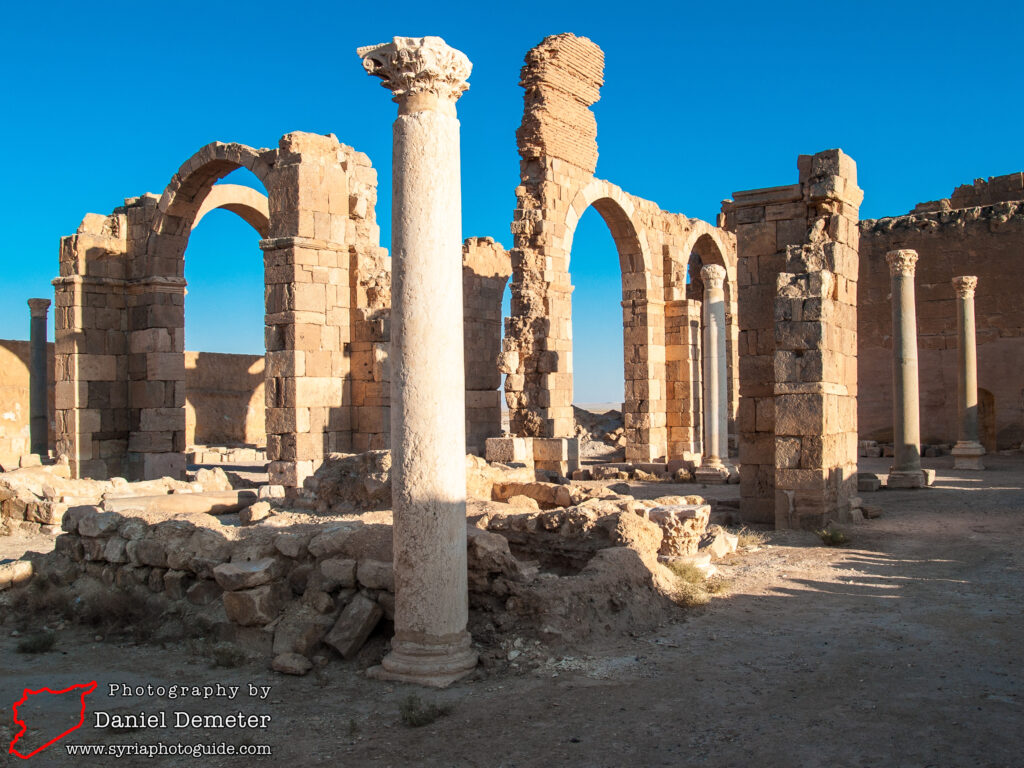
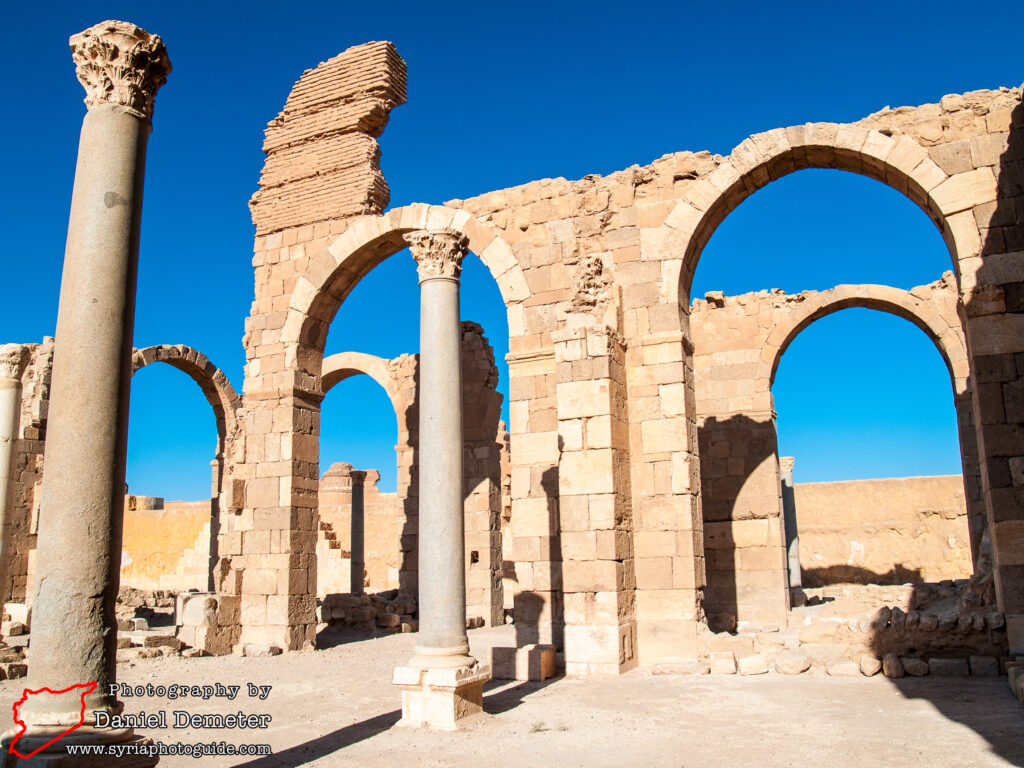
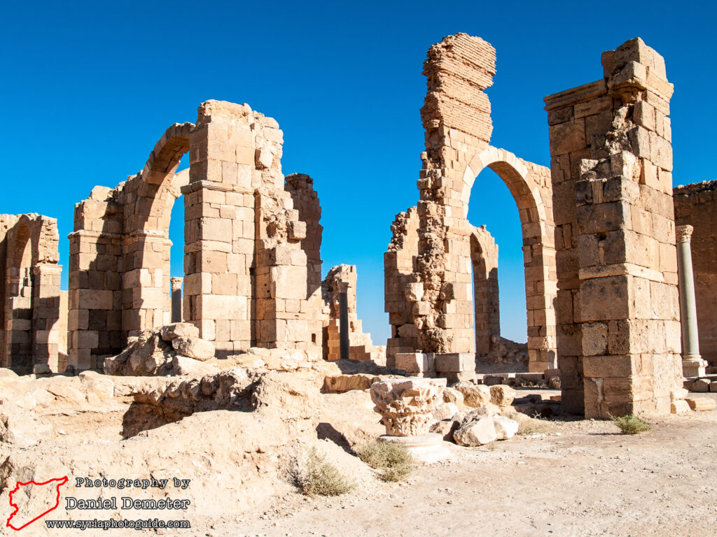
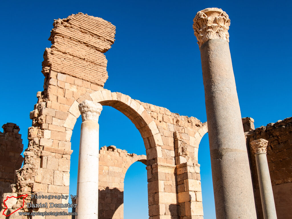
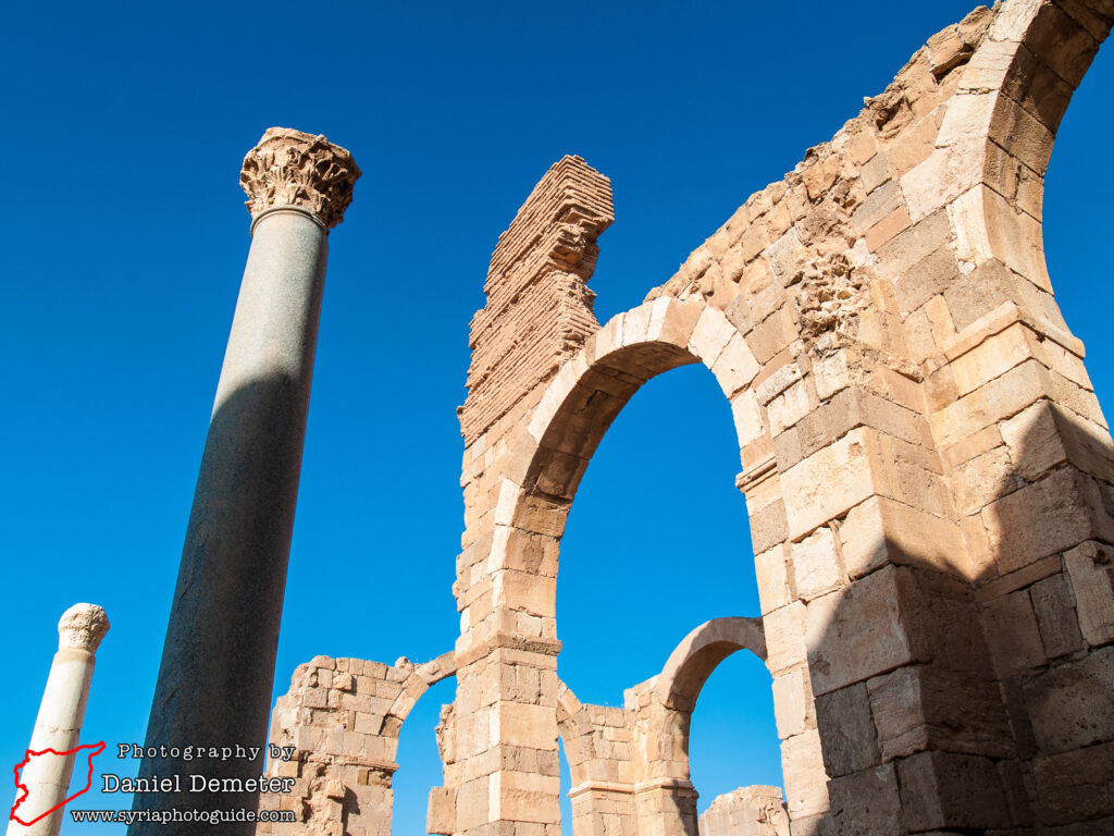
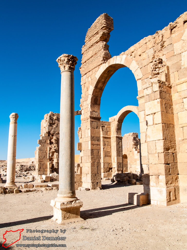
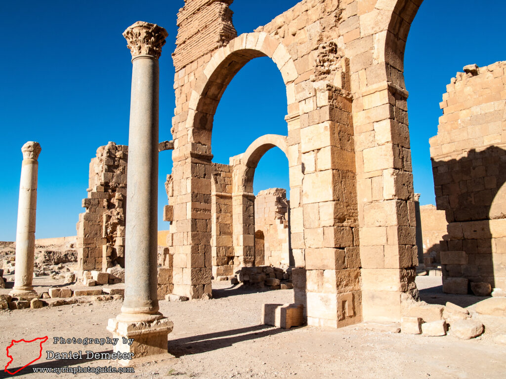
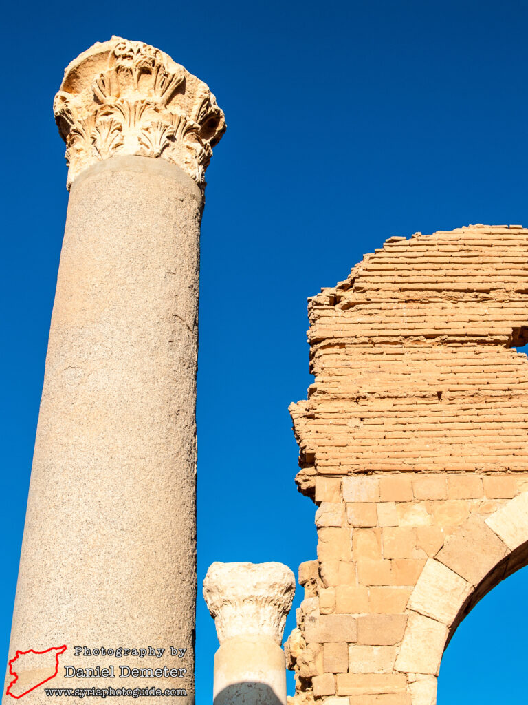
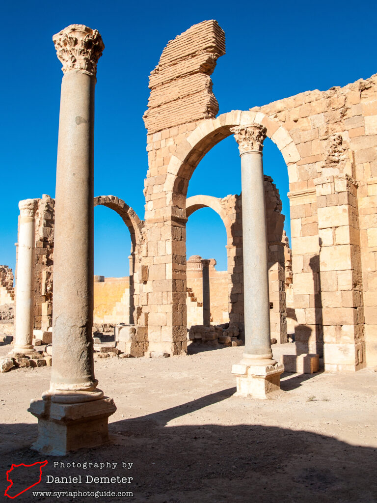
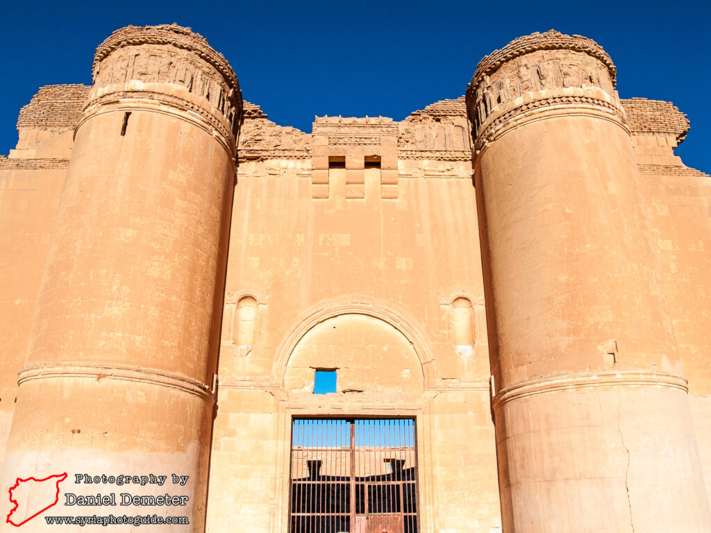
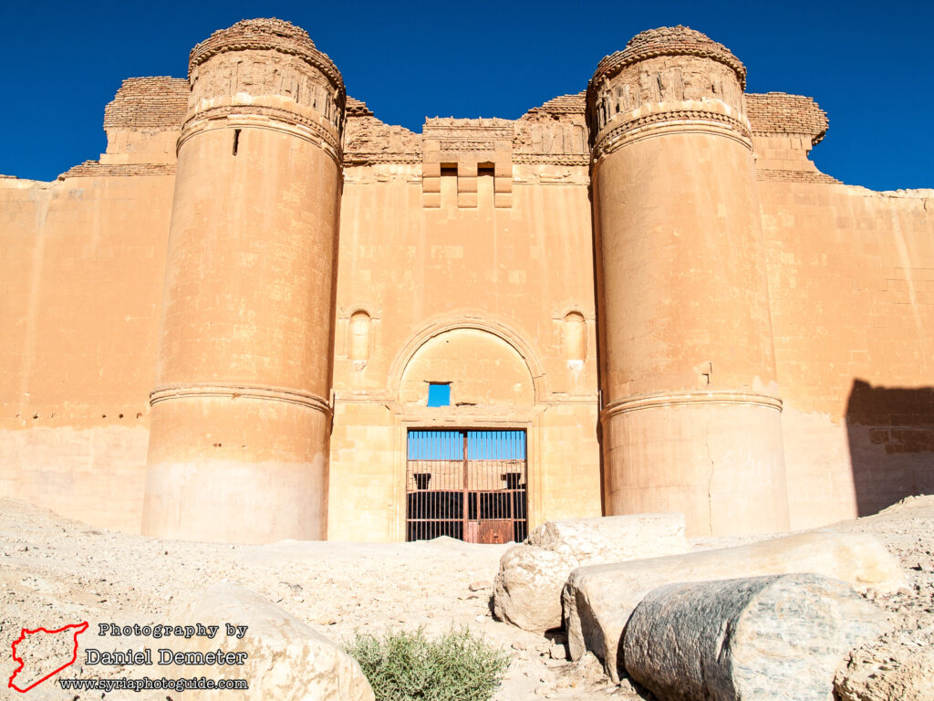
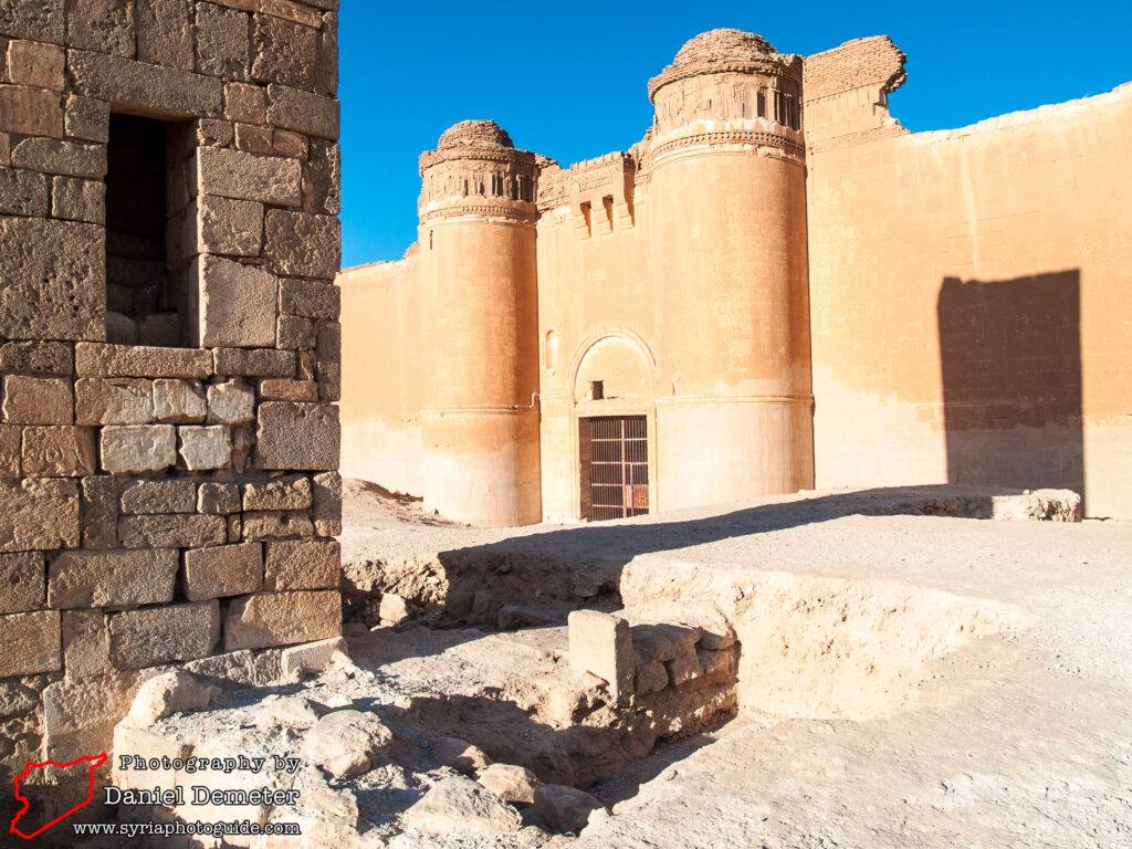
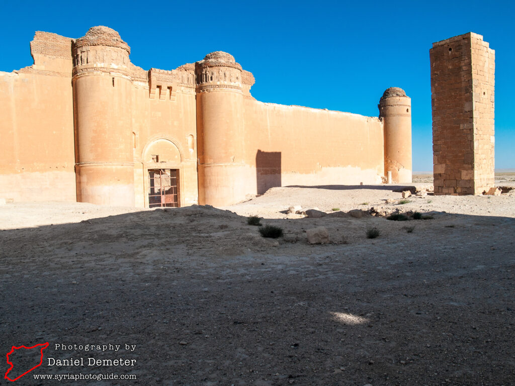
Little remains of the outer walls that once surrounded the whole settlement, but the inner fortifications survive in fairly good condition. Most impressive is the eastern palace, which features a richly decorated façade on its western side. The design shows influences of Roman, Palmyrene and Mesopotamian architecture. The purpose of this structure is debated, with some researchers describing it as a khan or caravanserai, and others viewing it as a palace. The walls are two meters thick and were originally twelve meters high, fortified by twelve semi-cylindrical towers. The interior is largely ruined, but included a central courtyard surrounded by a colonnade. Vaulted chambers on the first floor supported a second story, probably covered by a timber roof.
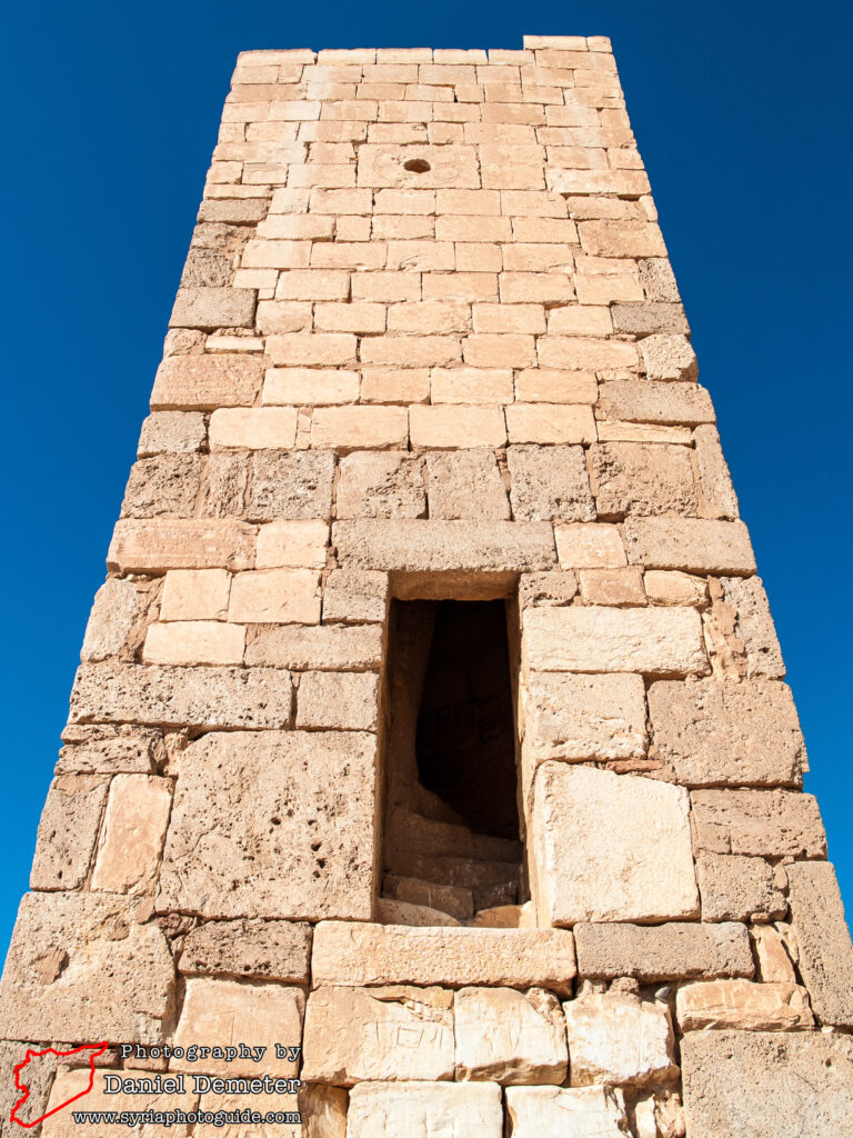
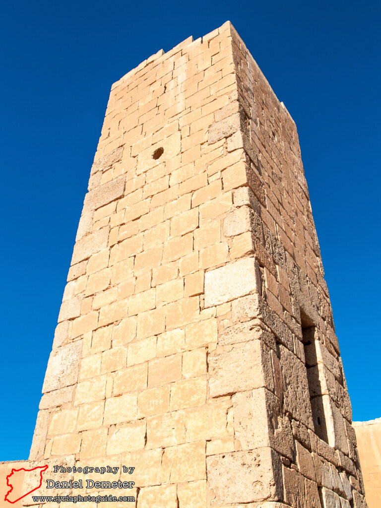
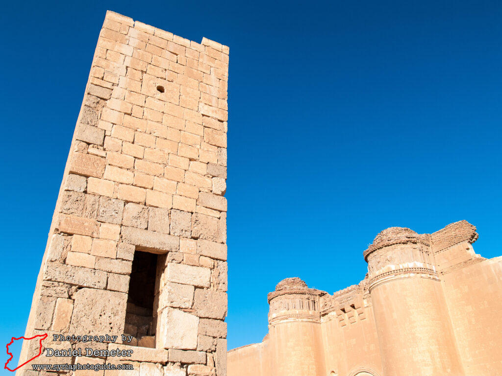
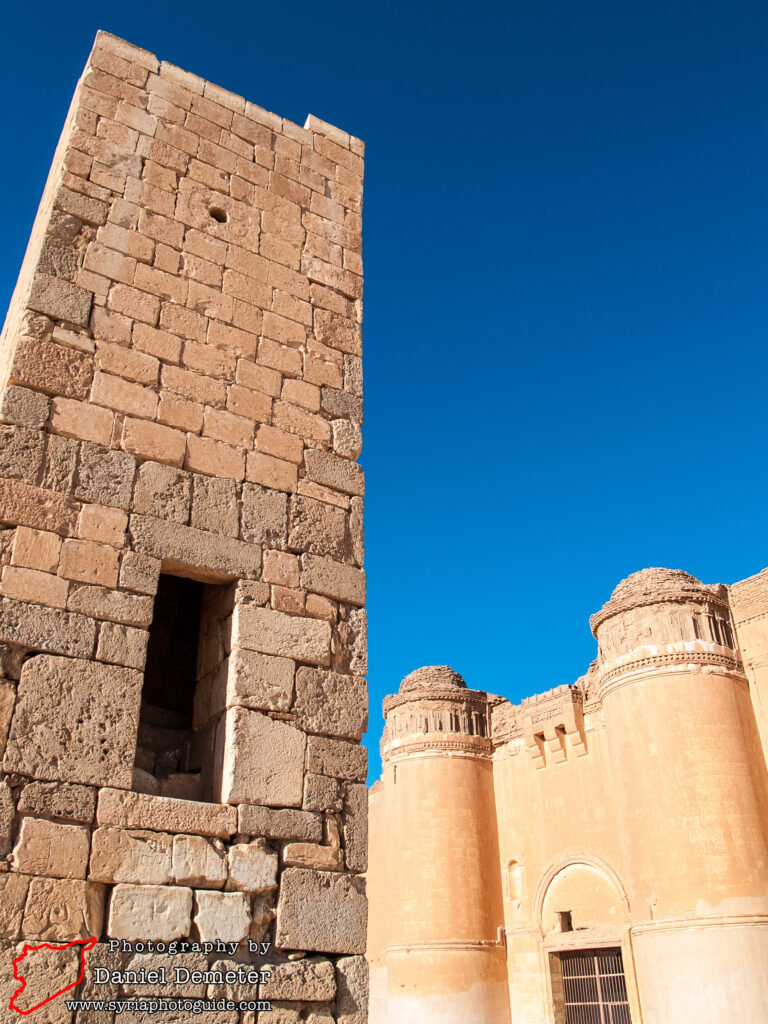
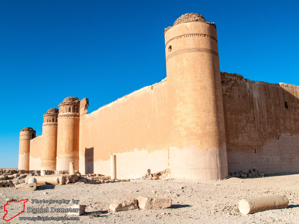
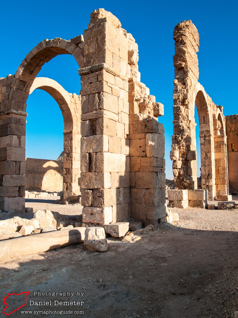
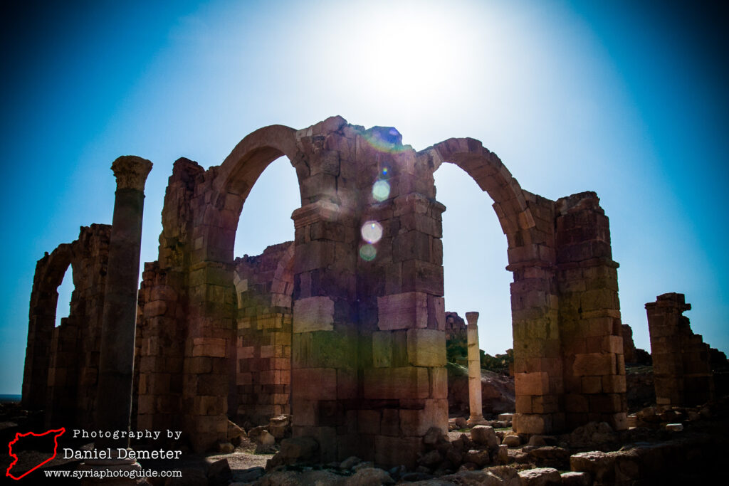
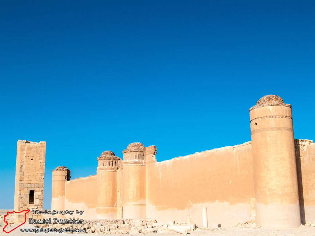
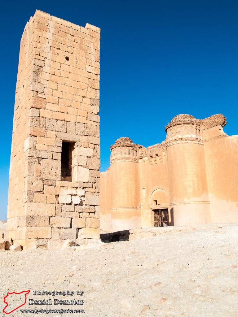
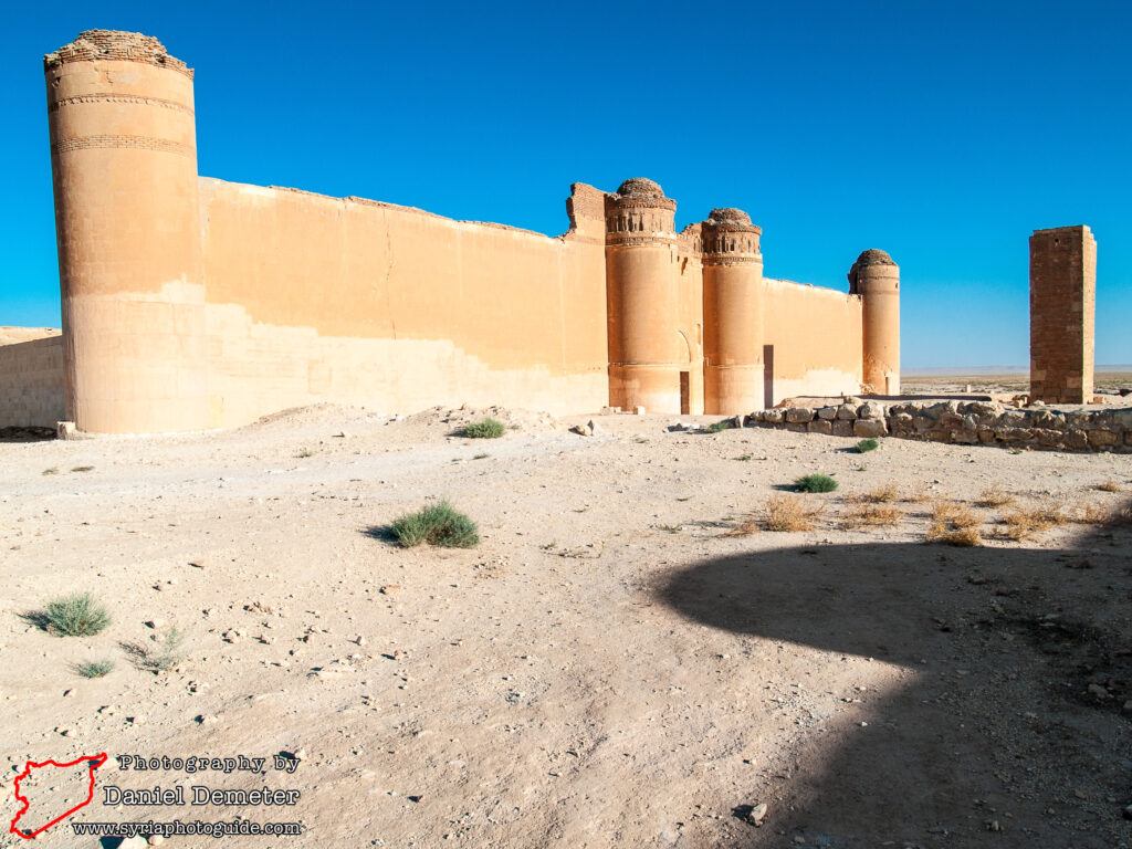
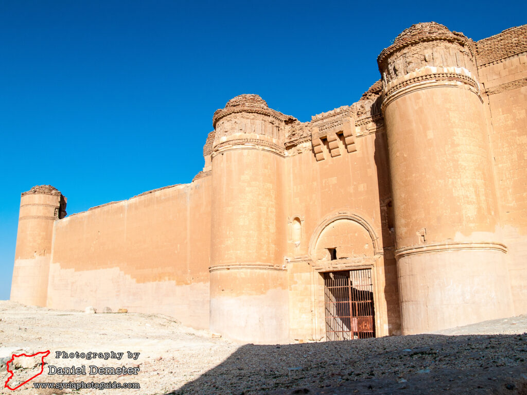
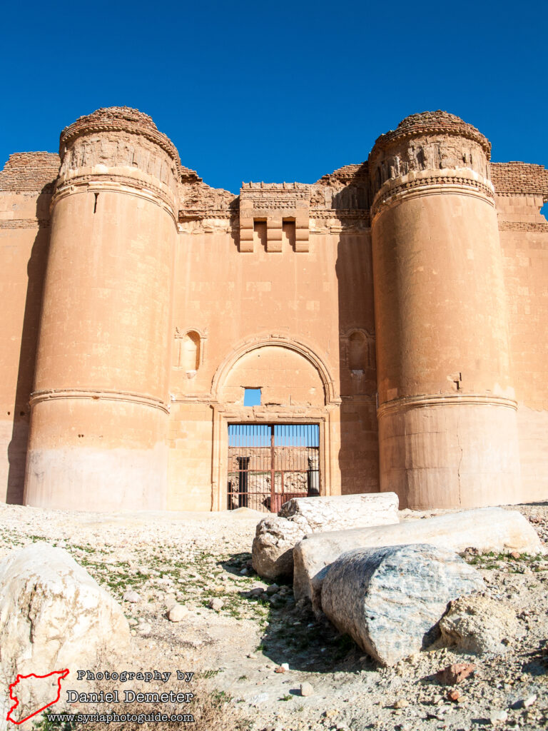
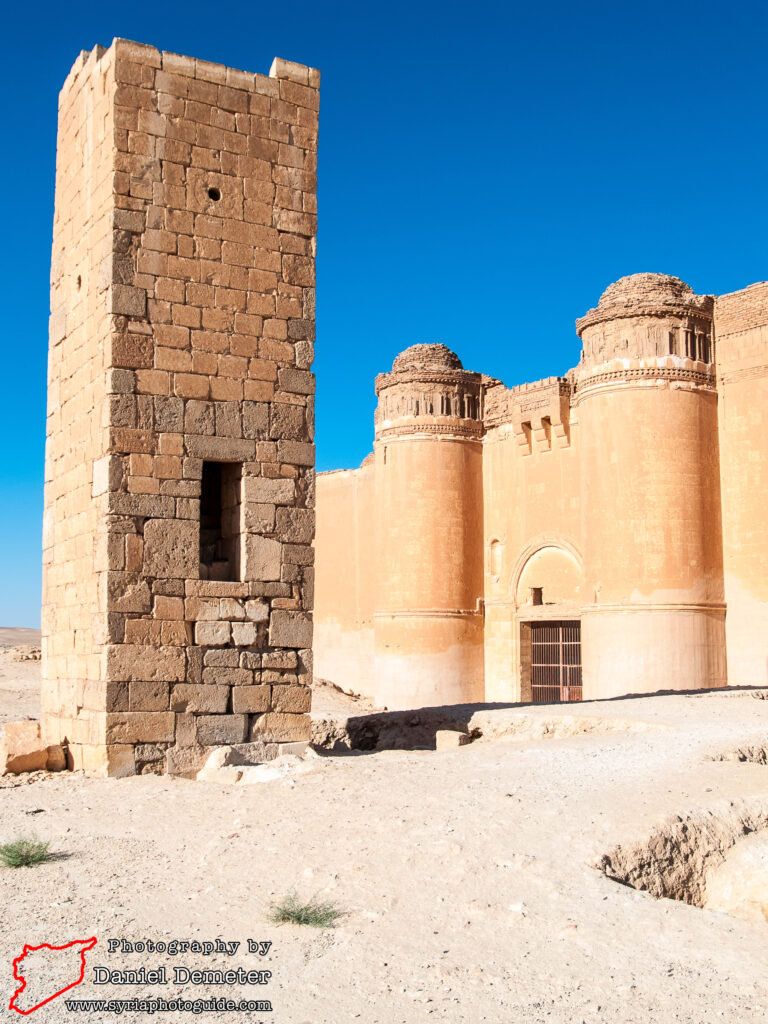
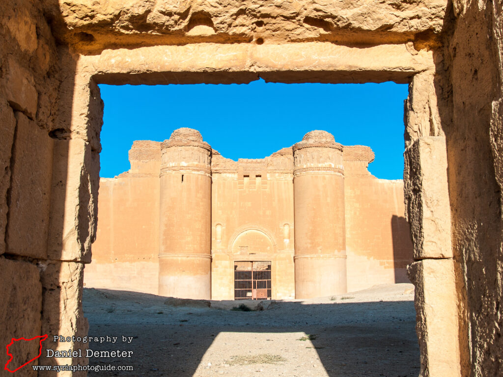
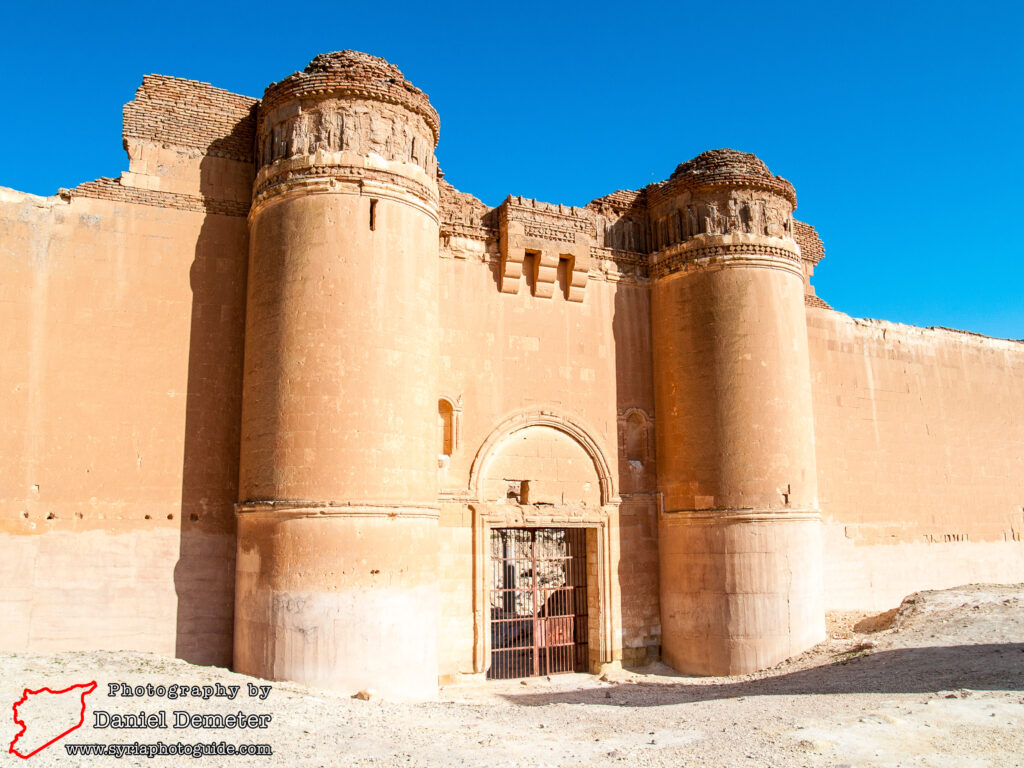
The much larger fortified complex to the west was defended with twenty-eight rounded towers. This was a planned urban settlement, subdivided into living quarters, service areas, administrative offices and a congregational mosque. The mosque, in the southeastern corner of this complex, is the only feature that is easily recognizable to visitors. Located between the two fortifications is a simple square minaret. Once assumed to be contemporary with the rest of the site, researchers later determined that the structure was connected to a congregational mosque that was constructed in the first half of the 13th century as part of the new Ayyubid settlement at the site. North of this area are the remains of public baths that date back to the original Umayyad construction.

Getting There: Qasr al-Heir al-Sharqi (قصر الحير الشرقي) is very remote, and is not possible to reach by public transportation. While technically within the governorate of Homs (حمص), the site is over 250 kilometers east of the city. Far closer is the city of Deir al-Zur (دير الزور), located 125 kilometers to the east, and Palmyra (تدمر), located 115 kilometers to the southwest. Most visitors to the site hire private transportation from Palmyra (تدمر). It may be possible, however, to find public transportation to the village of al-Sukhneh (السخنة), and arrange private transportation the remaining forty kilometers from there. One popular route is to visit both Qasr al-Heir al-Sharqi (قصر الحير الشرقي) and al-Rasafeh (الرصافة) while traveling between Palmyra (تدمر) and al-Raqqa (الرقة).
Coordinates: 35°04’26.00″N / 39°04’20.00″E
Transliteration Variants: Qasr al-Hayr al-Sharqi, Qasr al-Heir al-Sharki, Qasr al-Hayr al-Sharki
Rating: 7 / 10